


A cold night is ahead across Acadiana as temperatures drop close to the freezing degree mark.
A weak, upper-level impulse will approach the region by tomorrow morning and that will likely bring in enough moisture to the region to help generate precipitation chances.
With temperatures close to freezing, I would not be surprised to see some sleet mixing in with the precipitation (at least in spots).
Some slippery road conditions may also be possible across the area tomorrow morning, so keep that in mind but this event will only be a tease for the bigger winter storm event expected on Monday.
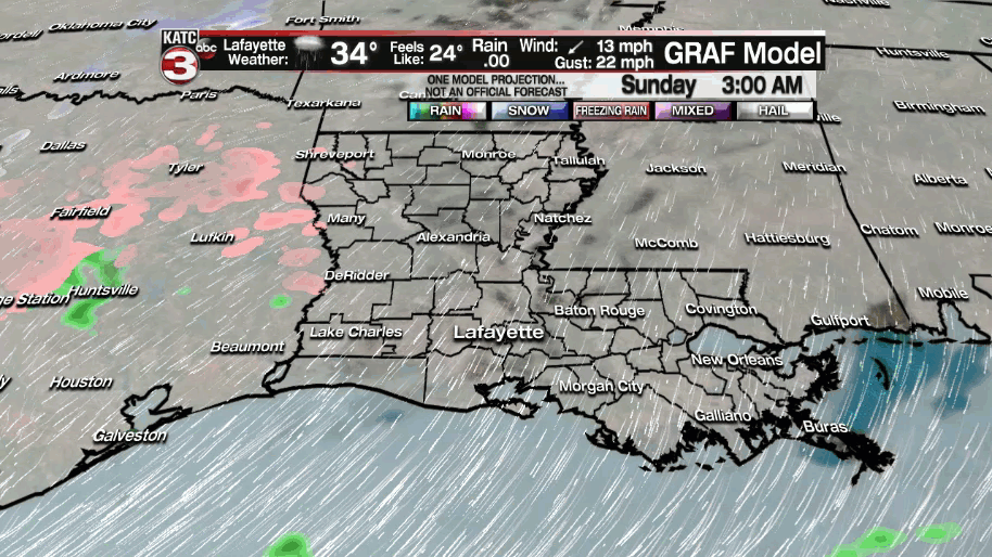
Temperatures will hover in the 30s throughout Sunday as wind chills likely stay in the 20s!
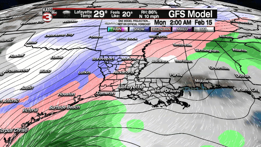
A Winter Storm WATCH remains in effect for most of Acadiana for the late Sunday night through the Monday time frame.

This for the expectation that we will see freezing rain (ice) and/or sleet during this time period, so it is not overly surprising that the weather service went ahead and issued this watch this morning.
The culprit will be a more impressive upper-level feature that will approach the area late Sunday night.
That will be inducing surface low pressure in the Gulf waters with a wave of moisture heading our way.
All the while, very cold air will be in place at the surface.
Atmospheric profiles continue to show a warm layer above the surface going into Monday, so precipitation will be melting as it falls through the layer, but as it encounters the freezing temperatures at the ground, it will re-freeze upon contact with the surface.
This is why we are expecting mainly a freezing rain/icing event (sleet mixing in) and not so much a snow event.
However, some snowflakes may be possible for some areas at the tail end of the event, but that is not a guarantee.
Our biggest concern continues to be ice accumulations across the area.
Models continue to disagree slightly on the accumulating ice amounts that we may see, but some have been a little concerning.

The GFS has amounts around .2"-.5" whereas the EURO, GRAF and NAM models all have ice accumulations at or exceeding .5", especially along and north of the interstate.
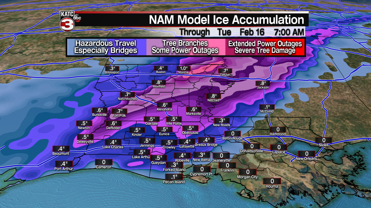


Regardless of what end of the spectrum we see, it is all but certain that travel is absolutely going to become quite treacherous and a major issue throughout the day on Monday, extending into Monday night/Tuesday morning, and depending if we warm above freezing Tuesday afternoon, could also be hazardous Wednesday morning as well.
Make sure to keep that mind and plan accordingly.
You will want to check travel conditions before you head out and of course heed the warnings from local law enforcement officials.
Also, those bridges and overpasses will ice over before the surface ground roadways.
If we see .25" of accumulating ice or more like some of the models indicate, then we will be dealing with other significant issues as well.
That amount of ice will cause some tree limbs to break/snap and we would also likely see some power outages across the area as well.
That still remains a bit uncertain and up in the air at this point, but it is something we will have to monitor closely, especially if models trend towards those higher amounts.
The bulk of the precipitation begins to work out of here by Monday afternoon/evening, but the threats and hazards will be far from over.
Temperatures will be plummeting into the mid-upper teens on Tuesday morning (Wind chills in single digits) and that is clearly pipe busting type cold.
Here are some tips to keep the pipes protected:

On top of this, roads/bridges will still be iced over on Tuesday morning so travel will remain nearly impossible and quite dangerous.
Partial sunshine expected on Tuesday, but still some uncertainties on how warm we get throughout the afternoon.
GFS keeps us at or below freezing and if that does indeed come to fruition, then travel remains dangerous through Wednesday morning until temperatures finally climb above freezing.
Another storm system pushes through late Wednesday into Thursday (just a rain event).
Behind this system, we will be eyeing down another hard freeze for Friday morning as temperatures fall into the mid-20s.
Sun finally returns for Friday afternoon with a gradual warm-up into the following weekend.
In the short-term, stay safe and warm out there!
------------------------------------------------------------
Stay in touch with us anytime, anywhere.
To reach the newsroom or report a typo/correction, click HERE.
Sign up for newsletters emailed to your inbox. Select from these options: Breaking News, Evening News Headlines, Latest COVID-19 Headlines, Morning News Headlines, Special Offers
