


Acadiana's miserable, wet and cold weather pattern will gradually give way to sunnier conditions by Friday, but temperatures will remain some 20 degrees below normal through Saturday morning.
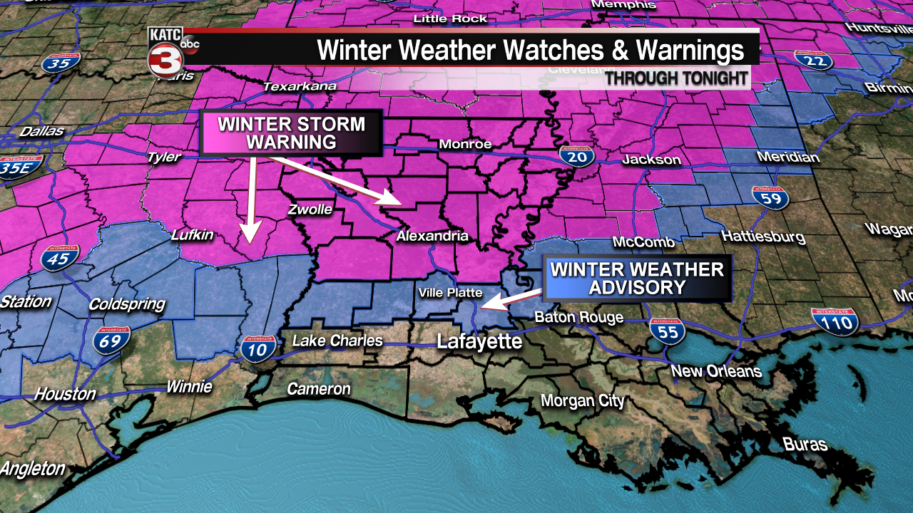
As of late Wednesday afternoon, rains continued to impact the Acadiana area with freezing rain & sleet making for icy conditions across the northern parishes (Allen, Evangeline & St Landry) where a Winter Weather Advisory remains in effect for potentially icy bridges & overpasses through Thursday morning.
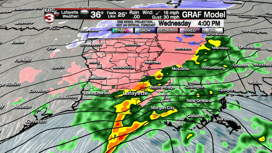
All the significant precipitation should come to an end during the early evening hours Wednesday with breezy and cold conditions following for the next 36-48 hours.

Temperatures will drop to near freezing Thursday morning along and south of the I-10 corridor and will remain a few degrees colder in the northern parishes where it will likely stay icy in spots through daybreak.

Thursday will bring more gray cloud cover, breezy north winds, temperatures no higher than the mid-upper 30s, and wind chills staying planted in the low-mid 20s.
There could be a few light sprinkles or an ice pellet or two from time to time Thursday into Thursday night, but any additional precipitation will not be problematic.
Skies are expected to clear late Thursday night into Friday morning with temperatures plummeting once again into the hard freeze zone with lows in the mid-20s.

Wind chills Friday morning will likely be in the mid-teens!

At least we should see sunny skies Friday allowing temperatures to warm to near the 40° mark.
Another hard freeze is anticipated Friday night into Saturday morning with lows dropping into the low-mid 20s.
This weekend will bring the beginning or a milder trend with partly sunny skies Saturday and mostly cloudy skies Sunday. Temperatures this weekend will top out near 50° Saturday and lower 60s Sunday.
Spring looks to be right around the corner later next week with highs reaching back into the 70s toward the end of our 10 Day Forecast!
------------------------------------------------------------
Stay in touch with us anytime, anywhere.
To reach the newsroom or report a typo/correction, click HERE.
Sign up for newsletters emailed to your inbox. Select from these options: Breaking News, Evening News Headlines, Latest COVID-19 Headlines, Morning News Headlines, Special Offers
