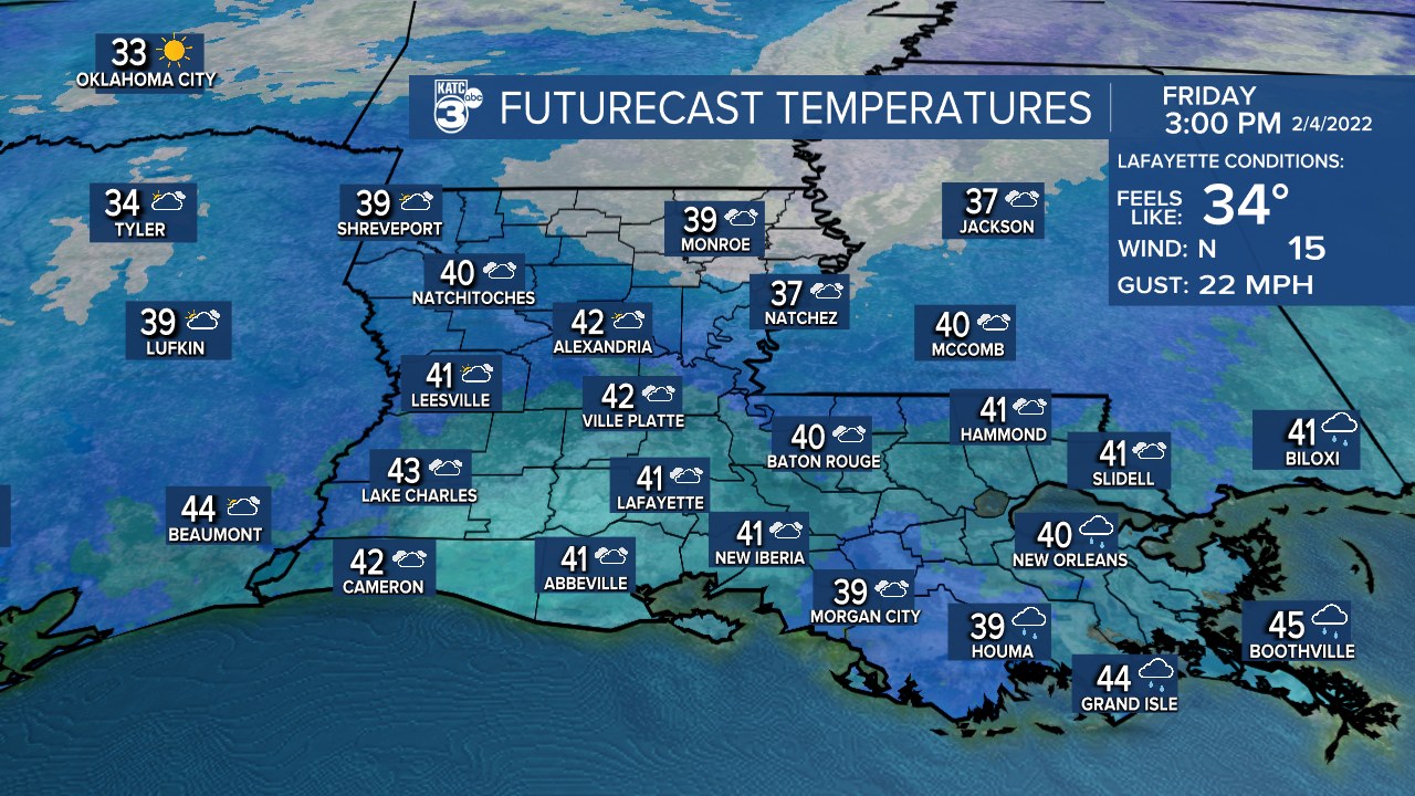
A strong cold front that pushed through Acadiana this morning will insure winter temperatures for the area into the weekend.
Plenty of clouds and some patchy light rains and/or drizzle/mist will likely stay in the area overnight but should be tapering into midday Friday.

No significant winter precipitation is expected anywhere in Acadiana. Latest Power Doppler 3 here.
Temperatures will be dropping into the low-mid 30s overnight through Friday morning, with the risk of light freezing temperatures primarily north of I-1o into the northern Acadiana parishes.

Add stiff northerly winds, and Acadiana's wind chills will drop into the mid-20s by Friday morning, and with breezy and cloudy conditions continuing all day Friday, our wind chills will stay in mostly the 20s to lower 30s.

Wind chills by Saturday morning look to drop into the lower 20s!

Temperatures Friday will stay mostly in the 30s, possibly peaking in the lower 40s for an hour or two tomorrow afternoon under dreary, cloudy skies with breezy north winds continuing.

Skies should clear Friday night, allowing temperatures to drop into the upper 20s in most areas...not a pipe-buster, but still cold by Acadiana standards.

This weekend will be a sunny and cold one for the area with highs in the lower 50s Saturday and mid-50s Sunday after another freezing start in the mid-upper 20s Sunday morning.

The weather pattern next week looks relatively quiet with one system bypassing us to the south early next week but just generating some cloud cover into Monday.
The rest of the week appears to stay seasonably cool and dry with a fair bit of sun. Our temperatures look to get back a little closer to normal for the following weekend.
See the KATC 10 Day Forecast for the latest.
The longer range outlook keeps temperatures below normal in the region through mid-month, with a slow week to week moderating trend expected for the latter part of the month.
------------------------------------------------------------
Stay in touch with us anytime, anywhere.
To reach the newsroom or report a typo/correction, click HERE.
Sign up for newsletters emailed to your inbox. Select from these options: Breaking News, Evening News Headlines, Latest COVID-19 Headlines, Morning News Headlines, Special Offers


