


Acadiana's weather will stay on a roll into the weekend with sunny and warm afternoons accompanied by seasonably cool nights through Saturday.
In the near term, expect another fresh night with lows dropping into the seasonably cool mid-upper 50s.
Sun-drenched skies are anticipated for our Friday with comfortable humidity and temperatures topping out in the lower 80s.
After another relatively cool night, look for more warm sunshine Saturday with highs in the lower 80s as winds turn southeasterly and increase in the afternoon.

The breezy winds Saturday afternoon will begin to usher in higher dew points and humidity into Saturday night which will likely hold our lows closer to the upper 60s to near 70° Sunday morning.
An approaching frontal boundary with storms to our north Sunday will translate to partly cloudy skies accompanied by gusty afternoon winds. Temperatures Sunday afternoon should push into the mid-80s.
A few showers or a thunderstorm may pop-up across the area Sunday afternoon, but it appears significantly higher rain chances may arrive into Sunday night.

A frontal boundary will sag southward and then stall across the Louisiana/Gulf Coast Sunday night into mid-next week keeping the chance of scattered showers and storms Monday through Wednesday.
A stronger upper level impulse should lead to higher chances of storms and heavier rains into Wednesday.
For now, no widespread severe weather is anticipated over the next week, but some stronger storms will certainly be possible Sunday night and then again Wednesday...and perhaps, anytime in between.
Models point to a rather wet scenario early-mid next week with rain totals ranging anywhere up to an inch or two locally with higher amounts in the 3-5" range or more to our north.
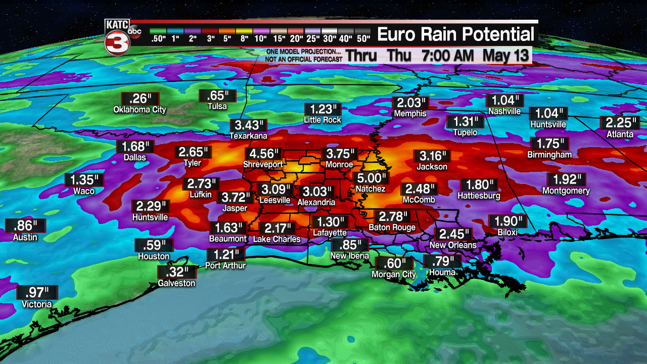
The rainfall and storm intensity projections are likely to change over the next several days so stay tuned for updates, especially later into this weekend...until then, enjoy the sunshine!
------------------------------------------------------------
Stay in touch with us anytime, anywhere.
To reach the newsroom or report a typo/correction, click HERE.
Sign up for newsletters emailed to your inbox. Select from these options: Breaking News, Evening News Headlines, Latest COVID-19 Headlines, Morning News Headlines, Special Offers
