


Well, we've made it to a new week and the weather is looking to cooperate with us for the most part.
We continued to turn the corner today on the colder weather as temperatures climbed into the middle-upper 60s under mostly cloudy skies for our Sunday.
Our next upper-level trough and associated surface "cold" front will continue to approach from the west tonight.
The cold front, lacking any sufficient colder air being it, will be pushing through the area during the early hours of our Monday morning.
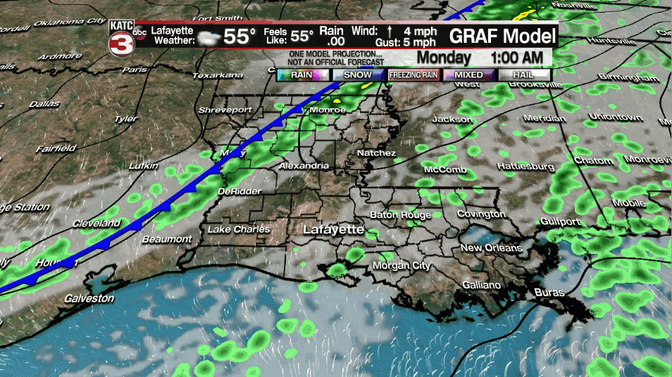
It won't be bringing much fanfare with it, but a few spotty light showers will be possible through the overnight period and into the very early parts of our Monday morning.

Areas of some patchy fog may also be possible first thing in the morning.

Of course, make sure to check back in with GMA first thing in the morning for the latest observations in your area.
We will be clearing out nicely by mid-morning with full sunshine returning through the course of the afternoon.
Temperatures will be slightly cooler in the lower-middle 60s.
Winds will be out of the north at around 6-12 mph.
High pressure will be moving right overhead by Tuesday morning, so with clear skies and calm winds in place, expect a cold start with readings in the 30s.
I continue to have forecast low temperatures above freezing.
Wall-to-wall sunshine can be expected for our Tuesday as high pressure remains in control.
Temperatures will be settling into the middle 60s.
Wednesday looks pretty good as well with mainly sunny skies anticipated for much of the day; however, some low-level clouds will try to work in by the latter part of the afternoon.
It'll be milder as well with temperatures pushing the lower 70s for the afternoon.
Another front will try to push through Thursday going into Friday, but it may actually run out of steam and stall out off to our north.
If that is the case, then that would keep mild conditions in place for Thursday/Friday (highs near 70).
Regardless, that front will look to move back to the north as a warm front this weekend.
This will drive our temperatures into the middle 70s for Saturday and Sunday.
Additionally, dew points may push the mid-upper 60s which would give us more of a humid feel to the air (wasn't it just like full blown winter last week?!).
Spotty rain chances for Friday-Sunday are in place for now.
Continue to check back in with us throughout the week for further details.
Let's make it a great week, y'all!
~Bradley
------------------------------------------------------------
Stay in touch with us anytime, anywhere.
To reach the newsroom or report a typo/correction, click HERE.
Sign up for newsletters emailed to your inbox. Select from these options: Breaking News, Evening News Headlines, Latest COVID-19 Headlines, Morning News Headlines, Special Offers
