


Acadiana is in for a gradual warming trend ahead of our next weather-maker that looks to arrive with showers and some intense storms by Saturday evening.
In the near term, temperatures will not be as cool overnight through Friday morning, and with clouds increasing, our lows should be some 10° milder, in the upper 40s to lower 50s by morning.
Friday will bring plenty of clouds and a very weak disturbance that could generate scattered, short-lasting showers with rain chances near 30% during the day.
Highs Friday will be in the upper 60s to lower 70s courtesy of breezy southerly winds at 10-15 with gusts to 20 mph possible in the afternoon.

A few showers/sprinkles may continue into Friday night as temperatures hold in the much balmier 60s and as Gulf moisture begins to increase.
A strong cold front will be advancing toward Acadiana Saturday with best rain chances likely to arrive Saturday evening.
Temperatures Saturday afternoon will push the upper 70s to near 80° with some partial sunshine possible early in the day.
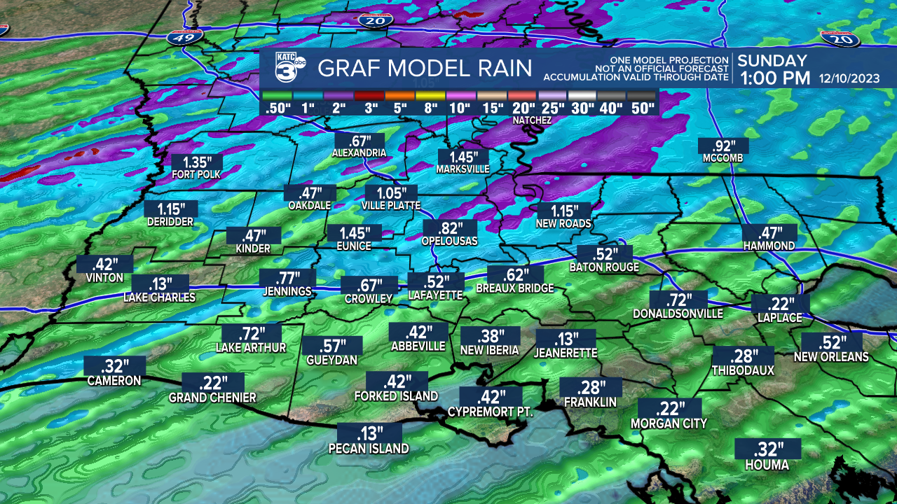
Rain chances will be in the 20-30% range most of the day Saturday, but will increase to 50-60% by sunset...thereafter, a near 100% chance of rain and storms will follow into Saturday night.

Best timing of storms based off of Thursday's models looks to be from 6pm-midnight from west to east.
The Storm Prediction Center has maintained a slight risk (level 2 out of 5) of severe storms for the northwestern sections of Acadiana while the rest of us will be in a lower, marginal risk.

The primary threat of what is expected to be a fairly solid squall line Saturday evening would be for damaging winds.
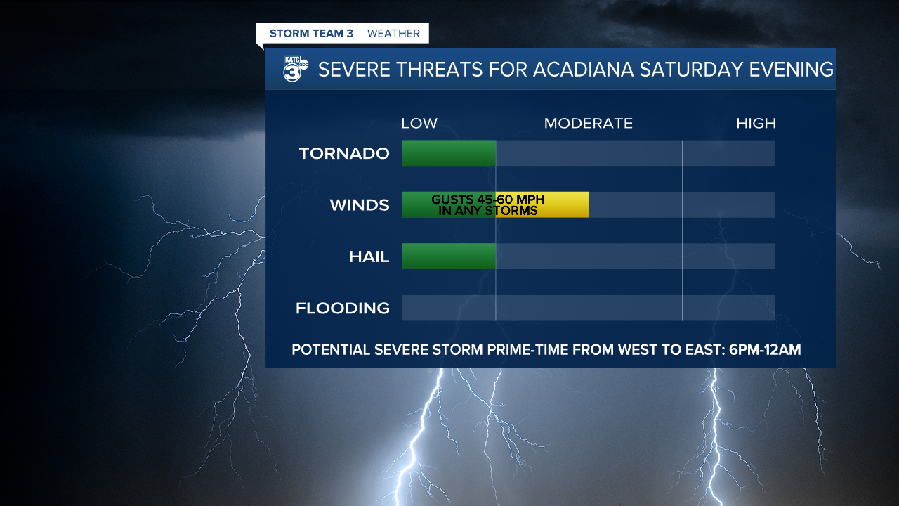
Don't expect much rain with this system with most folks catching 1/2-1" of rain as storms will be moving along quickly, and most of that will likely come in a 30-45 minute period.
Thereafter, it'll will be weather whiplash for the area with windy and colder conditions (and sun) returning Sunday.
Sunday's highs will be limited to the 50s while lows dive into the low-mid 30s (with likely a chill factor) come Monday morning.
Much of next week looks seasonably cool and dry with a possible unsettled period returning sometime the following weekend.
See the KATC 10 Day Forecast for the latest.
------------------------------------------------------------
Stay in touch with us anytime, anywhere.
To reach the newsroom or report a typo/correction, click HERE.
Sign up for newsletters emailed to your inbox. Select from these options: Breaking News, Evening News Headlines, Latest COVID-19 Headlines, Morning News Headlines, Special Offers
