


10/10 would completely recommend the weather today!
We saw plentiful sunshine out there as temperatures topped out pretty comfortably in the lower 70s.
Unfortunately, the nice weather won't be lasting long.
The frontal boundary that has provided the slightly cooler weather over the last couple of days will begin to make its jog back to the north as a warm front going into tonight and tomorrow morning.
As a result, it will not be nearly as cool tonight as clouds and muggier, warmer conditions move back into place.
With the return of higher dew points and moisture, some patchy fog will be possible overnight in spots.

Some isolated showers will be possible overnight as that boundary moves through.
The front will continue to lift northward throughout the day on Tuesday.

Expect a warm day on tap as highs climb into the upper 70s to near 80° under partly to mostly cloudy skies.
Winds will be breezy out of the south at around 12-18 mph.
With enough moisture in place coupled with some daytime heating, we may see a few pop-up isolated showers and storms developing through the course of the afternoon.
I've got rain chances sitting at 30%.
Patchy fog may be possible going into tomorrow night/Wednesday morning.
Wednesday starts out warm and muggy ahead of a stronger cold front that will be poised to push the area.
Showers and storms will be arriving out of ahead of that boundary by the afternoon.
Some gusty winds and small hail may accompany a few of the storms that push.
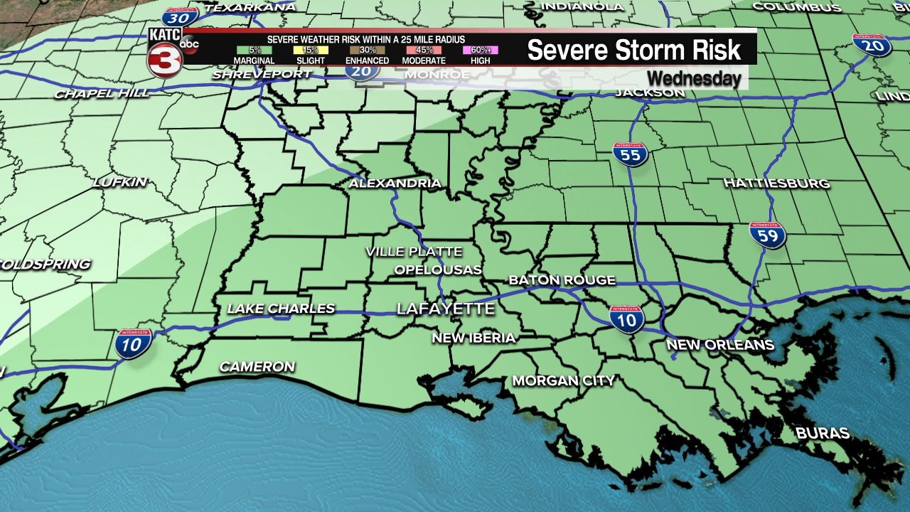
All of Acadiana is hatched in for a low-end marginal risk to see severe weather on Wednesday.
Rainfall totals look to stay below a half an inch for most spots.

Temperatures will be falling quickly behind the front.
In fact, after highs briefly get into the lower 80s, expect readings to drop into the 50s by late Wednesday afternoon/evening!
Gusty northerly winds will be filtering into the area as well.
Clear skies will be breaking out heading into Wednesday night as temperatures fall into the lower 40s.
Great looking weather as round out the week with sunny skies in place!
Afternoon highs will be settling into the lower to mid-60s for both Thursday and Friday.
Upper 30s will certainly be possible for Friday morning, so hopefully you did not pack up the jackets quite yet!
A bit warmer, but still seasonably cool heading into Easter weekend with maybe a few more clouds to contend with.
The weekend as a whole continues to look relatively quiet, but we will of course continue to keep you updated throughout the week.
~Bradley
------------------------------------------------------------
Stay in touch with us anytime, anywhere.
To reach the newsroom or report a typo/correction, click HERE.
Sign up for newsletters emailed to your inbox. Select from these options: Breaking News, Evening News Headlines, Latest COVID-19 Headlines, Morning News Headlines, Special Offers
