


It's going to be a warm week for Acadiana but a good-looking cool front is set to bring more fall-like conditions to the area for this weekend.
In the near term, look for a partly cloudy, warm and rather humid conditions to continue overnight with lows tonight holding in the lower 70s, thanks to the cloud cover.
There will be a slight chance of a passing shower or sprinkle overnight through Tuesday, with rain chances staying near 10% or less.
Tuesday will bring some clouds early but mostly sunny skies are anticipated for the afternoon.

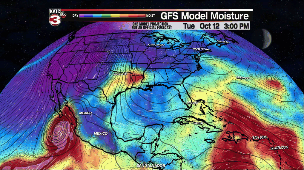
Wednesday and Thursday will remain fair to partly cloudy, with more high clouds as the week wears on associated with the remnants of a Pacific Hurricane (Pamela) that will primarily impact Texas.
Rain chances locally in Acadiana should stay low, in the 10% range Wednesday, and perhaps near 20% Thursday.
By Friday, a better chance of scattered showers, and possibly a few storms, should develop ahead of our much anticipated cool front.
Afternoon temperatures this week will stay in mid-upper 80s through Friday while night lows persist near the lower 70s.
The cool front may reach Acadiana sometime Friday night with the biggest chill lagging behind into Saturday and especially, Saturday night.

Look for fair skies accompanied by highs in the mid-upper 70s and a fresh northerly breeze this weekend with overnight lows expected to drop into the mid-upper 50s starting Saturday night into early the following week.
See the KATC 10 Day Forecast for the latest.
Meanwhile, other than a few weak, low-chance-of-development disturbances near the Caribbean, the tropics remain quiet.

Tropical Storm Pamela in the Eastern Pacific is expected to become a hurricane Tuesday, and perhaps a major hurricane prior to landfall on the Western Mexican Coast Wednesday.
The remnants of this system could bring some substantial rains to Texas Wednesday and Thursday but should stay west of our area.
Farther down the road the GFS Model continues to suggest tropical moisture pooling and an atmospheric weakness in the Gulf of Mexico in the 7-14 day period, but for now, there are no tropical concerns.
Some of the aforementioned tropical moisture however, could bring better ran chances to Acadiana mid-late next week.
------------------------------------------------------------
Stay in touch with us anytime, anywhere.
To reach the newsroom or report a typo/correction, click HERE.
Sign up for newsletters emailed to your inbox. Select from these options: Breaking News, Evening News Headlines, Latest COVID-19 Headlines, Morning News Headlines, Special Offers
