


Welcome to a new week!
Thankfully, plenty of shower activity late last night in the Gulf of Mexico helped to take away the instability and fuel needed for storms to really get going across Acadiana.
As a result, we managed to dodge the severe weather threat!
However, we still did see some moderate to heavy rainfall in spots early this morning.
It then turned out to be a pretty quiet afternoon as temperatures found their way into the upper 70s to lower 80s.
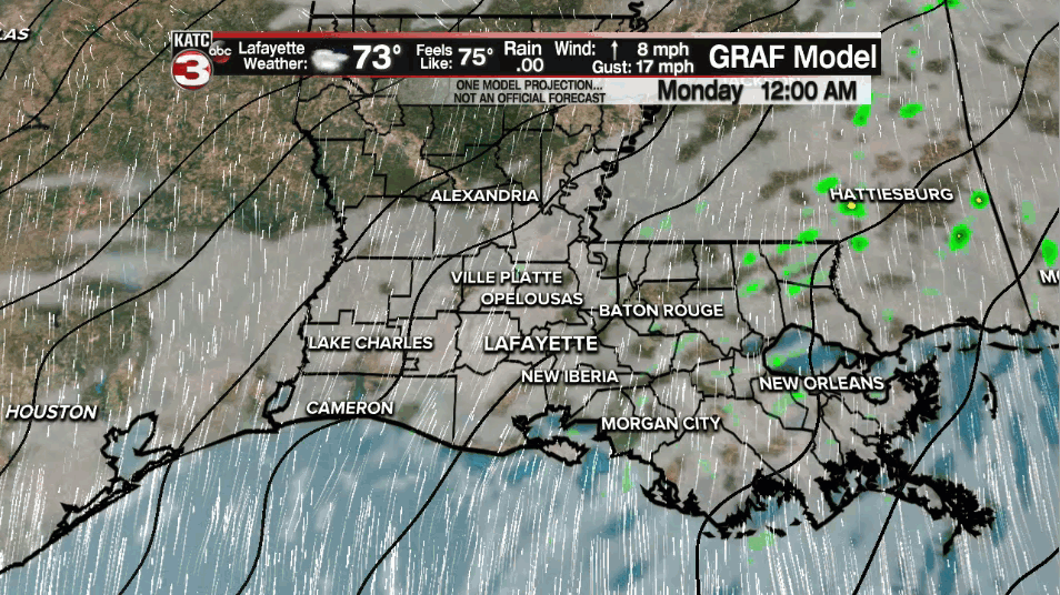
Overnight lows will drop into the lower 70s.
It'll be a warm and muggy one out there on Monday as temperatures climb into the upper 80s.
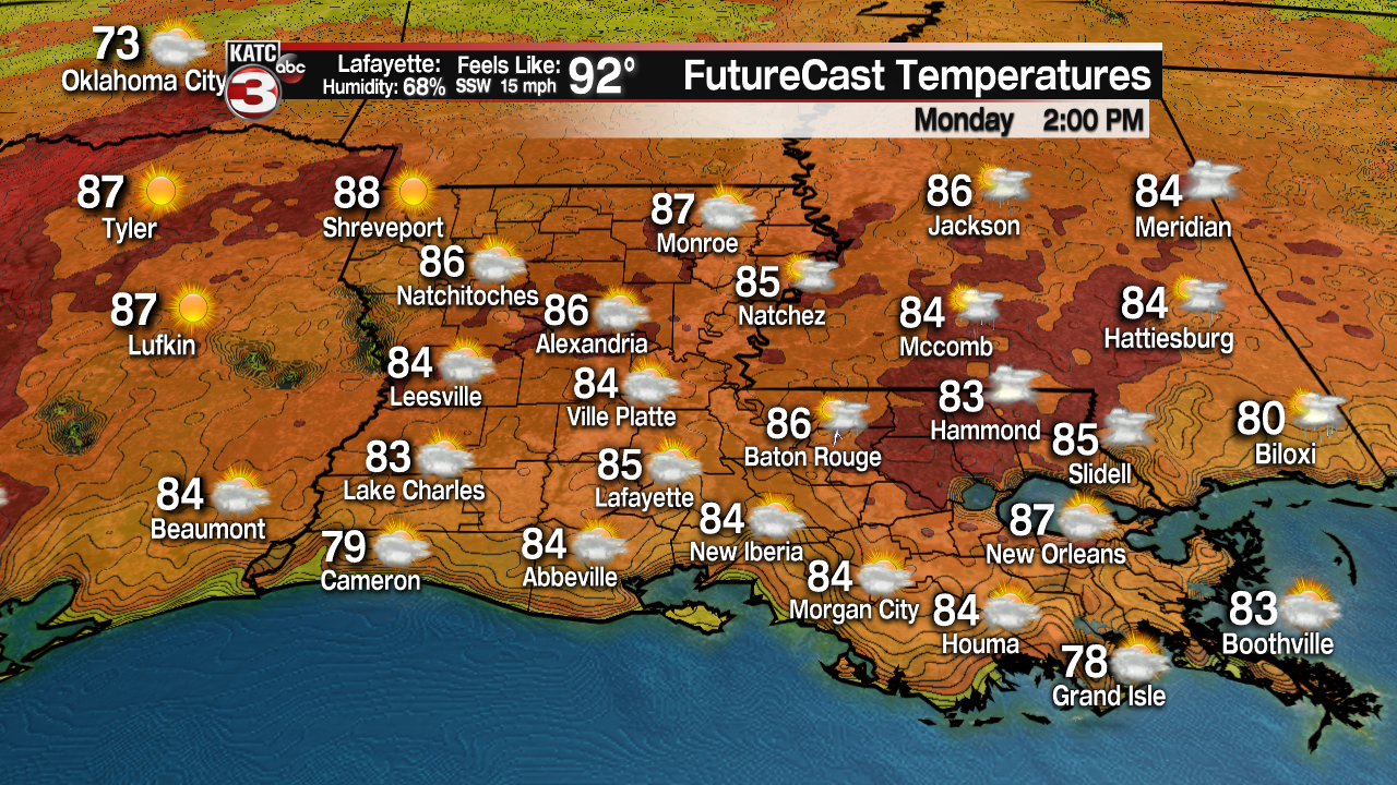
Heat indices will settle into the lower 90s! Whew!
Make sure to drinking plenty of fluids and take breaks if you have to be outside for an extended period of time on Monday.
Early morning clouds will give way to intervals of afternoon sun.
There will also be a 20% chance that we see a stray isolated shower throughout the day.
Warm conditions going into tomorrow night as low temperatures only fall back into the middle 70s.
A "cold" front (have to use that term lightly now considering we are in May, ha!) will approach the region by Tuesday afternoon.
That will help to generate scattered showers and storms across the area.
Some of those storms could be on the stronger side... SPC already has us locked in for a SLIGHT RISK (level 2 out of 5) to see severe weather.
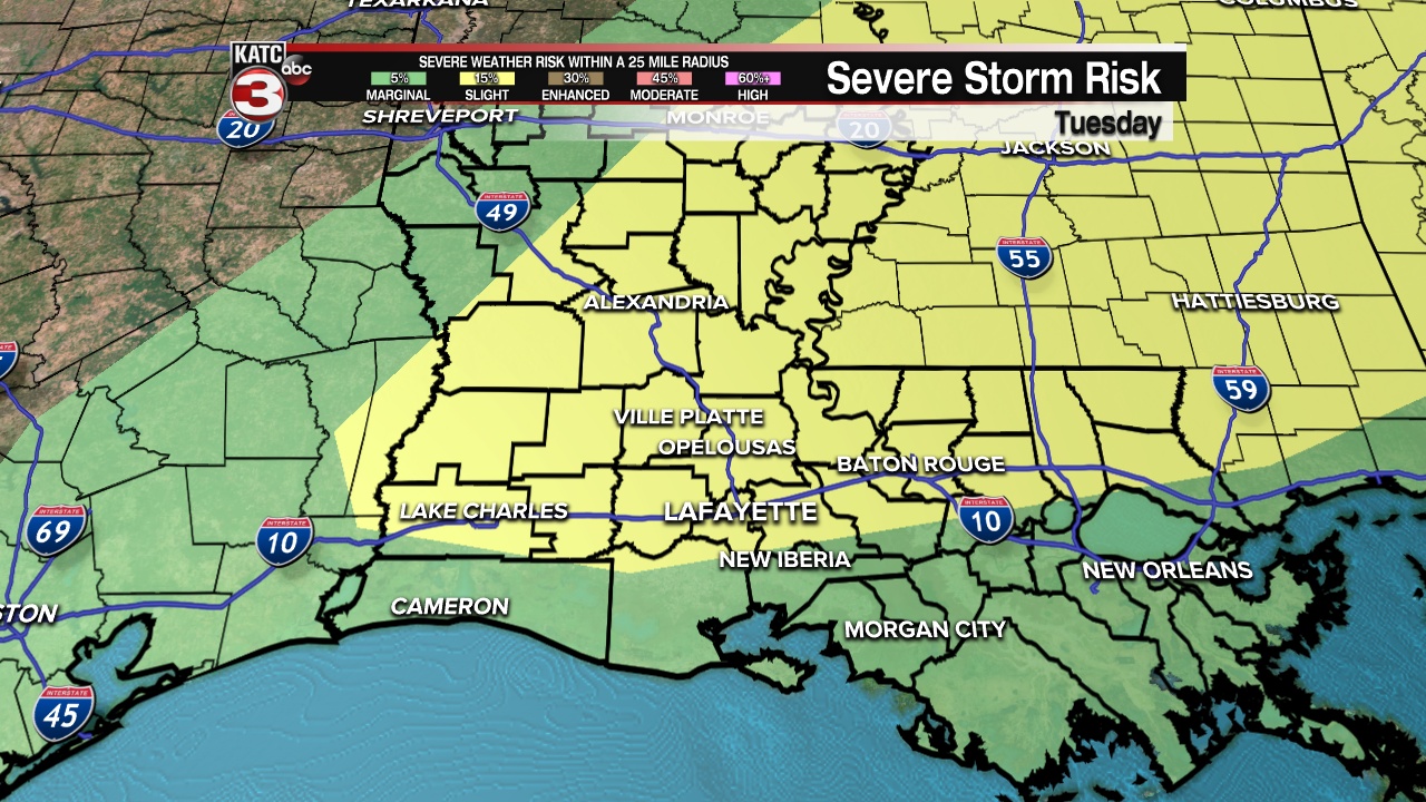
Gusty, damaging winds appear to be the primary threat at this time, but that will continue to come into better focus throughout the day on Monday, so stay tuned.
Additionally, CAPE (Convective Available Potential Energy) values will be fairly high on Tuesday which is supportive of thunderstorm development and growth.
As a result, some locally heavy downpours will be possible, especially in those heavier thunderstorms.
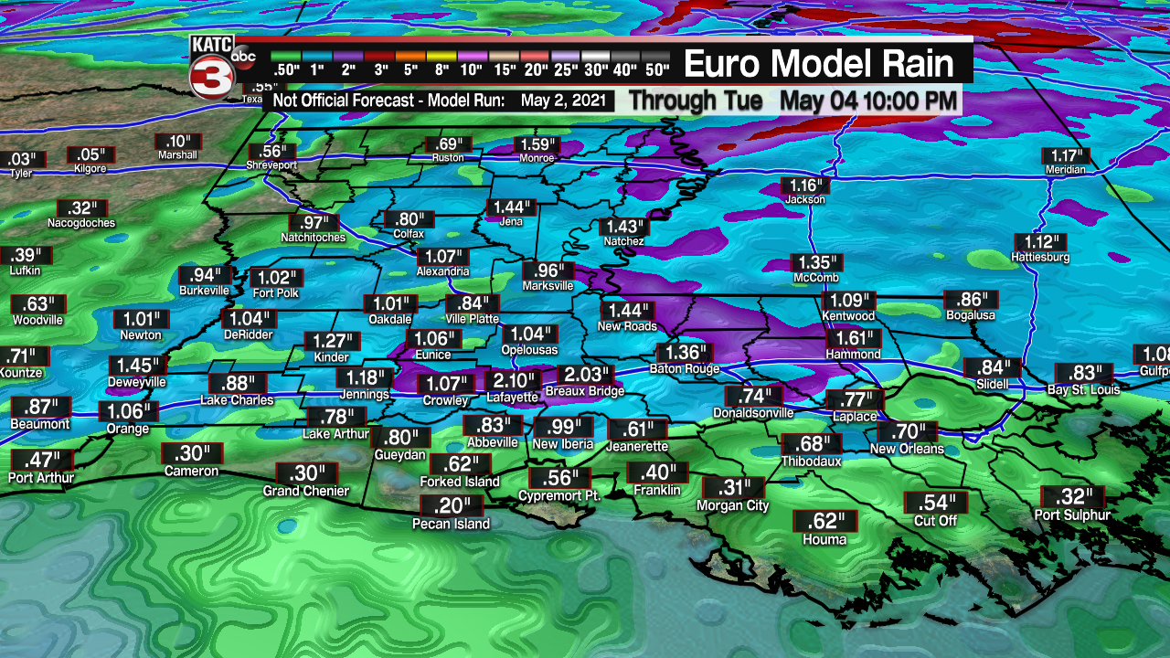
Models are going for around 1-2" of rainfall on Tuesday.
Timing for the showers and storms look to be during the afternoon and evening time frame.
Some leftover shower activity could be possible early Wednesday morning, but expect gradual clearing skies throughout the day.
Temperatures, especially overnight lows, will be slightly cooler as we round out the week as nicer weather conditions return to the region.
Next weekend looks pretty good as temperatures begin to rebound well into the 80s.
That warming trend will continue into the first half of next week as well.
A sign that summer is not too far away...
Y'all have a great week!
------------------------------------------------------------
Stay in touch with us anytime, anywhere.
To reach the newsroom or report a typo/correction, click HERE.
Sign up for newsletters emailed to your inbox. Select from these options: Breaking News, Evening News Headlines, Latest COVID-19 Headlines, Morning News Headlines, Special Offers
