


Acadiana will go from chilly to mild with rains before the week is done, back to cool this weekend, and then potentially frigid for a couple of nights next week.
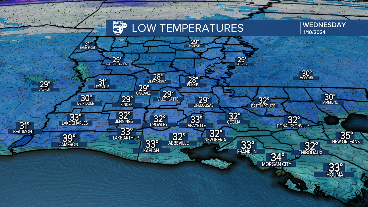
In the near term, look for gusty winds to diminish tonight with clear skies accompanied by temperatures ranging from the upper 20s to lower 30s by Wednesday morning.
Look for more sun Wednesday with warmer temperatures and a southerly breeze for the afternoon as highs approach the lower 60s.

It will be milder Wednesday night courtesy of those southerly winds, with lows Thursday morning closer to the upper 40s to lower 50s.
Partly to mostly cloudy and milder conditions are anticipated Thursday with highs reaching back into the lower 70s.

A quick passing light shower (20%) may be possible Thursday, with rain chances ramping up Thursday night (70%) into at least early Friday (80%)
This time around, although the Storm Prediction Center (SPC) has the area hatched in a marginal-slight risk of severe storms, the dynamics will not be as intense as Monday's weather system...nonetheless, we'll monitor future outlooks from the SPC, and never underestimate the threat...nor overplay either!

And after a mild start Friday, temperatures will chill into the afternoon and for the weekend with temperatures dropping into the lower 30s again for Saturday morning.
This weekend overall looks fair to partly cloudy and seasonably cool with highs in the 50s Saturday and 60s Sunday.
It should get interesting next week as the coldest air of the season to date (and maybe for what we see all winter) is poised to make a run from the Canadian Prairies to Louisiana.

The coldest air will arrive (after any rains early Monday) Monday night through Wednesday morning.
The EURO and GFS models are less in sync as compared with yesterday (GFS faster) on the timing of the cold, but they're both cold with night time lows in the hard freeze category of the low-mid 20s...which also mean teens may be possible for our northern parishes.
For now, the 10 Day forecast is a blend between the two models.
And NO, we're not expecting any winter precipitation at this time, as it looks to dry out well before the freezing temperatures arrive.
So expect a couple of overnight hard freezes next week that will require pipe protection for some...consult a plumber (not a meteorologist) for the specifics for your home!
-----------------------------------------------------------
Stay in touch with us anytime, anywhere.
To reach the newsroom or report a typo/correction, click HERE.
Sign up for newsletters emailed to your inbox. Select from these options: Breaking News, Evening News Headlines, Latest COVID-19 Headlines, Morning News Headlines, Special Offers
