


After severe storms, a possible tornado and flooding rains pummeled portions of Acadiana earlier Tuesday, the area is expected to remain entrenched in an unsettled and potentially stormy pattern through Thursday.

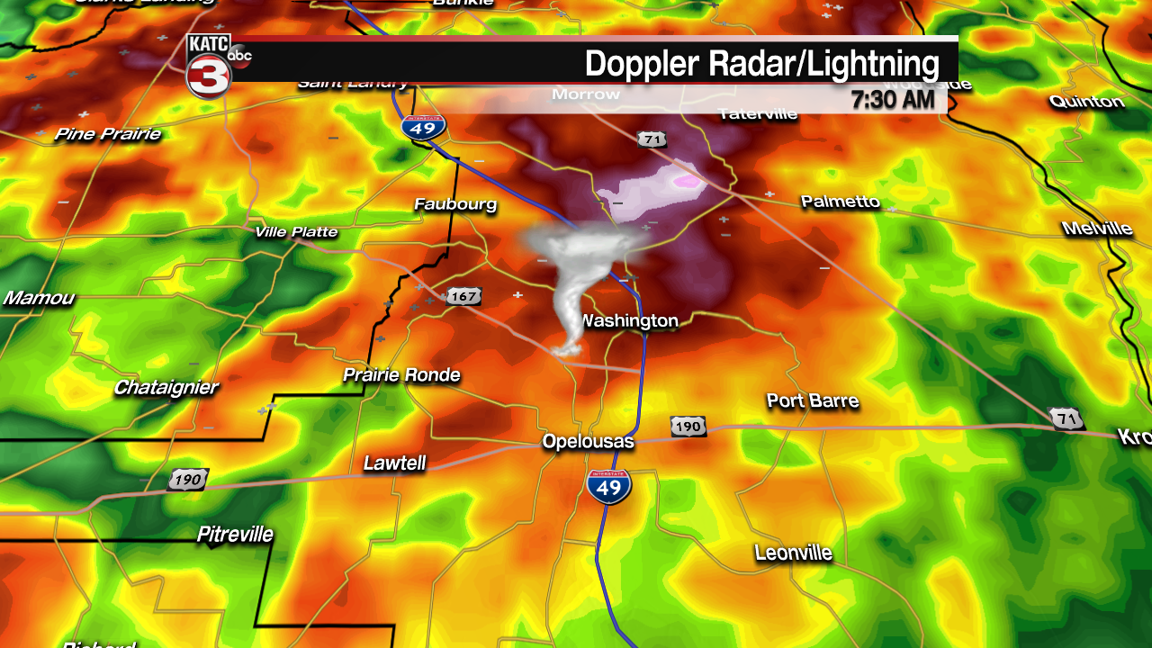
Storms early Tuesday morning produced flooding rains of 7" or better across the northern parishes of Acadiana while a tornado is suspected for producing damage to homes and businesses in the Washington area of St Landry Parish.
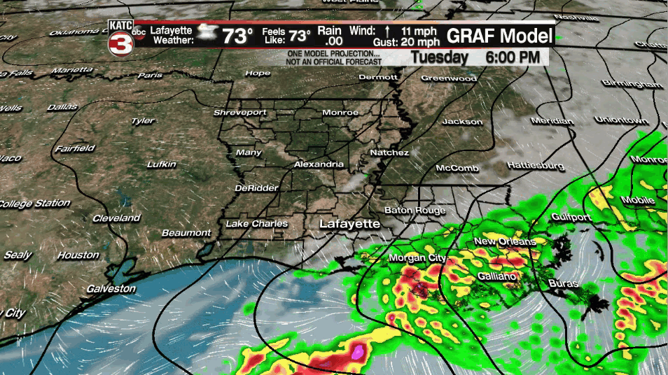
Lingering activity late Tuesday afternoon primarily across St Mary Parish will will gradually weaken and move off to the southeast...but not before producing upward of 4-7" of rain or more in this area.
Localized street flooding will continue be possible into Tuesday evening for St Mary and perhaps lower St Martin parishes.
Moving ahead into Wednesday, the same boundary that produced the widespread storms Tuesday will likely advance back to the north and across Acadiana Wednesday with scattered showers and a few storms possible...especially into the afternoon/early evening hours.

Portions of Acadiana will remain under a "marginal risk" for severe storms Wednesday, with the primary threat of storms that could produce damaging winds...perhaps an isolated tornado..remember while Acadiana is in the lowest threshold for a possible severe weather threat Wednesday, which was very similar to Monday's forecast ahead of the "over-performing" storms Tuesday.

A few storms could briefly become severe Wednesday...but the risk should be rather limited...nonetheless a storm containing damaging winds and/or an isolated tornado cannot be ruled out.
The next wave of storms will threaten the Acadiana area into Thursday with the severe weather dynamics increasing across the board with a "slight risk" of storms containing damaging and/or an isolated tornado. This outlook area will be further refined into Wednesday.

A "Tornado Watch" may be issued for portions of Acadiana at some point Thursday.
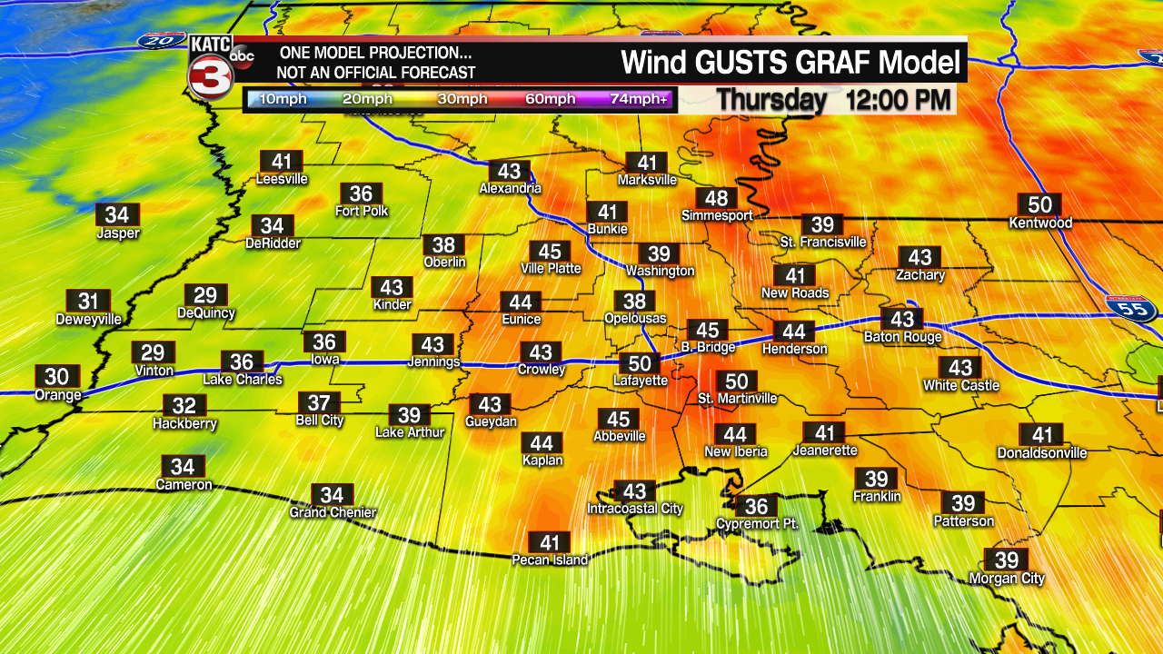
In addition, southerly winds into Wednesday will be breezy with a few gusts in the 20-25 mph range Wednesday, but when the dynamics increase Thursday, where portions of Acadiana could easily see wind gusts exceeding 40 mph from late morning into the mid-afternoon hours.
The storm system Thursday could be responsible for another tornado outbreak primarily into Northeastern & perhaps Eastern Louisiana, and large parts of Mississippi, Tennessee and Alabama
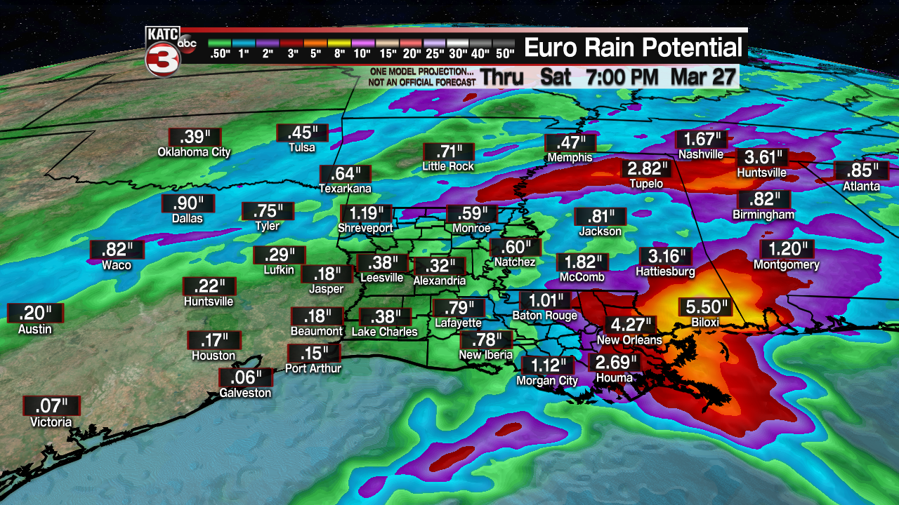
As for rainfall through Thursday, it appears the heaviest rains should be confined to Eastern/Southeast Louisiana, into portions of Mississippi and Alabama where flood watches continue through Friday morning.
Beyond Thursday, Friday is looking rather nice for Acadiana with fair skies and temperatures approaching 80° along with more pleasant humidity.
This weekend will be partly to at times mostly cloudy and quite balmy with highs reaching the lower-mid 80s Saturday and near 80° Sunday.
A cool front, accompanied by scattered showers and a few thunderstorms should sweep across the region Sunday with high temperatures dropping back closer to mid-70s while lows dip back down into the more refreshing 50s for a few days early next week.
See the KATC 10 Forecast for the latest.
------------------------------------------------------------Stay in touch with us anytime, anywhere.
To reach the newsroom or report a typo/correction, click HERE.
Sign up for newsletters emailed to your inbox. Select from these options: Breaking News, Evening News Headlines, Latest COVID-19 Headlines, Morning News Headlines, Special Offers
