


Acadiana's weather pattern will move into a more unsettled phase as the main regional weather-maker will be festering near the Northern Gulf of Mexico for most of the next week.
Our area will be on the western fringe of what could be a prodigious rain-maker for areas primarily east of Acadiana.
This feature could drift a little more westward in the days which would change the forecast for Acadiana to a much more wetter scenario.

The National Hurricane Center (NHC) is giving a potential low end tropical system (depression) a 30% chance of development through Friday.
The main story will be that any tropical disturbance (development or not) will be slow-moving, perhaps nearly stationary for a few days, which should feed deep tropical moisture northward toward Gulf coastal areas and increase a possible flood threat.
As of Monday, it appears that the greatest risk of heavy, excessive rainfall and potential flooding may develop later this week for portions of Southeast Louisiana, Mississippi, Alabama and the Florida Panhandle.

The Weather Prediction Center (WPC) is forecasting at least a 10-15" rainfall primarily offshore with some of the higher amounts working its way inland all east of Acadiana.
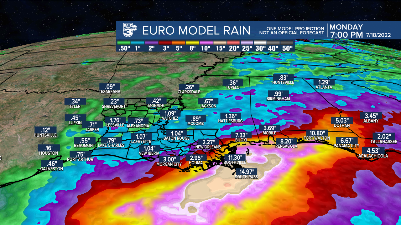
The WPC rain accumulation forecast is consistent with the Euro and GFS forecasts issued Monday.
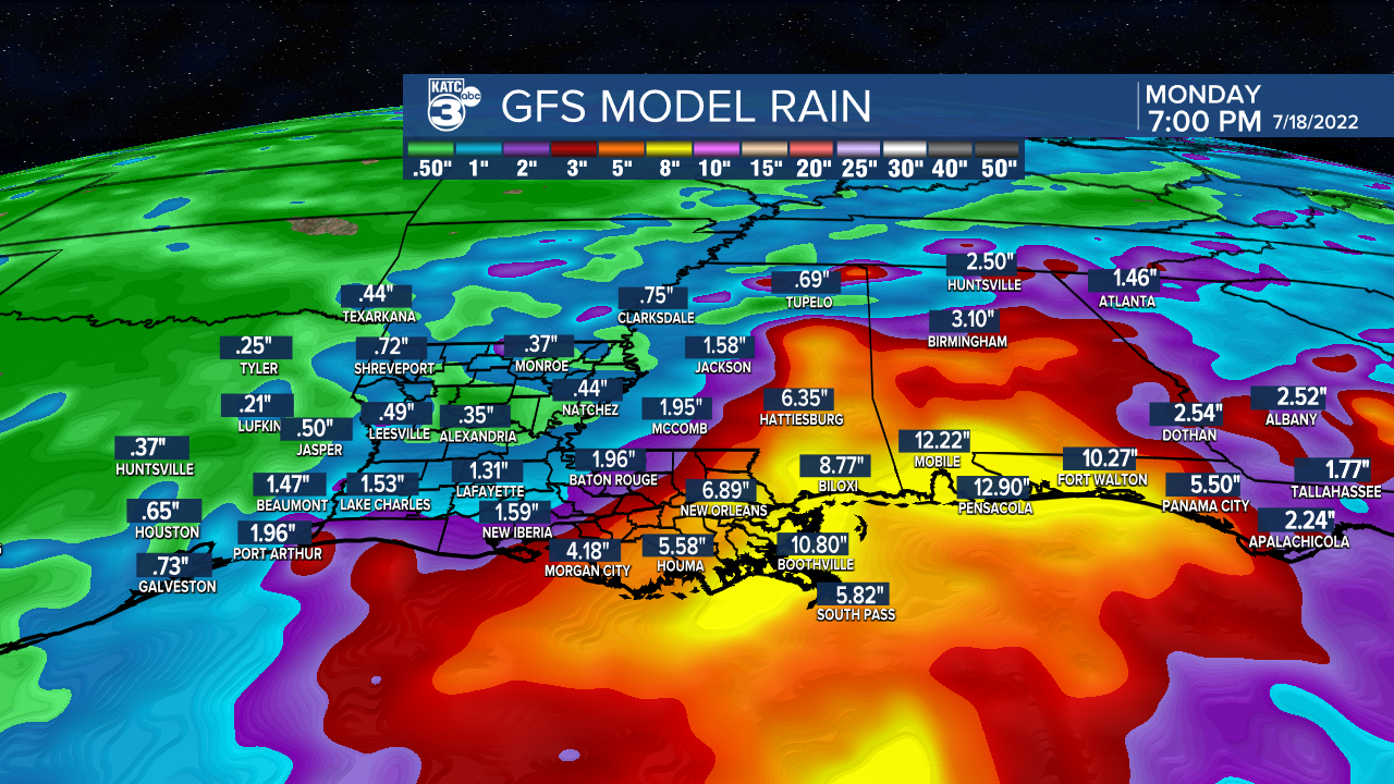
All the main action with this feature looks to stay east of Acadiana, unless the disturbances drifts more westward (per the GFS model).
Nonetheless, the forecast for Acadiana calls for rain chances near 40% Tuesday increasing to 60% Wednesday, especially later in the day and into the early evening hours.
Thereafter, we continue to maintain a good daily chance of showers and storms through the rest of the week but our rain chance percentages may go further up or down depending on the orientation and organization of any potential Gulf disturbance.
Stay with KATC for the latest and consult the latest KATC 10 Day Forecast for the outlook.
------------------------------------------------------------
Stay in touch with us anytime, anywhere.
To reach the newsroom or report a typo/correction, click HERE.
Sign up for newsletters emailed to your inbox. Select from these options: Breaking News, Evening News Headlines, Latest COVID-19 Headlines, Morning News Headlines, Special Offers
