


A few isolated showers and embedded storms will be possible through this evening.
We'll be quiet after midnight under fair skies.
Temperatures will start out in the middle 70s for our Monday morning.
Expect another hot day out there as afternoon highs climb into the lower and even mid-90s in spots.
And as the moisture and heat builds up throughout the day, that will give way to some scattered showers and storms across the area.
Prime time for the activity would be during the afternoon and evening hours.
If you miss out on the rain, it'll feel quite hot out there as winds will be light and variable.
Pretty similar set-up through the rest of the workweek with only small variations in day-to-day rain chances... nothing out of the ordinary for mid-August!
By the end of the upcoming weekend, upper-level ridging may try and bank in which could help to suppress shower and storm activity.
We'll see how that plays out in the days ahead...
Additionally, a full tropical breakdown is posted below.
Have a great week!
In the tropics:
Fred was upgraded back to a tropical storm on Sunday.
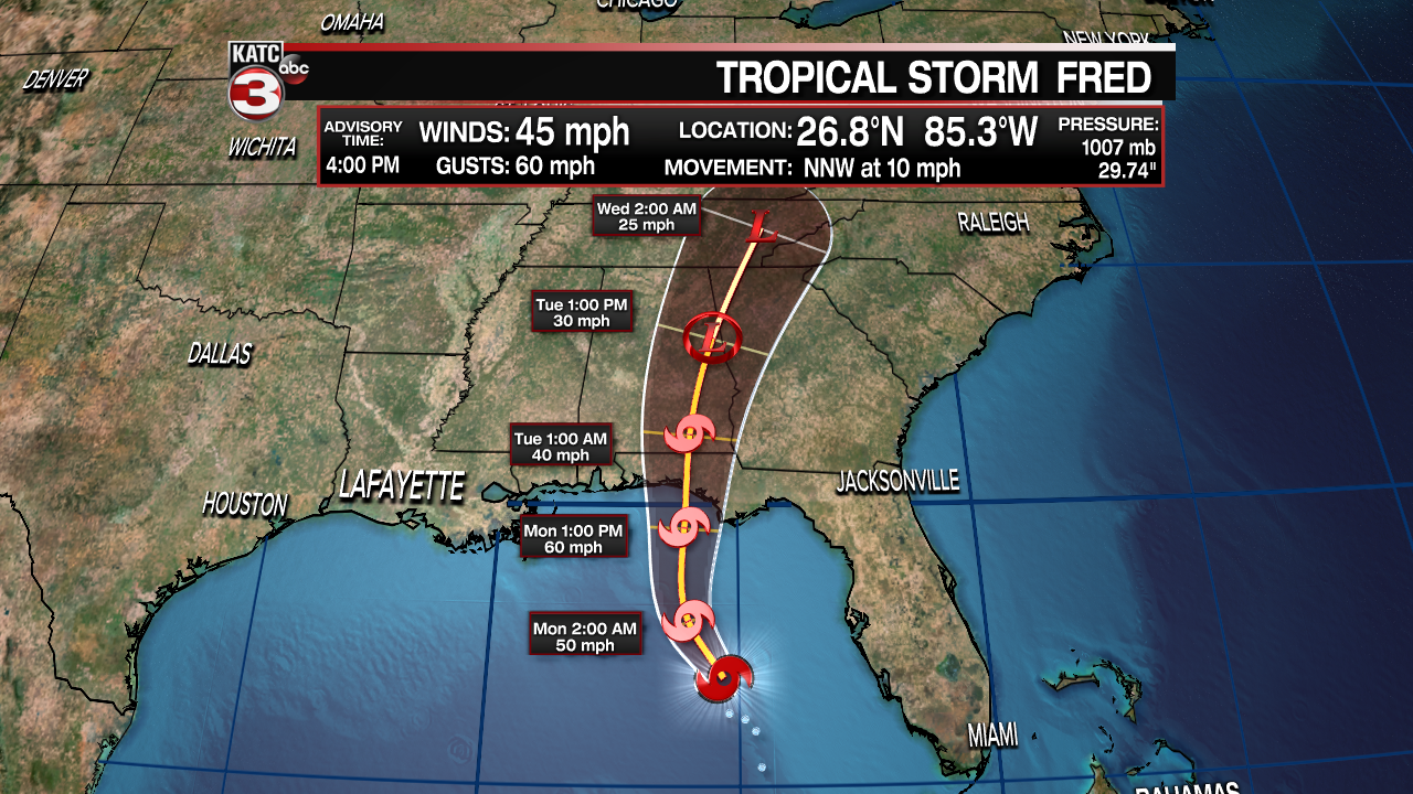
No real change in the thinking as it will make landfall across the Florida panhandle tomorrow evening.
No impacts for Acadiana.
On the contrary, Grace remains disorganized and has actually been downgraded to a depression with winds of 35 mph.
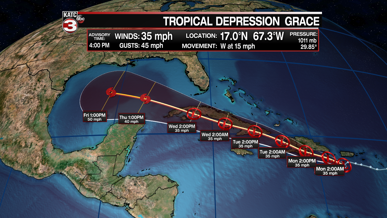
Main issue in the short-term is going to be land interaction with the Caribbean islands (As was the case with Fred).
That, coupled with some dry air should help to keep the storm intensity relatively in check.
It will continue to be steered westward by the Bermuda high and eventually will make its way into the Gulf of Mexico by mid/late week.
Similar to Fred, what is left of the system by that point, is still yet to be seen.
Forecast has shifted slightly a bit farther south and west once in the Gulf... pretty much in line to how some of the more reliable models have been trending.
Below you'll find one of the model's upper-level steering pattern for the days ahead.

Upper-level ridging may try and work in across the south-central US by the upcoming weekend and following week.
If that came to fruition, it would tend to steer the system more toward our south and west.
NOTE: This is just one model projection and NOT and official forecast.
Bottom Line: We are still in the early stages of the forecasting process, so by no means is anything set in stone.
We'll continue to watch the trends in the days ahead and of course, we'll be here to keep you informed and updated!
