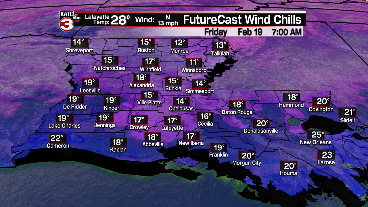
Acadiana will be in store for a couple of more nights of winter deep freezes before a gradual moderating trend kicks in this weekend.

A Hard Freeze Warning is in effect for most of Acadiana, from the I-10 parishes northward where temperatures by Friday morning will drop between 23-27° in most areas.

Add breezy north winds, and our wind chills Friday morning will be in the mid-teens!

Skies will clear Friday ushering in some much awaited sunshine that will help get the mercury into the lower-mid 40s for the afternoon.

But clear skies coupled with light winds will likely allow for another hard freeze Friday night into Saturday morning with lows closer to the low-mid 20s.

Expect more sunshine, perhaps mixed with some clouds Saturday, with temperatures climbing back into the relatively balmy low-mid 50s for the afternoon.

Clouds move in for Sunday, but temperatures are expected to climb further, thanks to southerly winds, and reach near 60° for an afternoon high.
A weak front will push through the area Sunday night and clear the region early Monday. This front should generate a 40% chance of showers, primarily near the pre-dawn hours Monday.
Although it will be slightly cooler Monday, a slow warming trend will follow next week with daytime highs climbing back well into the 60s to perhaps lower 70s by next Thursday, before the next weak front arrives.
See the KATC 10 Day Forecast for the latest.
------------------------------------------------------------
Stay in touch with us anytime, anywhere.
To reach the newsroom or report a typo/correction, click HERE.
Sign up for newsletters emailed to your inbox. Select from these options: Breaking News, Evening News Headlines, Latest COVID-19 Headlines, Morning News Headlines, Special Offers


