


Deep tropical moisture across the Bayou State will remain in place into Wednesday with scattered showers and storms a good bet for Acadiana once again Wednesday, but drier more stable conditions later this week will allow for lower rain chances and consequently hotter temperatures to return to the area.
Look for rain chances for Acadiana Wednesday to remain near the 60-70% range, but there should be a few more intervals of sun, helping push temperatures into the mid-upper 80s.
Drier more stable air will slowly begin to build into the region, primarily from the Eastern Gulf of Mexico, which should help to lower, but not eliminate our rain chances Thursday and most especially, for Friday.
An upper level trough approaching from the northwest this weekend should become a focal point for more scattered primarily afternoon showers and storms...and that same trough may ultimately have some impacts on the steering of a potential tropical system that will be approaching the Bahamas, Florida and portions of the Southeast U.S this weekend.
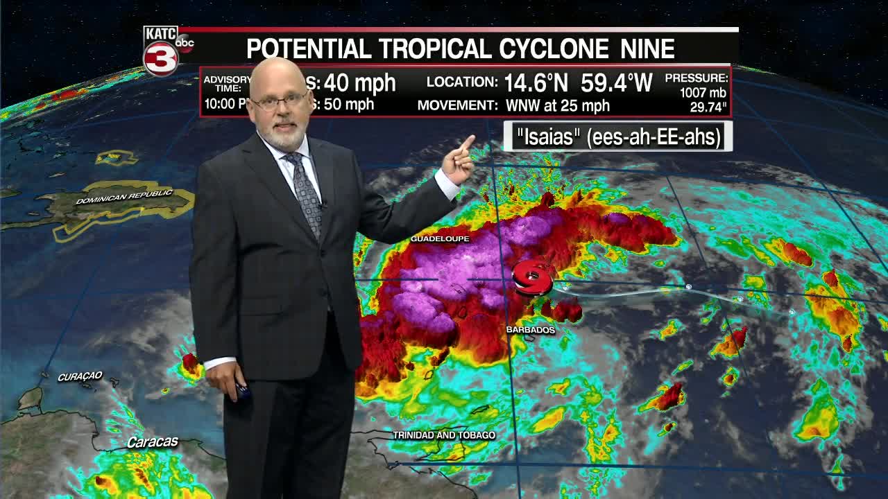
As for the tropics, Hurricane Hunters were unable to find a closed circulation of Potential Tropical Cyclone 9 east of the Eastern Caribbean Tuesday afternoon.
This system is expected to slowly get more organized through Wednesday, likely becoming the earliest 9th tropical storm named in the Atlantic Basin on record...by more than a week.
If the cyclone is upgraded to a tropical storm, it will be named "Isaias" (ees-ah-EE-ahs) sometime Wednesday.
Heavy rains and tropical storm wind impacts are expected from the Leeward Islands to Hispaniola over the next few days while the interaction with islands may limit intensity for bulk of the next 4 days or more.
Once a closed circulation develops and is identified the track and future intensity forecasts should improve.
Right now the National Hurricane Center has this system in the Bahamas Friday and reaching South Florida this weekend.
While it's too early to call the ultimate track and intensity due to the aforementioned reasoning, the Southeast U.S, the East US Coast and perhaps portions of the Central & Eastern Gulf (per the latest European Model) could be in play for something...stay tuned.
------------------------------------------------------------
Stay in touch with us anytime, anywhere.
To reach the newsroom or report a typo/correction, click HERE.
Download our free app for Apple, Android, Roku and Amazon devices.
Sign up for newsletters emailed to your inbox. Select from these options: Breaking News, Evening News Headlines, Latest COVID-19 Headlines, Morning News Headlines, Special Offers
