


Just two weeks into the Atlantic hurricane season, the tropics are heating up with one area in particular that could bring the threat of heavy, flooding rains to Louisiana into the weekend.
In the near term, hot and humid weather is expected for Acadiana over the next few days with a good chance of scattered showers and storms into Tuesday afternoon/evening with fewer storms Wednesday and especially Thursday ahead of a potential developing tropical system.

Daytime highs Tuesday will be in the lower 90s while we could push closer to the mid-90s Wednesday and Thursday. Heat indices will be over 100° each afternoon, but still just shy of "heat advisory" criteria.
The big weather-maker appears to be the threat of heavy, potentially flooding rains for Acadiana/Louisiana developing by late Friday and continuing into the weekend.
The National Hurricane Center (NHC) upgraded the chances of tropical development in the Gulf of Mexico this week to 70% as an area of disturbed weather and broad low pressure continues to fester in the Bay of Campeche/extreme Southwestern Gulf of Mexico.
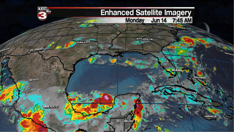
This disturbance is likely to stay bottled up to the south with little or no intensification (thanks to plenty of upper shear) through Wednesday.
By Thursday upper conditions are expected to relax while a weak upper low begins to entice the system to move northward while potential tropical organization becomes more favorable.
Currently it appears that this system could attain tropical depression status by Thursday and perhaps become a low-mid range tropical storm by early Friday.
If the above timing would be the case, then we could see tropical storm "watches" posted for portions of Louisiana as early as Wednesday night or early Thursday morning.
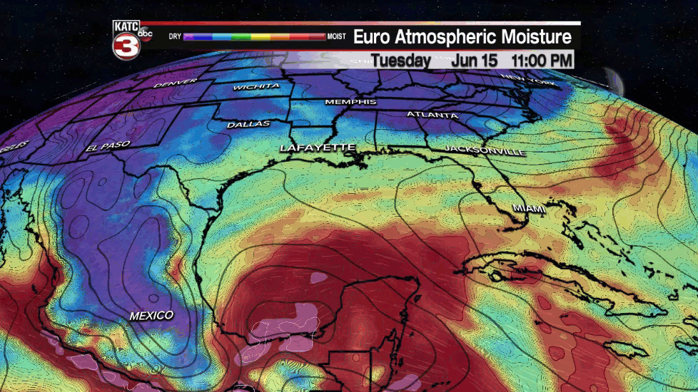
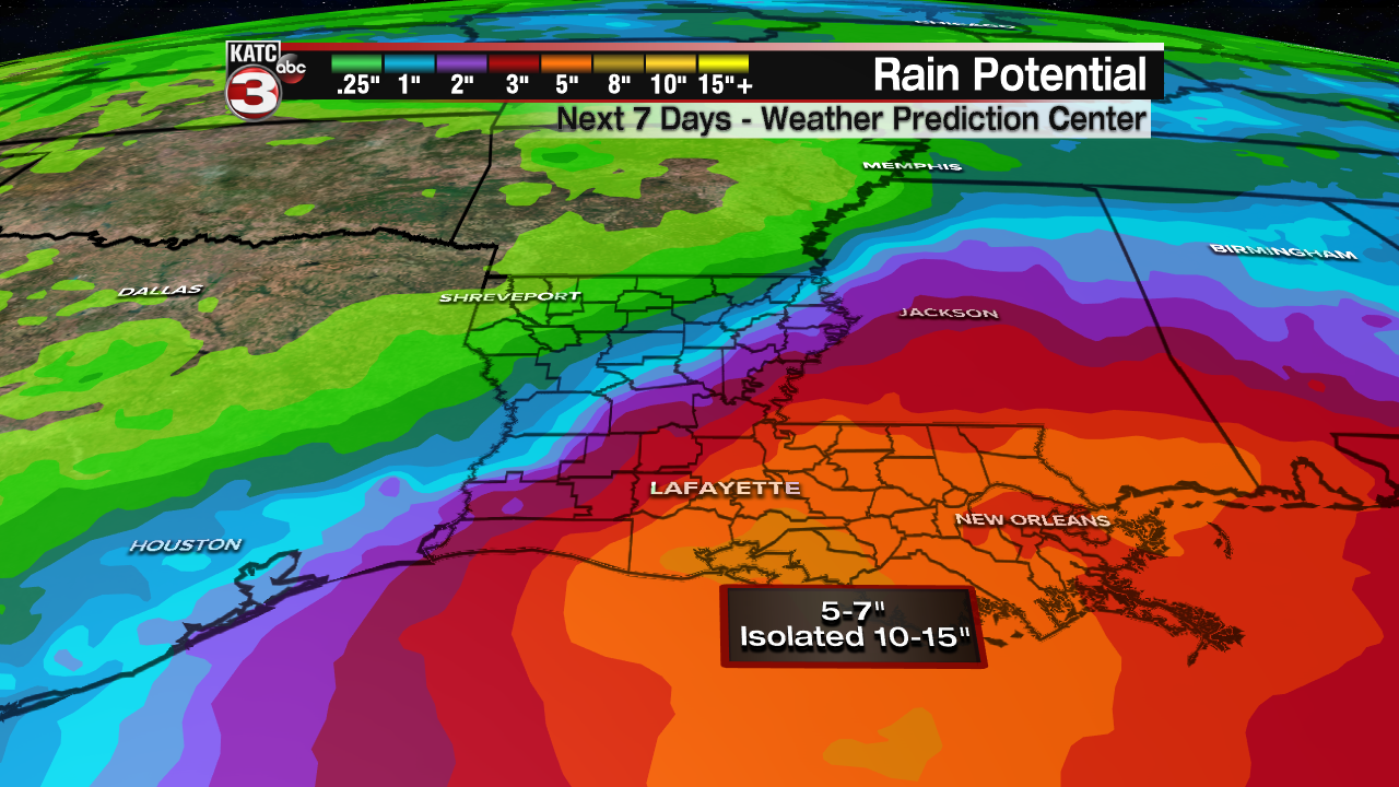
All of our models continue to indicate a system approaching the region by late Friday with the threat of heavy rains developing as early as Friday night, and likely bringing stormy weather Saturday.
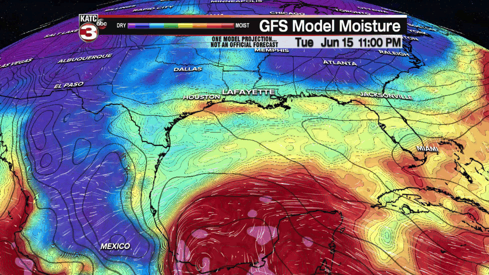
Both the GFS and Euro models bring this system to tropical storm strength at landfall somewhere along the Louisiana Coast, with an attendant heavy rain threat near and east of the center.
Obviously there could be many changes to the forecast with a developing system so all stated above and below are subject to change.
For now, it appears that the greatest threats to Acadiana and Louisiana will be flooding rains, and depending on the intensity, some coastal tidal flooding.
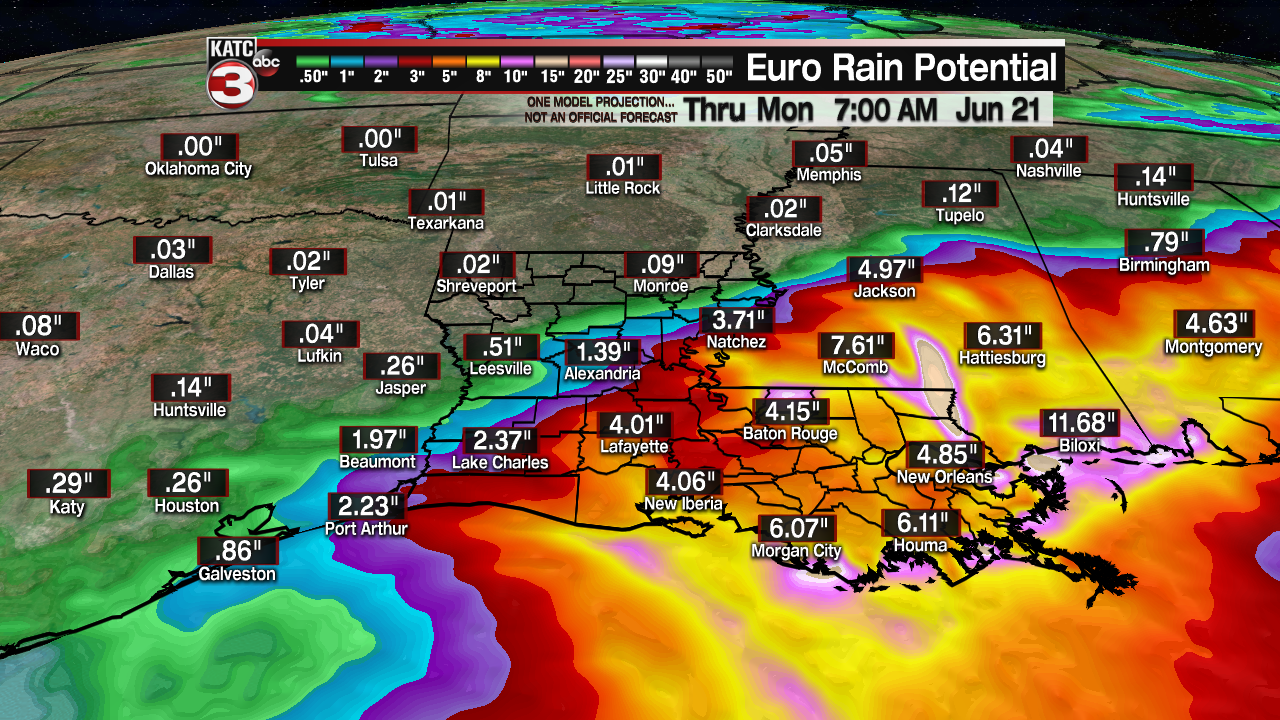
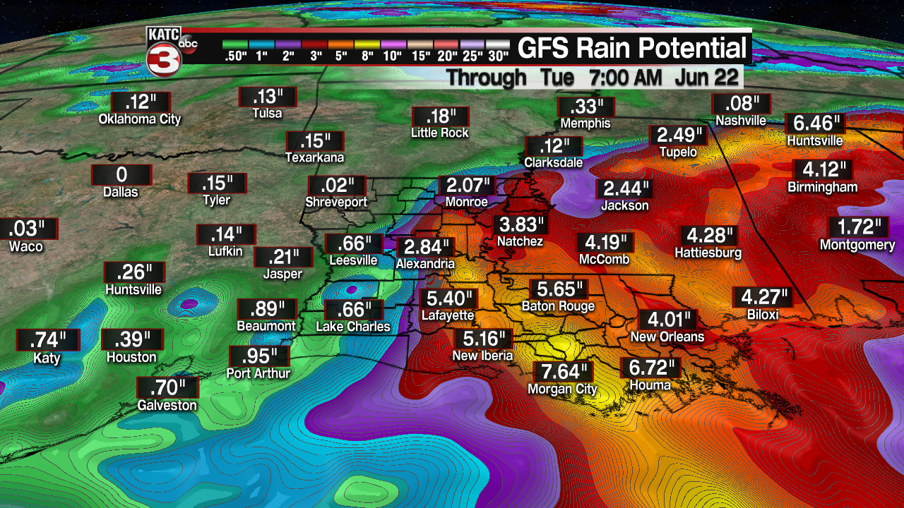
Although it's impossible to issue an accurate forecast on where the heaviest rains will ultimately focus, but for now we can expect anywhere from 4-7" in Acadiana, with isolated amounts likely approaching the 10-15" range, especially east of wherever the center makes landfall...on today's models, that would be toward Eastern/Southeastern Louisiana.
Depending on how quickly or not this system moves, there could still be threat threat of some locally heavy rains into Sunday.
It appears that we will likely resume or more typical summer pattern into next week. See the KATC 10 Day Forecast for the latest.
Elsewhere in the tropics, Tropical Depression #2 formed off the East Coast in the Atlantic today and could briefly become a tropical storm into Tuesday before dissipating over open waters, while a new system emerging off of the African Coast as a low chance of development in the next 5 days.

If TD #2 becomes a tropical storm, the name will be "Bill"...leaving the next name, and potential Gulf system with the name: "Claudette".
As always, our forecast will change and our rainfall estimates will improve as the week wears on, but stay with KATC, katc.com and our social media pages for the latest on this weekend threat.
------------------------------------------------------------
Stay in touch with us anytime, anywhere.
To reach the newsroom or report a typo/correction, click HERE.
Sign up for newsletters emailed to your inbox. Select from these options: Breaking News, Evening News Headlines, Latest COVID-19 Headlines, Morning News Headlines, Special Offers
