


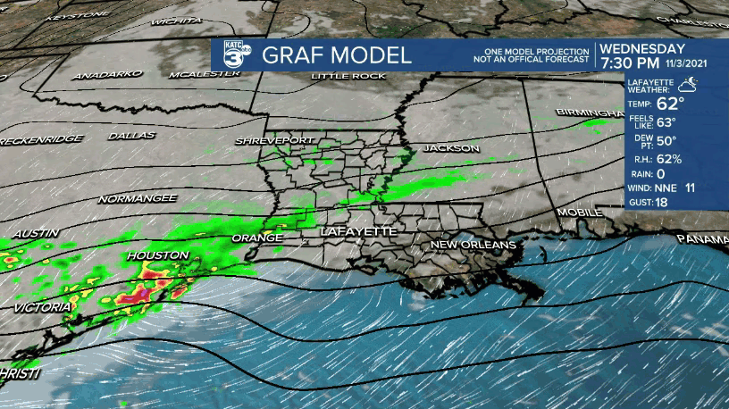
An upper level disturbance and weak low pressure system in Southeast Texas Wednesday afternoon will bring scattered showers to Acadiana overnight followed by a wintry feel to the weather for Thursday.
Shower activity across Texas was moving from the northwest into Louisiana late Wednesday afternoon with this activity to expected to become less widespread and more scattered in nature into the evening/overnight hours.
So with that, rain chances for the area will be in the 50% range...with a higher risk of getting wet in the Northwest parishes of Acadiana while the Southeast parishes should be drier and may not see any rain at all.
All of us however will feel chillier temperatures moving in by morning along with breezy northeasterly winds, bringing a little but of a chill factor to the area.
Lows by morning will be in the upper 40s to lower 50s.

Lingering clouds are expected Thursday with temperatures struggling to get out of the 50s for a few hours in the afternoon. Gusty northeast winds will make it feel rather blustery.
In fact, with highs in the lower 60s expected, it will feel a little more like a typical mid-winter day!
Clouds could thin for some limited sun late Thursday afternoon, but expect skies to definitively clear Thursday night.
Temperatures Friday morning will likely dip down closer to the mid-40s with wind chills dropping into the lower 40s, perhaps upper 30s across northern portions of Acadiana!
Lots of sunshine and seasonably cool temperatures are expected Friday with highs reaching the upper 60s...roughly 8-10° below normal.
The chilliest of conditions should arrive Friday night with low temperatures getting close to the lower-mid 40s.
Full sunshine and a beautiful fall weekend is on tap for the region with daytime highs climbing into the low-mid 70s while night time/morning lows stay in the mid-40s.
Some temperature moderation is expected for next week with the pattern remaining quiet for the most part.
Our next front is looking to arrive next Thursday or Friday.
See the KATC 10 Day Forecast for the latest.
------------------------------------------------------------
Stay in touch with us anytime, anywhere.
To reach the newsroom or report a typo/correction, click HERE.
Sign up for newsletters emailed to your inbox. Select from these options: Breaking News, Evening News Headlines, Latest COVID-19 Headlines, Morning News Headlines, Special Offers
