


We have been enjoying some really nice weather over the last couple of days, but unfortunately that will be quickly changing starting on Tuesday.
An upper-level trough is taking shape out west and will be progressing eastward in the days ahead helping to energize the subtropical jet stream.
It does not take much this time of year with daytime heating and Gulf moisture in place to increase our rain chances.
So, with a little upper-level energy support, expect a decent scattering of showers and storms over the next several days.
Tuesday will start off relativity quiet with temperatures in the upper 60s.
Expect rain chances to increase to around 60% by the afternoon with some of the activity lingering into the early evening as well.
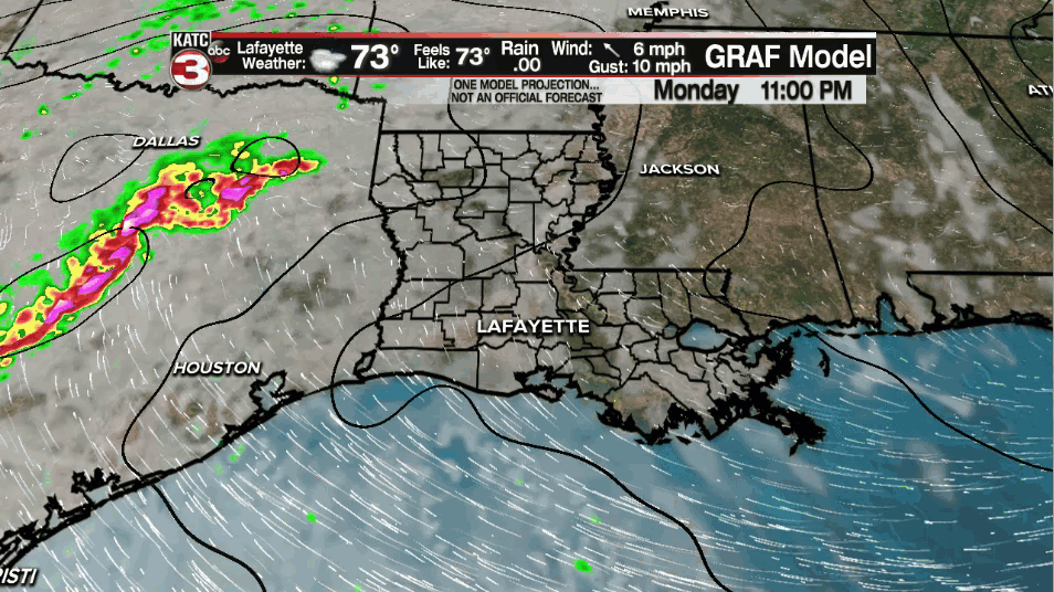
Some brief heavy downpours/gusty winds could accompany a few of the storms.
As per usual this time of year, any activity that we do see get going will start to settle down after sunset once we lose the heating of the day.
Quiet tomorrow night as temperatures hover in the lower 70s.
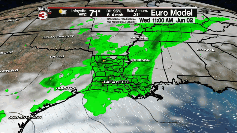
Another round of scattered showers and storms will be on the way for Wednesday, and really, that will be the theme for the rest of the week.
Now it will not be raining continuously every day nor complete washouts, but we will definitely have to dodge some showers and storms out there for sure, so keep the rain gear nearby.
We look to stay unsettled through the weekend with our next upper-level disturbance approaching by the end of the weekend and into the first half of next week.
That will likely keep our rain chances elevated through that time period as well.
With the clouds and showers around, afternoon highs will be kept in check in the lower to middle 80s.
Overnight lows will be in the lower 70s for the most part.
A decent soaking looks to be in store over the next several days as well...
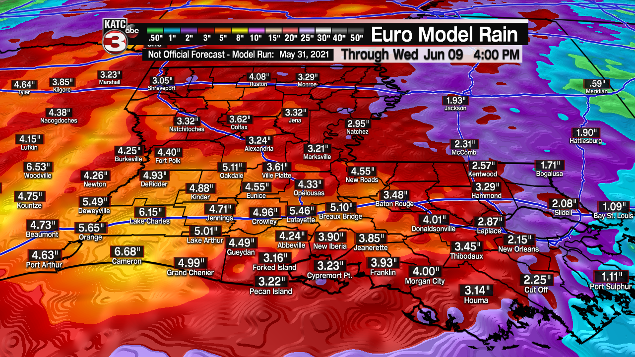
Keep in mind that this is likely to fall in a multi-day period as the above model is taking us through NEXT Wednesday.
Be sure to stay with us for the very latest information.
Have a great rest of the week!
In the tropics:
Hurricane season officially starts on Tuesday.
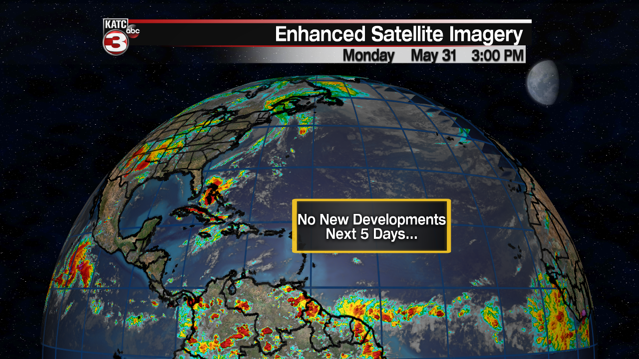
However, all remains quiet at this time with no new developments expected at least through the next 5 days.
------------------------------------------------------------
Stay in touch with us anytime, anywhere.
To reach the newsroom or report a typo/correction, click HERE.
Sign up for newsletters emailed to your inbox. Select from these options: Breaking News, Evening News Headlines, Latest COVID-19 Headlines, Morning News Headlines, Special Offers
