


A surge of high pressure from the north will bring breezy and chillier conditions to Acadiana Friday with sub-freezing temperatures expected by Saturday morning.
In the near term, expect temperatures not to be as cold as they have been going into Thursday night and Friday morning,

Lows by daybreak Friday will be closer to the upper 30s to lower 40s as clouds move in overnight.
Friday will start off mostly cloudy, but should finish mostly sunny, breezy and seasonably chilly.

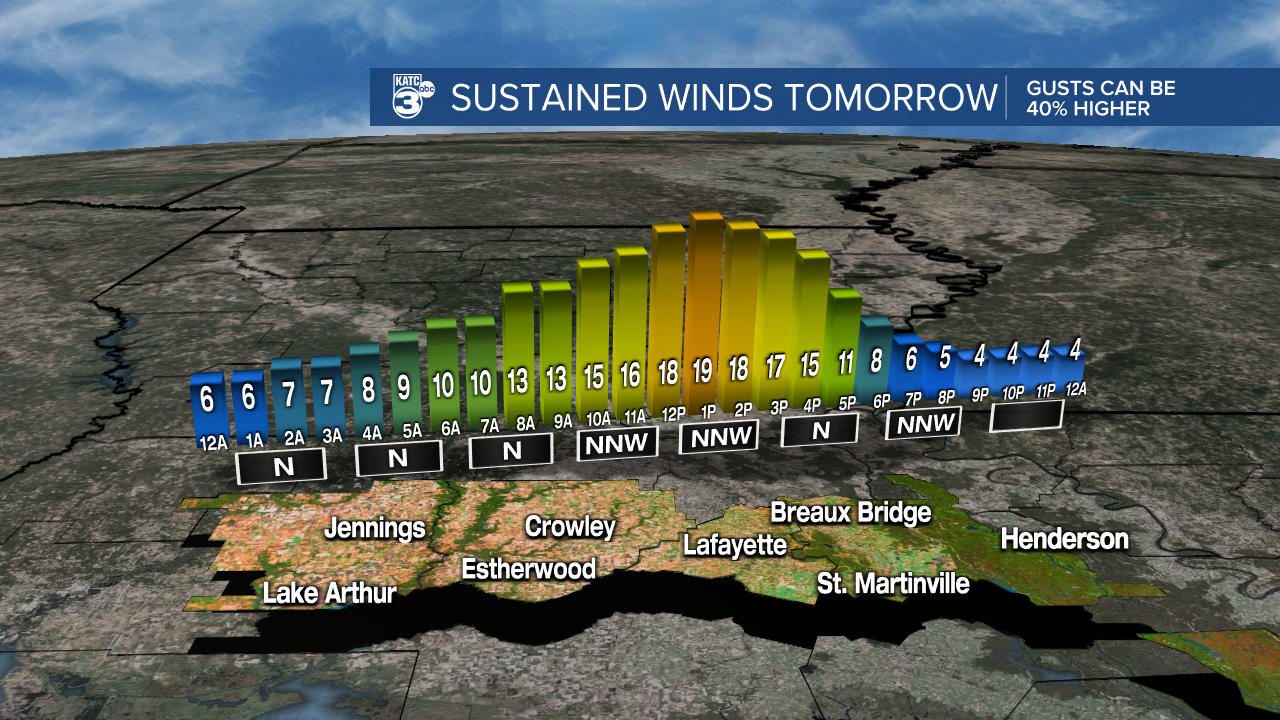
Gusty north winds will increase into the 15-25 mph range during the afternoon making our projected highs in the mid-50s feel colder.
A winter chill will be back in full force Friday night into Saturday morning with temperatures dropping into the lower 30s to upper 20s outlying areas north of the I-10 corridor.

This weekend is looking like a very nice January weekend with lots of sunshine.
We'll see highs Saturday in the low-mid 50s, and readings Sunday afternoon will reach the milder mid-60s.

Next week is still looking more "dynamic" and mild through mid-week with scattered showers and some thunderstorms possible through Wednesday and perhaps Thursday.
Best rain chances for now appear to be Monday night, then again into Wednesday.
Some heftier storms will also likely be in the forecast around Wednesday ahead of our next frontal system.
Thereafter, it looks like winter will make at least a four day return late next week into the following weekend with highs in the 40s and 50s accompanied by lows in the upper 20s to lower 30s.
See the KATC 10 Day Forecast for the latest.
Meanwhile in other weather news, the Northeast and New England will be watching a potent Nor'easter riding up along the East Coast Friday into Saturday.
Very heavy snows will be possible from Long Island to the coastal areas of New England.

Models are showing the likelihood of totals of a foot or more will be possible in spots, especially Eastern Massachusetts ...along with strong winds, drifting snow will be likely.

There's no winter precipitation in the forecast for Acadiana through the next few weeks...
Stay in touch with us anytime, anywhere.
To reach the newsroom or report a typo/correction, click HERE.
Sign up for newsletters emailed to your inbox. Select from these options: Breaking News, Evening News Headlines, Latest COVID-19 Headlines, Morning News Headlines, Special Offers
