


After a couple of chilly, gray overcast days, Acadiana will be treated to a sunny and mild Wednesday...but don't get too used to it as clouds and the threat of soaking rains return Thursday into Friday.

In the near term, skies are expected to clear overnight with temperatures dropping into the mid-40s by morning.
Ahead of our next weather-maker, look for sunny and much milder conditions for the area Wednesday with high temperatures reaching the mid-70s.
Moving into Thursday, a large-scale upper low in the Pacific Northwest will drop through the Rockies Wednesday, slowing down as the system nears Texas into Thursday.

This will set-up Acadiana for what should be several rounds of rain and storms over roughly a 48 hour period.
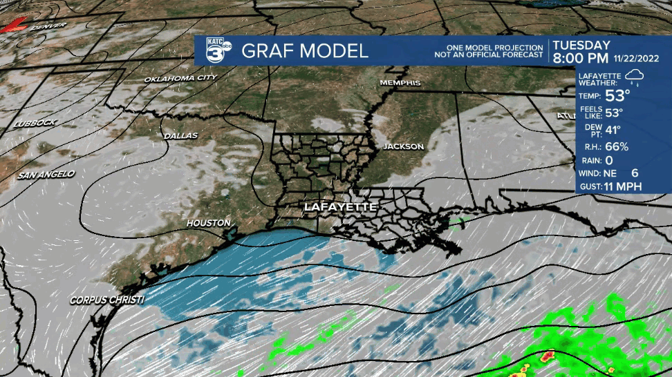
The onset of the rain Thursday literally remains up in the air with the latest GRAF Model holding off on the high rain chances until Thursday evening while both the Euro & GFS models are bringing the precipitation into the area by midday.

So for now, rain chances will start out near 70% Thursday and will likely increase to near 80-90% Thursday night, Friday and into Friday night before activity tapers Saturday morning.
Thunderstorms will be most likely Thursday into Thursday night, and while the area is not hatched in for any substantial severe weather risk, there could still be a couple of hefty storms in the region through early Friday.
Later Friday into Friday night the precipitation should just be in the form of mostly rain, which could be heavy at times, but rumbles of thunder will still be possible.
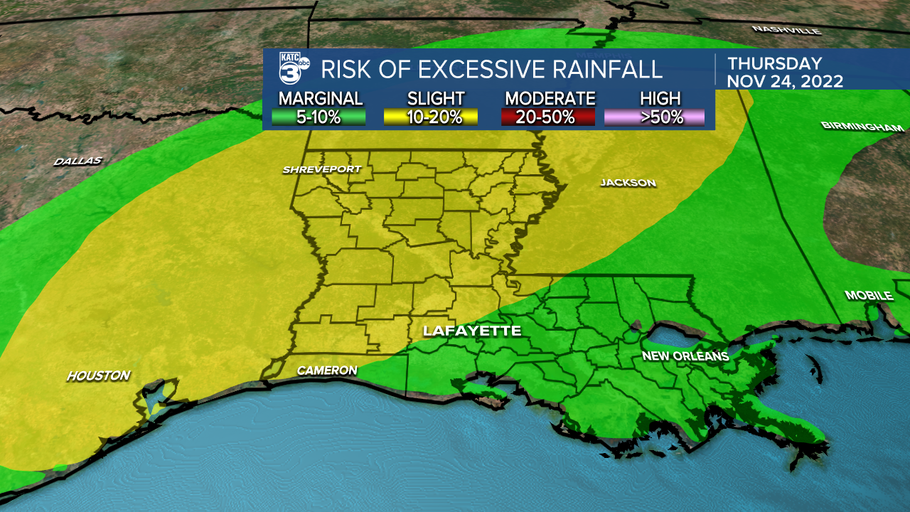
The two day rain totals could be an issue in the region, thus the Weather Prediction Center (WPC) has Eastern Texas, half of Louisiana, and the northwestern sections of Acadiana hatched in for a slight risk (level 2 out of 4) for excessive rainfall that could lead to some localized flooding from 7am Thursday through 7am Friday.

The risk of excessive rainfall will very likely spread eastward into Friday.
Rain totals per the WPC should be in the 1-3" range for Acadiana with isolated areas possibly double that amount.
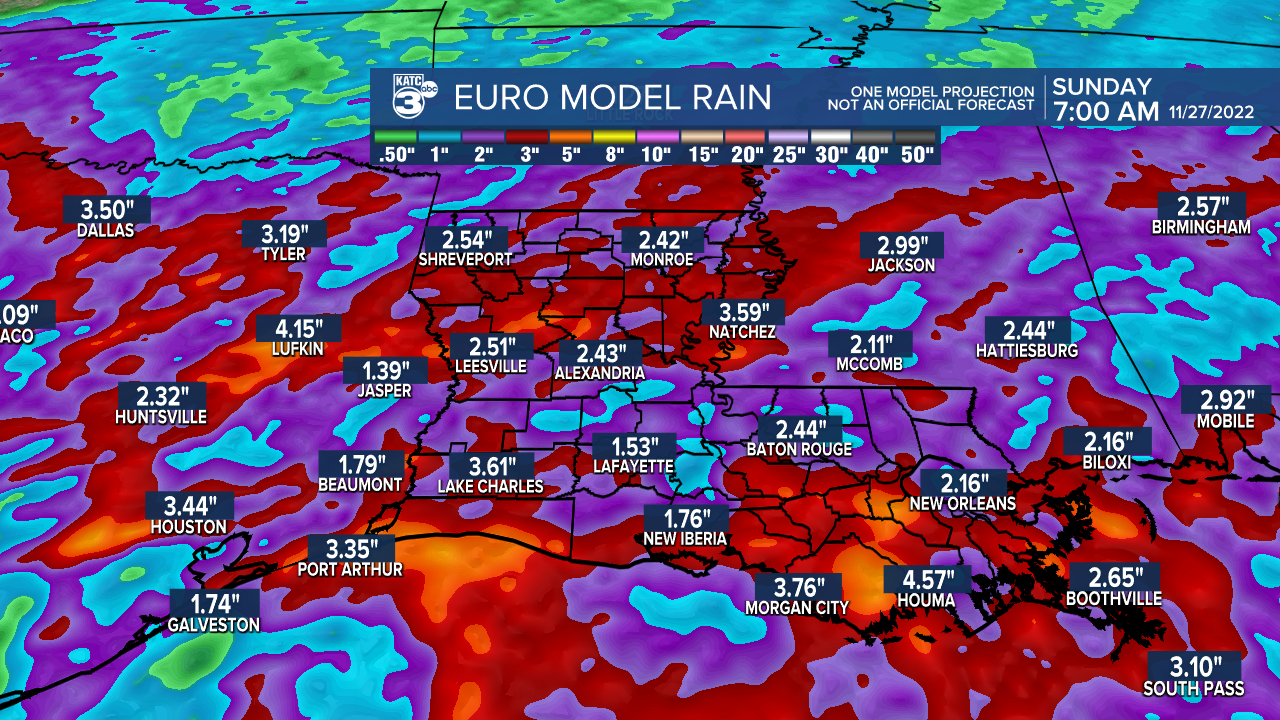
Models remain consistent on our rainfall forecast with most areas seeing up to 2-3" per the Euro and GFS.

The greatest threat of flooding with this system in Louisiana seems to be pointing toward the western, central and northern parts of the state.
Showers look to come to an end across Acadiana by Saturday afternoon with some sun possible before the day is done.
Sunday into early next week should bring fair and seasonable weather.
See the KATC 10 Day Forecast for the latest.
So at least the big travel days before and after Thanksgiving will be favorable across our region...but always factor in airport hub weather in Dallas, Houston, Nashville and Atlanta...the latter two especially, may have some weather issues Sunday.
------------------------------------------------------------
Stay in touch with us anytime, anywhere.
To reach the newsroom or report a typo/correction, click HERE.
Sign up for newsletters emailed to your inbox. Select from these options: Breaking News, Evening News Headlines, Latest COVID-19 Headlines, Morning News Headlines, Special Offers
