


It's going to be a sun-drenched typical winter weekend for Acadiana with cool days followed by chilly, perhaps frosty nights.
Temperatures Friday night into Saturday morning will drop into the mid-30s as winds will gradually decrease, but probably not enough for a widespread frost to develop.
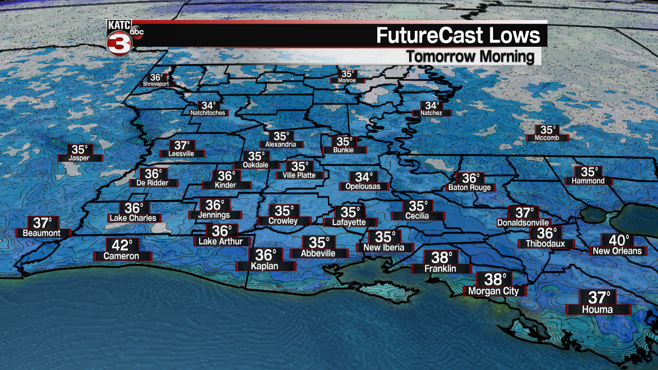
Nonetheless, you'll probably want to cover the plants over the next several nights as temperatures will be in the "frost-zone" through Monday morning.

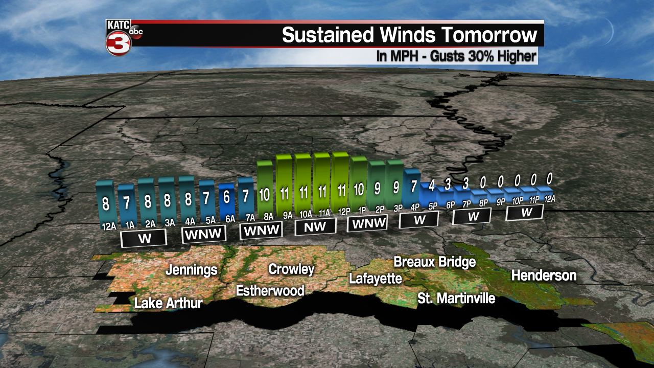
Lots of sunshine is expected Saturday with highs in the mid-50s accompanied by a northwest breeze...but winds won't be as gusty as they were Friday (where gusts exceeded 30 mph) and will be closer to 10-15 with a few gusts to 20 mph.
As high pressure moves nearly overhead, lighter winds are expected Saturday night into Sunday morning with frost a better bet.

Some high clouds should move in early Sunday as another ridge of high pressure builds into the area, otherwise expect another nice winter day with temperatures moderating back to near normal: the lower 60s.

More sunshine is expected for MLK Day Monday with afternoon highs reaching the low-mid 60s after a possibly frosty start to the day.
Definitively milder temperatures are in the forecast later next week with highs reaching the upper 60s to lower 70s Tuesday and the low-mid 70s Wednesday through Friday.
The longer range models have been trending milder and perhaps not as wet, but there will likely be some rain chances developing for the latter part of the week and perhaps continuing into the weekend.

For now, we see no severe weather or heavy rain threats on the horizon. See the KATC 10 Day Forecast for the latest.
Climate Notes: On a longer range note, it appears that the latter part of this month may finish off with near or slightly above normal temperatures, even though there might be a few chilly days ahead, and into February too.
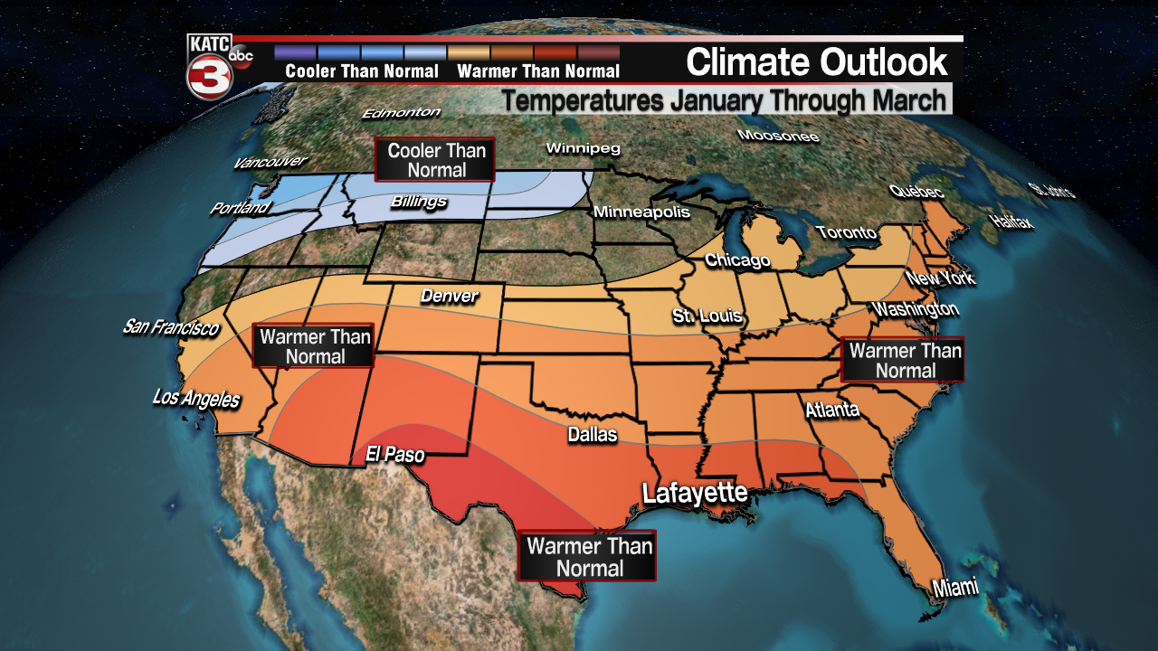
Examining the Climate Prediction Center's forecast for January through March however (made mid-December), calls for above normal temperatures and near or slightly below normal precipitation through the next couple of months.
Typically Acadiana's coldest weather can occur anytime between now and the first few weeks of February, and the clock is beginning to look like it may be running out for any true arctic air shots or any winter weather events for us locally...although it does appear that frigid air may make a move into the Midwest to the Northeast later this month and/or into February.
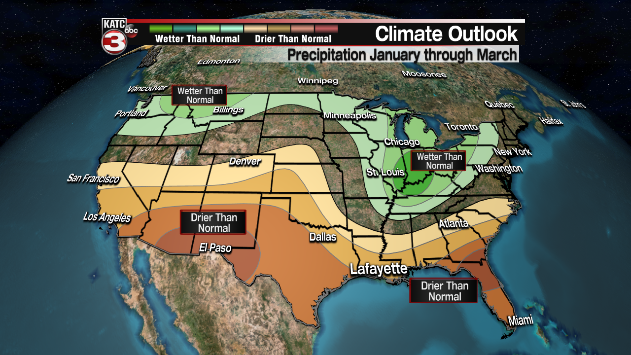
It should be noted that with an "above normal" forecast, there can still be some very cold periods ahead for us with the long-term numbers still likely to average out above normal from here on out...and the same could be said for precipitation as well...we'll see!
------------------------------------------------------------
Stay in touch with us anytime, anywhere.
To reach the newsroom or report a typo/correction, click HERE.
Sign up for newsletters emailed to your inbox. Select from these options: Breaking News, Evening News Headlines, Latest COVID-19 Headlines, Morning News Headlines, Special Offers
