


Acadiana is in for a stormy period starting early Sunday, and after a brief break Sunday night into Monday, more storminess is in the forecast Tuesday into Wednesday.
In the short term, expect mostly cloudy skies to persist for the area through Saturday with slight rain chances (near 20%) overnight and the possibility of a few more showers, possibly an isolated storm (near 30%) Saturday afternoon.

Lows Saturday morning will be a little cooler, but not by much, in the upper 60s.
Highs Saturday afternoon, with the possibility of a few intervals of sun, should be in the upper 70s to lower 80s.
The pattern turns for the darker late Saturday night into Sunday morning with widespread storms becoming likely, and possibly remaining on and off through the early afternoon hours.

The Storm Prediction Center (SPC) has most of Eastern and Southern Texas hatched for a marginal risk of severe storms Saturday with dynamics improving and shifting eastward up to a "slight risk" for most of Louisiana and all of Acadiana Sunday.

The current thinking based on upper atmospheric analyses is that there should be an organized round of strong to severe storms in the area from predawn to the post-dawn hours Sunday...thereafter, scattered strong to severe storms will be possible through the early afternoon.

Storms containing damaging winds and isolated tornadoes will be possible, with a stronger than normal signal for some hail, especially from mid-morning into the mid-afternoon.
So Sunday we may start off with a possible tornado watch for portions of the area which could segue into a severe thunderstorm or an additional tornado watch into the afternoon...so stay weather aware this weekend, and don't miss our forecasts updates Saturday.
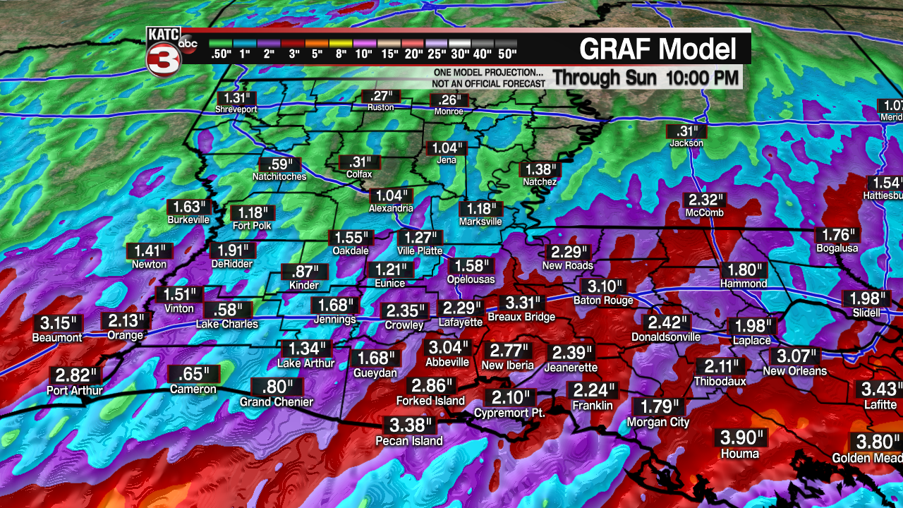
On top of that, the threat of locally heavy rainfall for the area appears to be growing with the latest GRAF model indicating up to 2-3" or of rain possible for portions of the area, with isolated amounts possibly higher with localized street flooding possible if cells "train" over the same areas.
Storms may end early enough for a little sunshine later Sunday afternoon.
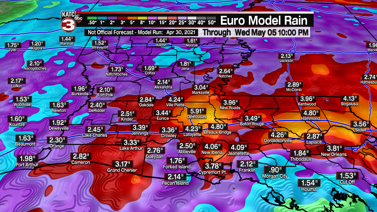
We'll remain in between systems Monday before another potent system approaches the area Tuesday, bringing back the risk of strong to possibly severe storms, and the threat of heavy rainfall to the area later Tuesday into early Wednesday.

Several more inches of locally heavy rains will be possible through the mid-week period.
Thereafter, the models remain consistent on a more pleasant weather pattern for the latter part of next week which should carry into the following weekend...and by then we will have earned it!
------------------------------------------------------------
Stay in touch with us anytime, anywhere.
To reach the newsroom or report a typo/correction, click HERE.
Sign up for newsletters emailed to your inbox. Select from these options: Breaking News, Evening News Headlines, Latest COVID-19 Headlines, Morning News Headlines, Special Offers
