


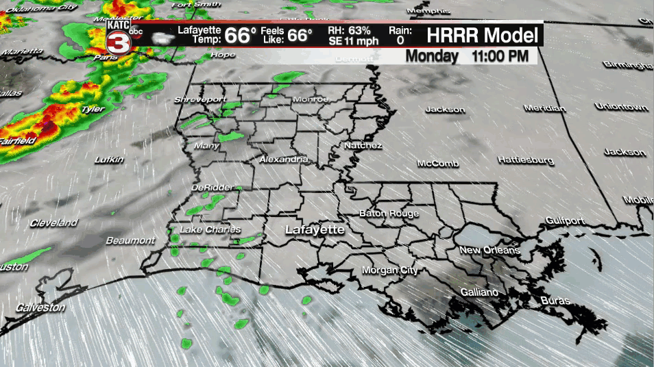
Acadiana will enter a much more unsettled and potentially stormy pattern Tuesday with the the threat some localized heavy rains, a low-end severe weather risk, and the prospect of much heavier rains continuing just to our east continuing through Thursday.
A storm system in Oklahoma will advance northeastward Tuesday with the system trying to drag a stalling front into the region.

And with an active upper level pattern, the risk of showers and thunderstorms will be increasing and pushing the 70-80% range Tuesday.
While shower activity may briefly abate into Tuesday evening, the stalled frontal boundary in the region will remain the the focus of showers and storms into Wednesday and likely Thursday as well.

The Storm Prediction Center (SPC) has Acadiana hatched in for a low-end "marginal" risk (level 1 out of 5) of severe storms Tuesday with the same anticipted Wednesday.

The SPC goes on indicating that more robust severe weather ingredients may be in place for our area Thursday, with the forecast status expected to increase to at least a "slight" risk level..and the threat level may go higher in spots across the region in subsequent forecasts.

Storms containing strong/possibly damaging winds and small hail can be expected from time to time anytime Tuesday, Tuesday night into Wednesday, Wednesday night and Thursday.
While it still early in the severe weather forecast game, the storms Thursday could yield a potentially more serious tornado threat...stay tuned for further updates.
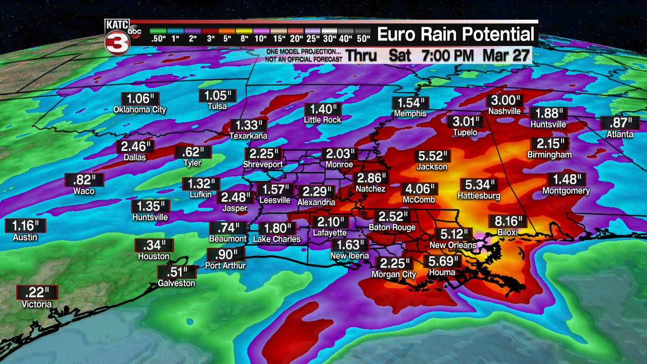
As for rainfall, the models have been remarkable in their consistency that the heaviest rain threat, and possible flooding manifesting more toward Eastern Louisiana, Mississippi, and Alabama where rain totals could be in the 5-8" range this week...it won't all come at once, but there could be some issues mainly east of our area.
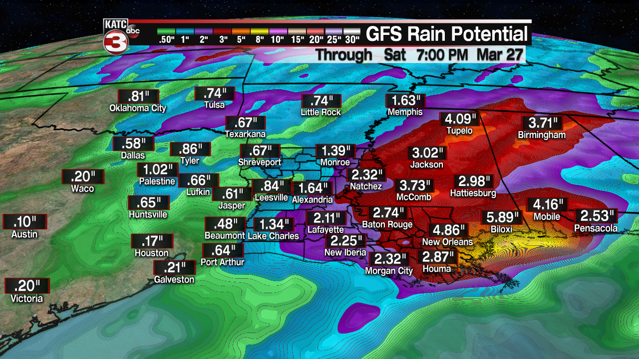
The National Weather Service has posted a Flash Flood Watch east of Acadiana in anticipation of the these heavier rains.

For now, most of Acadiana may see rain totals approaching the 2-3" range over the next several days...
Drier more stable air will bring mostly sunny skies back to our area Friday, but the weekend could finish off with another round of showers and storms with a cool front Sunday.
See the KATC 10 Day Forecast for the latest.
------------------------------------------------------------
Stay in touch with us anytime, anywhere.
To reach the newsroom or report a typo/correction, click HERE.
Sign up for newsletters emailed to your inbox. Select from these options: Breaking News, Evening News Headlines, Latest COVID-19 Headlines, Morning News Headlines, Special Offers
