


It was a stormy afternoon across Acadiana as we saw heavy rainfall, gusty winds, and frequent cloud to ground lightning.
Some storms produced hail and winds in excess of 60 mph, but we managed to make it through the day without any tornado warnings across Acadiana, so certainly that was the good news.
That wasn't the case for portions of Mississippi and Alabama where several warnings have been issued and are currently still ongoing.
For us, expect storm activity to settle down this evening around 6-7 pm as the threat of severe weather continues to diminish from west to east as the front advances eastward..
Until then, still plan on some gusty winds (perhaps upwards to 60 mph) and maybe even some hail for southern and eastern Acadiana.
Thereafter we will be clearing out nicely as cooler air starts to filter in.
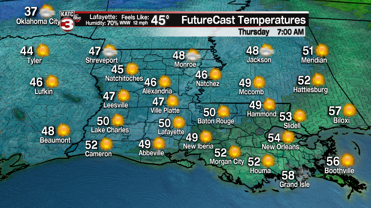
In fact, expect a start in the upper 40s to near 50° on our Thursday morning.
Abundant sunshine will be back on Thursday as high temperatures climb into the upper 60s.

Winds will stay breezy on Thursday, but we will out of the northwest at around 15-20 mph. Gusts at times could exceed 25-30 mph.

Partly cloudy skies return for Friday.
Chilly starts for Friday-Sunday mornings with readings getting down into the 40s and even lower 40s for Saturday morning.
Fair to partly cloudy skies can be expected through the weekend with highs in the 60s for Saturday and near 70° on Sunday.
Quiet start to next week before rain chances start to increase once again by mid-week.
Temperatures will be returning to the 70s next week as well
