


The weather pattern for Acadiana will change to a more unsettled, potentially stormy, and a wetter one for the weekend into the middle part of next week.
After a relatively quiet night, Friday will bring the chance of scattered showers and a few storms as the stormy pattern in Texas associated with a weak frontal boundary and upper low pressure system slowly advances eastward.
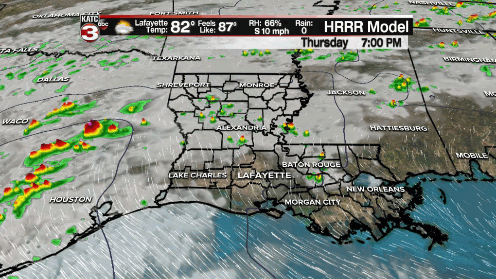
Highest rain chances Friday will be over Southwest Louisiana northward into the western part of the state where some hefty storms could develop overnight through daybreak Friday.
Activity should weaken as it moves toward Acadiana into the afternoon with mostly shower activity accompanied by a few isolated thunderstorms will be possible.
Look for temperatures to rise into the upper 70s to lower 80s Friday afternoon after another morning start in the lower 70s.
Rain chances should briefly diminish Friday night into early Saturday but they will likely rise dramatically into Saturday evening/night and certainly into Sunday as the previously mentioned upper level low migrates eastward toward the area.

Showers and locally heavy thunderstorms will become likely Sunday with the threat of some locally heavy rainfall and perhaps a low end risk of a few severe storms that may be capable of producing damaging winds and hail.
Thereafter we should see a brief lowering of rain chances Monday, but expect another upswing in the risk of scattered showers and thunderstorms Tuesday into Wednesday.

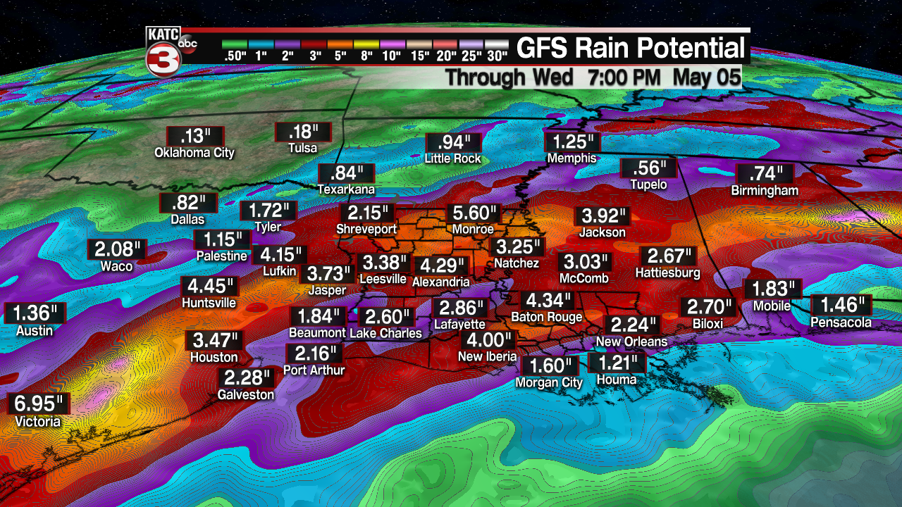
Rainfall totals over the next 6 days look to be in the 2-4" range for most of Acadiana...and some spots may catch that in just one day.
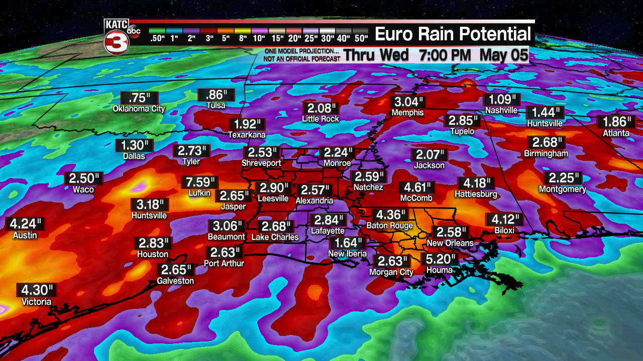
Bother the Euro and GFS models paint a rather wet period for the region, with highest rain totals pushing up to 4-8 inches or more over the same period focused into Texas.
Fortunately the pattern looks to change to a drier more pleasant one toward the end of next week that could carry into the following weekend.
See the KATC 10 Day Forecast for the latest.
------------------------------------------------------------
Stay in touch with us anytime, anywhere.
To reach the newsroom or report a typo/correction, click HERE.
Sign up for newsletters emailed to your inbox. Select from these options: Breaking News, Evening News Headlines, Latest COVID-19 Headlines, Morning News Headlines, Special Offers
