


While clocks go forward this weekend, it appears that Acadiana's weather pattern will spring forward toward increased prospects of showers and thunderstorms late Sunday night through Wednesday.

In the near term, expect another fair and mild evening giving way to higher humidity and more clouds toward daybreak Sunday.
Sunday morning lows will again be in the mid-60s with a few patches of fog possible by daybreak.
Sunday will bring another warm day framed with plenty of clouds and a few intervals of sun.

There will be a slight chance of an isolated shower with the risk at 20% or less during the day.
One most pronounced difference moving into Sunday is that it will get quite breezy again, with southerly winds increasing to 10-20 mph accompanied by gusts in the 22-28 mph range into the afternoon.

The winds will be in response to low pressure (and a major snow storm and severe weather-maker) slowly emerging from the Rockies to the High Plains.
This system will push a fizzling cool front toward Louisiana and with it the increased chance of scattered showers and perhaps a thunderstorm or two beginning late Sunday night into early Monday.
This front will become stationary across the state Monday and will begin drifting back to the north Tuesday.

A series of weak disturbances aloft will keep the chance of scattered showers and a few storms in the forecast Monday into Tuesday.
By Wednesday, a stronger system and frontal boundary will push through Louisiana and Acadiana bringing the best chance of storms for this week, and perhaps our first legitimate chance of some severe weather this spring.
While it's still early in the forecast game, the Storm Prediction Center is already hatching in much of the state and Louisiana in the slight risk category for severe storms Wednesday.

Incidentally there could be a few severe storms Sunday into Sunday night well north of Acadiana into Arkansas with a marginal risk possible as far south as Central Louisiana.

Stay tuned as the details gradually evolve and come into focus in the days ahead.
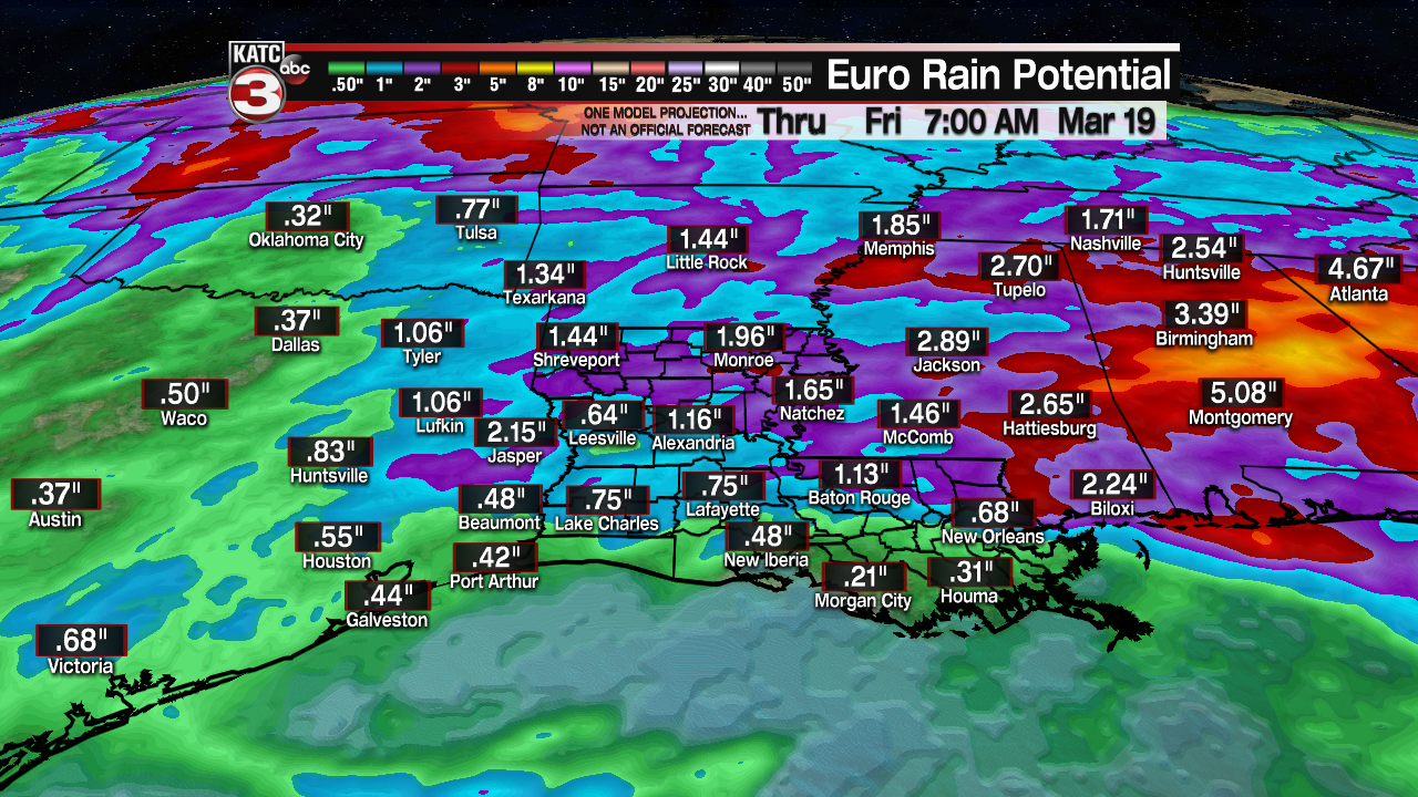
Outside of the severe weather threat into Wednesday, local rain totals are not expected to be that great with latest model guidance indicating a total near 1" for the Acadiana region over the three day period...heavier rains will likely be found into northern Louisiana, Mississippi and Alabama.
Behind our mid-week weather-maker look for breezy and cooler conditions to return to Acadiana for the latter part of next week and into the following weekend.
See the KATC 10 Day Forecast for the latest.
------------------------------------------------------------
Stay in touch with us anytime, anywhere.
To reach the newsroom or report a typo/correction, click HERE.
Sign up for newsletters emailed to your inbox. Select from these options: Breaking News, Evening News Headlines, Latest COVID-19 Headlines, Morning News Headlines, Special Offers
