


Spring-like weather will continue for Acadiana into early Thursday before an arctic air mass begins to slowly ooze into the area Friday into the weekend.
In the near-term, areas of dense fog are expected to develop overnight into Wednesday with temperatures hovering mostly in the low-mid 60s (our normal high temperatures for this time of year).

The National Weather Service has issued a Dense Fog Advisory for all of I-10 parishes in Acadiana southward to the coast.

Wednesday will be a mostly cloudy day with the risk of some scattered shower activity primarily during the morning hours perhaps into the early afternoon.
It will be quite mild Wednesday with highs well into the mid-70s.
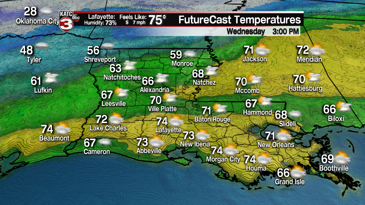
A little sunshine is expected during the afternoon Wednesday, and enjoy that sun as we won't see much of it until mid-late next week!

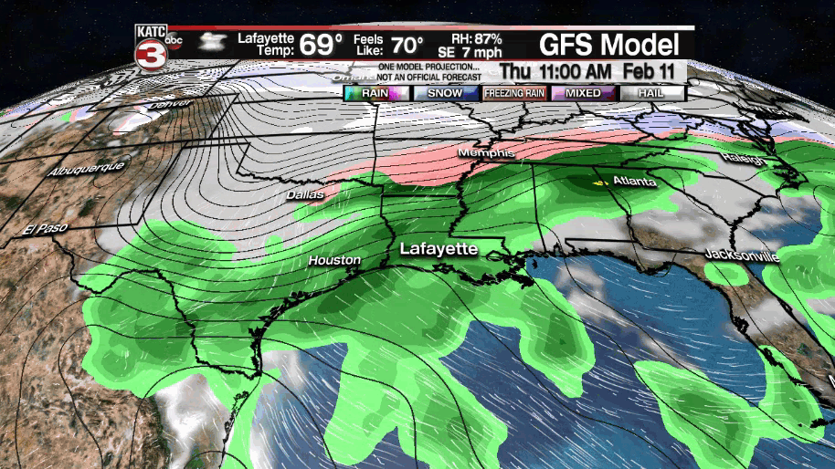
A cold front will begin to slowly sag southward into Thursday, and with an active sub-tropical jet stream, scattered showers and thunderstorms will be a good bet for Thursday.
An inch to perhaps up to 2 inches, will be possible with our soaking Thursday rains, but widespread flooding nor any severe weather is not currently anticipated.
Temperatures will likely top out in the lower 70s early Thursday before dropping sharply into the mid-40s Friday morning.
Lingering rains early, plenty of clouds and much cooler temperatures topping out in the mid-upper 40s are anticipated for our Friday.
Once again, with models not in agreement on the intensity of the cold air heading our way this weekend with the forecast remaining a hedge on the data between the Euro and GFS models.
And keeping in with tradition of late, the GFS remains much colder than the Euro Model.
The bottom line for now, our KATC 10 Day Forecast remains a blend of the models with the chance of hard freezes Sunday, Monday and Tuesday nights.
The question then follows on whether we'll see any precipitation "events" while it gets quite cold?
For now our forecast confidence is way below normal, but Acadiana could see rain, sleet and/or some freezing developing Monday into Monday night...and there could be some icy accumulations...but we can't get too ahead of ourselves until we can establish the severity, breadth and impact of the impending cold snap.
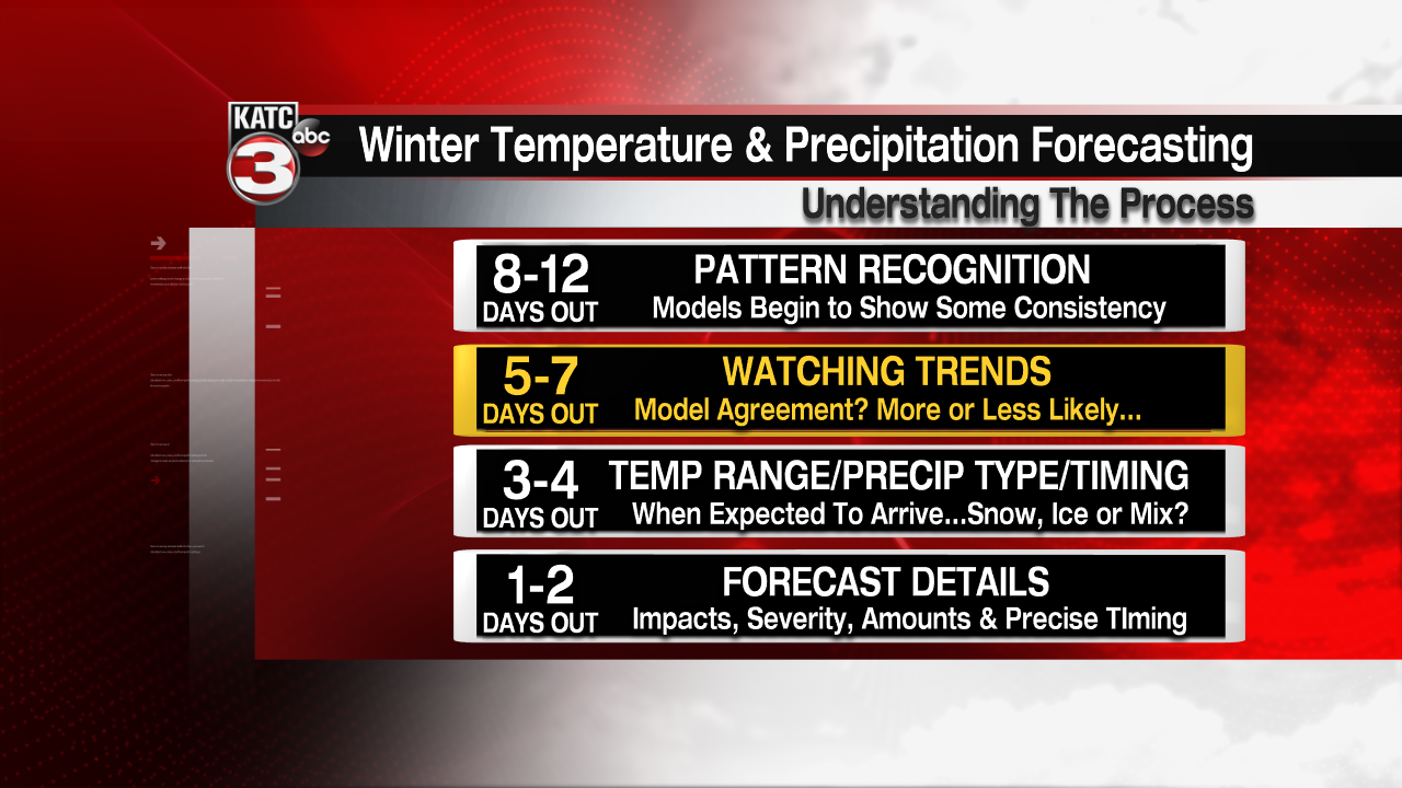
We are still in the "Watching Trends" stage of this winter event, and do expect further clarity and changes on the extent of the cold temperatures heading our way, and then we'll take up the forecast for any wintry precipitation events.
------------------------------------------------------------
Stay in touch with us anytime, anywhere.
To reach the newsroom or report a typo/correction, click HERE.
Sign up for newsletters emailed to your inbox. Select from these options: Breaking News, Evening News Headlines, Latest COVID-19 Headlines, Morning News Headlines, Special Offers
