


It's going to feel increasingly spring-like across Acadiana this week as temperatures warm & breezy southerly winds mark each and every day.
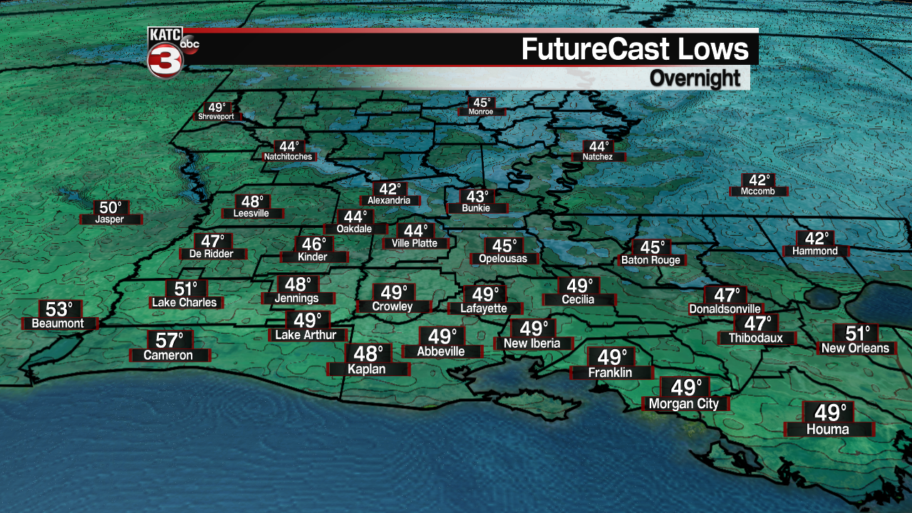
Look for one more fairly cool but seasonable night into Tuesday morning with lows in the mid-upper 40s to near 50° under fair skies.
Mostly sunny skies are expected for the area Tuesday with temperatures climbing into the mid-70s.

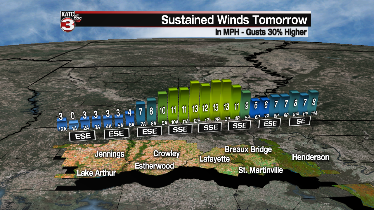
Breezy south to southeast will be likely from late Tuesday morning into the afternoon hours near 10-18 mph with a few gusts likely 20-25 mph.
Each day for the rest of the week could be characterized by milder temperatures at night with late night and early morning cloudiness, giving way to partly cloudy, breezy and warm conditions for the afternoons.

Daytime highs will rise to near 80° from Wednesday on into the weekend while overnight lows moderate into the low-mid 60s...air conditioners will be clicking on later this week!

A change should come in the pattern late this weekend into early next week as a series of upper level systems will bring a more unsettled pattern with the chance of thunderstorms Sunday night and into the middle part of next week.

While not overt at this time, there could be some sort of severe weather threat(s) accompanying the pattern that is roughly a week away...it will be that time of year!
For now, consult the KATC 10 Day Forecast for the latest.
------------------------------------------------------------
Stay in touch with us anytime, anywhere.
To reach the newsroom or report a typo/correction, click HERE.
Sign up for newsletters emailed to your inbox. Select from these options: Breaking News, Evening News Headlines, Latest COVID-19 Headlines, Morning News Headlines, Special Offers
