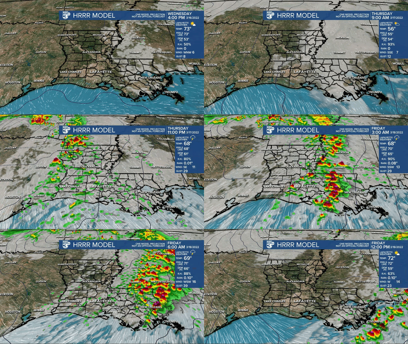
After a cool start Thursday, Acadiana will get to enjoy a breezy, spring-like Thursday, but look out for the potential of some strong, possibly severe storms late Thursday night.
In the near term, expect fair skies and slightly cooler conditions overnight with lows dropping into the upper 40s in most locations.
Some patchy fog will be possible by daybreak.

Thursday will be mostly sunny and will become breezy into the afternoon. Temperatures will warm into the mid-upper 70s.

A low pressure system moving Eastern Oklahoma and the ArkLaTex Thursday evening is expected to swing a frontal boundary through the region by Friday morning.
Out ahead of the front, showers and thunderstorms will become likely with rain chances increasing to near 100% after midnight.

Storms through the wee morning hours Friday could be potentially severe as the Storm Prediction Center (SPC) has the area hatched in for a slight risk, level 2 out of 5 for severe storms.

Damaging winds and hail will be the primary threats, but an isolated tornado may also be possible.
Storm prime-time for Acadiana looks to be between midnight and 5 am Friday, while the severe weather threat appears a little higher into Southeast Louisiana predawn Friday.
As a result, portions of Acadiana may be under a "tornado watch" Thursday night...stay tuned.
Showers and storms will be ending from west to east early Friday morning with sunny skies returning for the afternoon and just in time for all the Festivals Acadiens et Creoles events this weekend.
Expect mostly sunny and pleasant conditions this weekend with seasonably cool temperatures topping out in the mid-upper 60s Saturday and reaching the mid-70s Sunday afternoon.
Early next week will become windy and warmer with yet another round of strong to severe storms possible Tuesday and perhaps into early Tuesday night.

The SPC also has us hatched in for a slight risk of severe storms, but this time around, storm dynamics should be more robust, so the risk of damaging storms (and subsequent outlooks) may be substantially higher than what is expected late Thursday night.
See the KATC 10 Day Forecast for the latest.
Heads up for Wednesday Evening:
Acadiana should have a great view of the Space Station starting at 8:03 pm. It will be directly overhead at 8:06pm!
The station will appear in the southwestern sky moving to the northeast.
------------------------------------------------------------
Stay in touch with us anytime, anywhere.
To reach the newsroom or report a typo/correction, click HERE.
Sign up for newsletters emailed to your inbox. Select from these options: Breaking News, Evening News Headlines, Latest COVID-19 Headlines, Morning News Headlines, Special Offers


