


Acadiana will get an early taste of some spring-like weather through mid-week with arctic air settling southward to bring more winter-like temperatures and perhaps winter weather, this weekend.
In the near term, with milder night-time temperatures and a return flow slowly setting up from the Gulf of Mexico, areas of fog will likely develop in spots across the region through Tuesday morning with a stronger signal for dense fog area-wide Tuesday night into Wednesday morning.

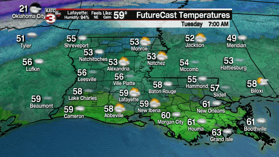
Temperatures will drop and stay in the mid-upper 50s through Tuesday morning while afternoon highs tomorrow push into the balmy mid-70s.
As the return flow continues and amplifies from the Gulf of Mexico into Wednesday expected the chance of a couple of isolated showers or misty/drizzle (on top of the fog) Tuesday night with a few scattered showers, possibly a thundershower early Wednesday.

High temperatures Wednesday will once again top out in the mid-70s.
A wet weather system ahead of an arctic cold front is on tap for Acadiana Thursday with the possibility of soaking rains and a few embedded thunderstorms. An inch to two inches of rain appears to be possible with the system.
Thereafter, the forecast remains a low-confidence one into the weekend.
What we know: colder air will slowly ooze southward into the region this weekend but the extent of how cold the air remains is yet to be determined.

Daytime highs will likely drop into the 40s and perhaps the 30s this weekend while sub-freezing night time lows are expected over the weekend into early next week.
There continues to be a big disparity between the Euro and GFS models (our two best mid-range models) with the Euro a day later than the GFS in delivering the colder air while the GFS is back to being "all in" for record threatening cold temperatures.
In particular, the GFS is going for morning lows and wind chills of 18°/1° Sunday morning, and 11°/-4° Monday morning. Plus the GFS is more bullish on a potential winter weather "event" this weekend that would likely involve freezing rain and/or sleet.
In addition, the GFS model is going for a period of sub-freezing temperatures from Saturday through Wednesday morning which would make this an extremely high end/impact event for our area...with perhaps an additional chance of more winter precipitation!
Remember, forecasting these winter type outbreaks are very difficult until we're closer to a 2-4 day window of the event occurring and we're not there yet.
Either way, the risk of some pipe-busting cold weather is still very much on on the table for Acadiana potentially for this weekend into early next week.
For now, the KATC 10 Day Forecast remains a model compromise on the cold weather, but with the German ICON and the Canadian models lending credence to the GFS solution for the cold weather this weekend, expect more changes in this part of the forecast in the days ahead.
------------------------------------------------------------
Stay in touch with us anytime, anywhere.
To reach the newsroom or report a typo/correction, click HERE.
Sign up for newsletters emailed to your inbox. Select from these options: Breaking News, Evening News Headlines, Latest COVID-19 Headlines, Morning News Headlines, Special Offers
