


Scattered splash and dash showers and storms remain in the forecast for Acadiana for the rest of the week, and likely continuing into next week as well.
High pressure to our north continues to feed Acadiana with an easterly flow of weather...and with daytime heating, scattered showers and thunderstorms.

For the most part rain chances will remain in the 40-50% range through Thursday with most activity firing up around noon and diminishing toward sunset.

Per usual, roughly half of the area will see enough rain to wet the ground, with most areas over the next couple of days seeing an inch or less.
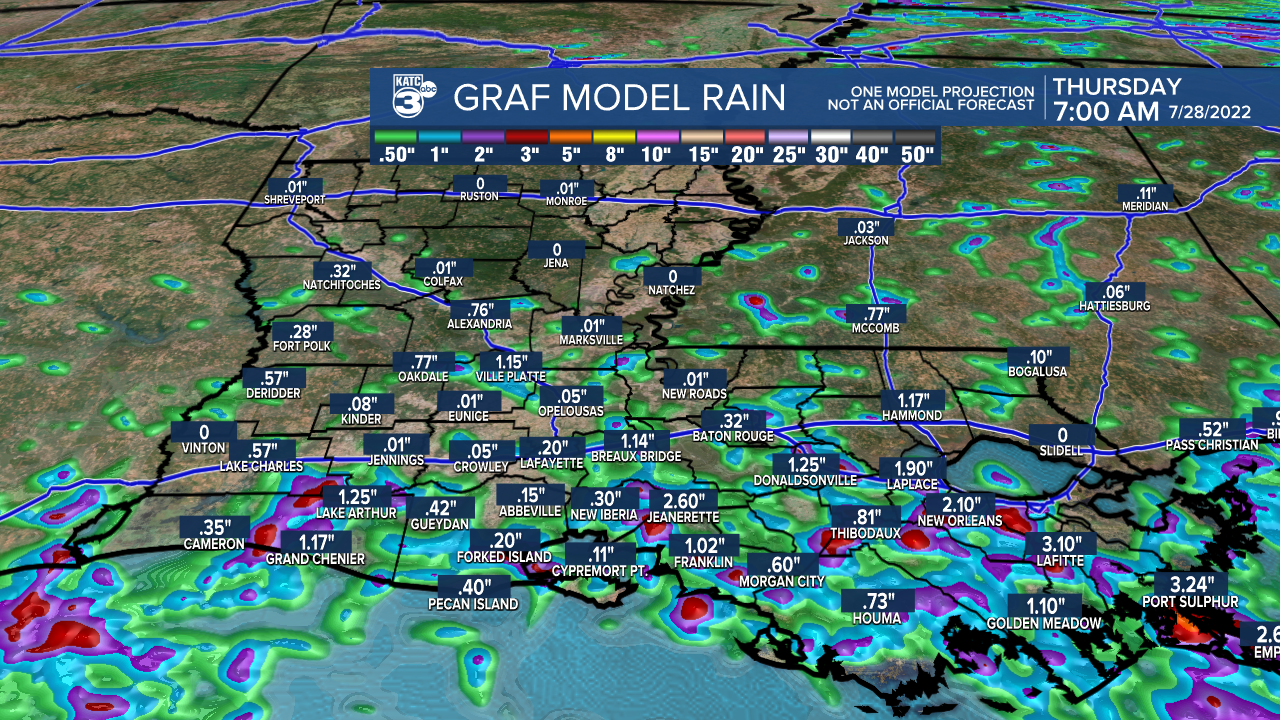
But as with any slow-moving thunderstorms this time of year there is the remote possibility of catching 2-3" inside of an hour.
By Friday, our rain chances may go a little higher as a tropical wave traverses east to west across the Gulf of Mexico.
Daytime highs for the foreseeable future will stay in the 91-93° range while night-time lows stay planted in the mid-upper 70s.
See the KATC 10 Day Forecast for the latest.
The Atlantic tropics remain quiet at this time with just a few non-threatening tropical waves noted.

Our part of the tropics look to stay quiet into the first week of August with activity expected to gradually ramp-up thereafter.
------------------------------------------------------------
Stay in touch with us anytime, anywhere.
To reach the newsroom or report a typo/correction, click HERE.
Sign up for newsletters emailed to your inbox. Select from these options: Breaking News, Evening News Headlines, Latest COVID-19 Headlines, Morning News Headlines, Special Offers
