


Mild temperatures and scattered showers are back in the forecast for Acadiana into Thursday with an excellent chance of soaking rains and some strong storms expected late Thursday night into early Friday.
Temperatures will hold in the mid-60s overnight into Thursday morning (some 20° above normal) as moisture continues to increase from the Gulf of Mexico.

Scattered shower activity will develop overnight with chance of rain and/or some drizzle at 40%.
It should stay breezy enough overnight to keep fog at bay, however there could some spots that see lower visibility, especially toward the coast as some sea fog tries to work it's way inland through Thursday morning.

After scattered shower activity, primarily through midday Thursday, look for some intervals of sun accompanied by spring-like temperatures in the mid-70s for the afternoon.
Acadiana's next weather maker will arrive in the form of a vigorous upper low and surface trough that will push through the area Thursday night into Friday with rain chances increasing to 90% or better.

Some strong storms will be possible Thursday night/early Friday with the possibility of gusty winds and perhaps some small hail.

In addition to the storminess, the threat of some locally heavy rainfall will be possible per model guidance, with rain totals expected to be in the 1-3" range.

There could be a few areas this see more with some "training" storms, that could lead to some localized street flooding.
It appears that our highest rain chances Friday should be confined to the morning hours, but a secondary disturbance could keep patchy rain and showers in the forecast later into Friday afternoon, evening and part of the night.
Acadiana gets a break this weekend though with partly cloudy skies Saturday and mostly sunny conditions Sunday.
Highs will be in the upper 60s to lower 70s Saturday and should push the mid-70s Sunday.
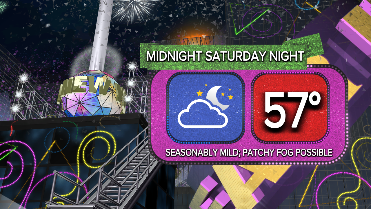
The weather also looks favorable for New Year's Eve with temperatures in the mid-upper 50s under partly cloudy skies at the stroke of midnight...there could be however, some patchy fog in the region through Sunday morning.
Another stormy, wet weather-maker should arrive early next week with high rain chances for now indicated for Monday and Tuesday...an additional few inches of rain will be possible again.

Per the Storm Prediction Center (SPC), there could also be a severe weather threat with the system early next week.
Thereafter, it should dry out and cool off a little mid-late next week with the following weekend also looking favorable.
See the KATC 10 Day Forecast for the latest.
------------------------------------------------------------
Stay in touch with us anytime, anywhere.
To reach the newsroom or report a typo/correction, click HERE.
Sign up for newsletters emailed to your inbox. Select from these options: Breaking News, Evening News Headlines, Latest COVID-19 Headlines, Morning News Headlines, Special Offers
