


The soaking rains and storms will continue for Acadiana for the next several days, with the risk of some localized flooding increasing through mid-week.

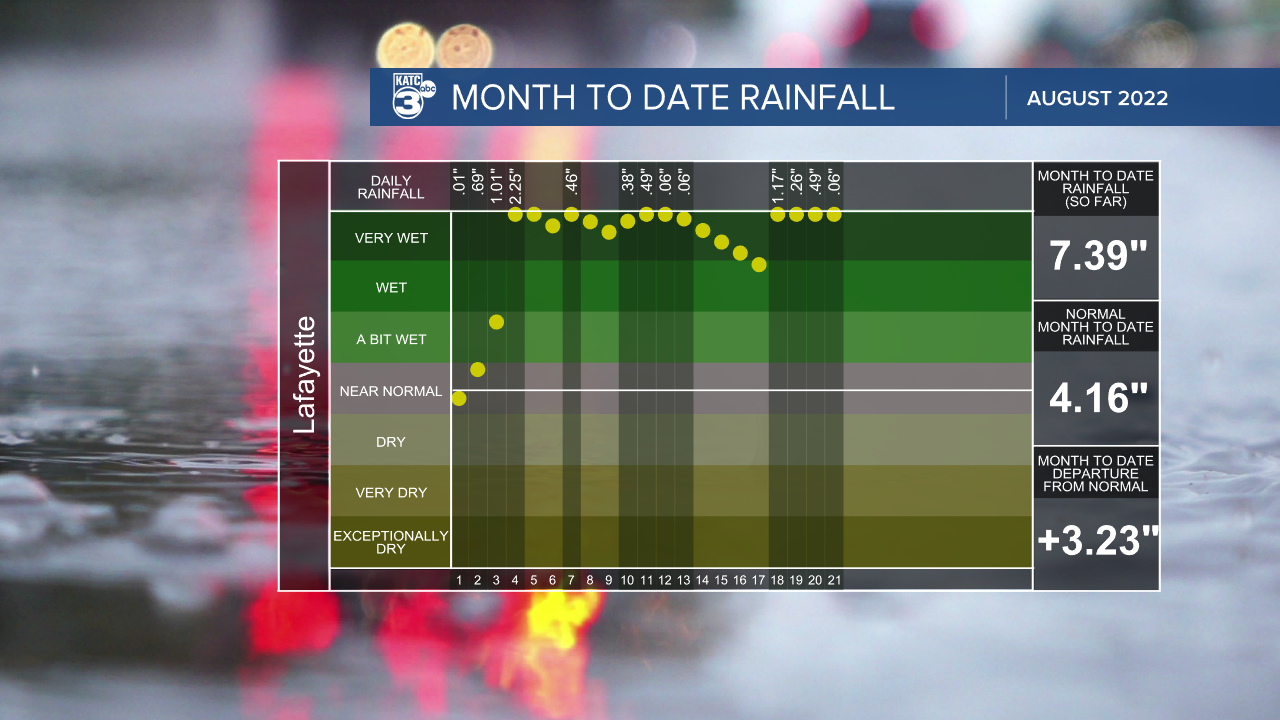
After a rather wet July continuing through much of August, the grounds across Acadiana are becoming increasingly saturated.
As a weak nearly stationary frontal trough draped west to east across the state continues to interact with deep tropical moisture and instability supplied in the upper atmosphere, the threat of widespread showers and storms looks to continue for much of the next week.
Highest rain chances this week look to be Tuesday and Wednesday, perhaps into Thursday.
As for Tuesday, look for highest rain chances from the morning hours...around daybreak through mid-afternoon.

Much the same can be anticipated Wednesday.
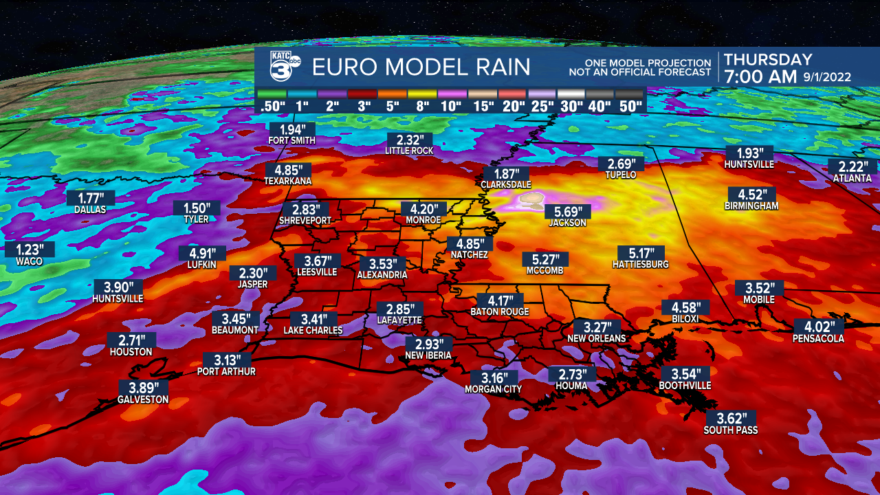
Additional rain totals over the next 48-72 hours will likely top 1-3" in most areas with isolated amounts pushing 4-7".
Given the wet pattern, computer model guidance, and depending on where showers and storms manifest through the next days, a Flood Watch might be issued for the area by the National Weather Service.
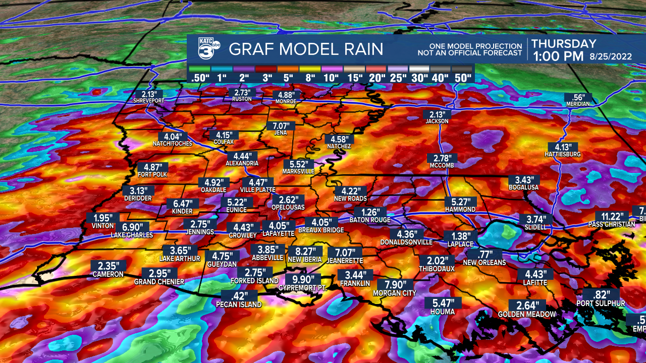
Some localized street flooding or worse might be possible in the days ahead per the latest GRAF Model rainfall forecast...which may be overdone, but has earned respect during tropical season.
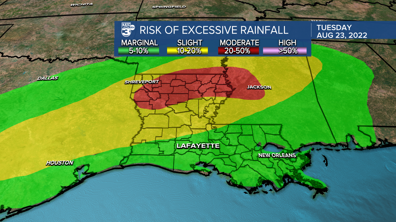
Per the Weather Prediction Center, Acadiana will remain in a marginal risk of excessive rainfall Tuesday and should increase to a slight risk (level 2 out of 4) into Wednesday.
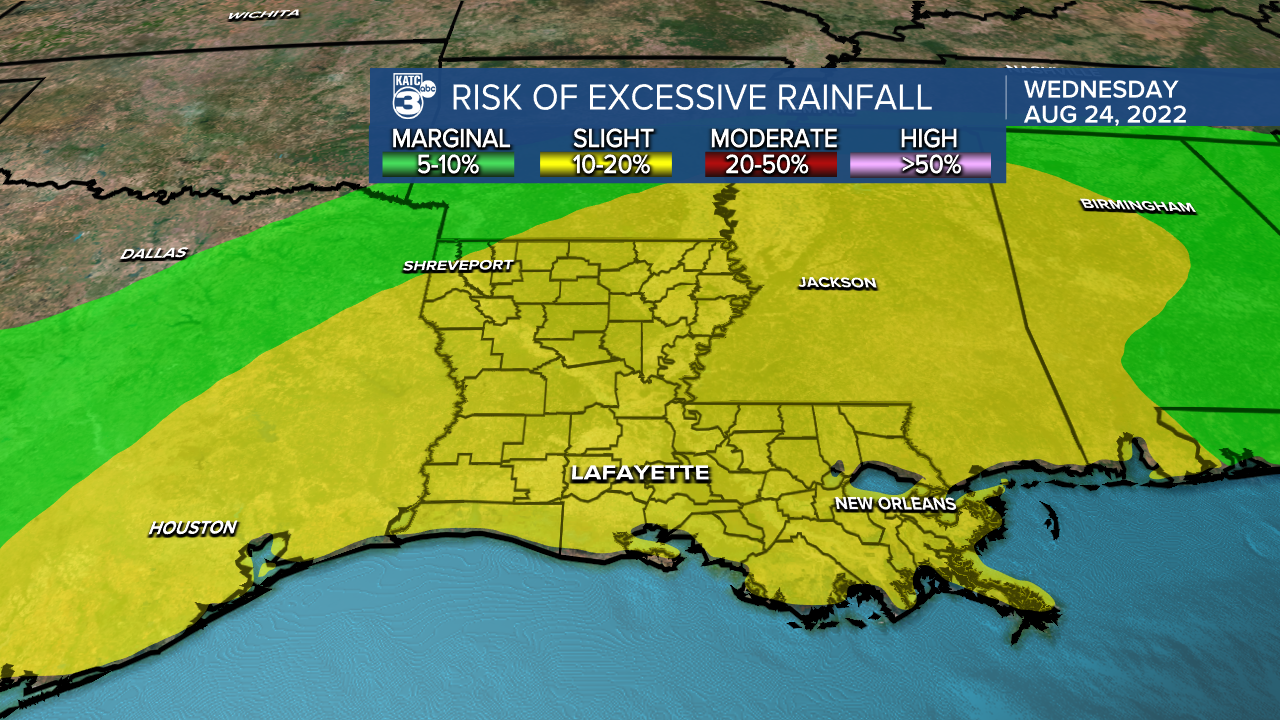
Rain totals and consequently the risk of flooding will shift from Northeast Texas today to Central and Northern Louisiana Tuesday, sliding into Mississippi Wednesday.
There's no end in sight to our soggy pattern with some models indicating a brief ease in rain chances toward the weekend, but for now that's not given much credibility at this point.
See the KATC 10 Day Forecast for the latest.
Meanwhile in the tropics, a disturbance in Eastern Tropical Atlantic has a 30% chance of development...but no threats to any land are expected at this time.

Models continue to be rather tropically "excited" in the 10-16 day time-frame as climatologically-speaking, they should this time of year.
------------------------------------------------------------
Stay in touch with us anytime, anywhere.
To reach the newsroom or report a typo/correction, click HERE.
Sign up for newsletters emailed to your inbox. Select from these options: Breaking News, Evening News Headlines, Latest COVID-19 Headlines, Morning News Headlines, Special Offers
