


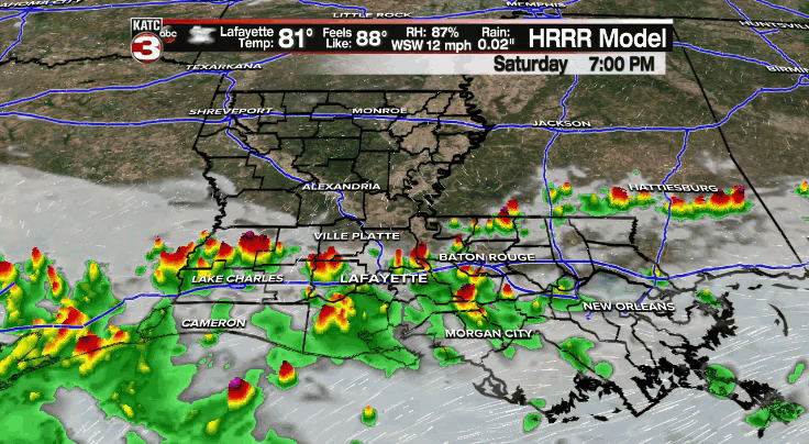
Scattered showers and storms will remain possible through this evening as a frontal boundary remains a draped across the region, especially for areas along and south of the interstate.
Some locally heavy downpours could be possible.
Back to fair skies a little bit later on tonight as overnight lows will be dropping down into the lower and middle 70s.
That front will start to drop farther to the south on Sunday with drier air filtering in behind it.
As a result, rain chances will be a little bit lower sitting at around 30% for a few scattered afternoon showers and thunderstorms.
Slightly better rain chances for the coastal parishes and offshore areas.
High temperatures will be topping out in the upper 80s to lower 90s under otherwise, partly cloudy skies.
Typical scattered afternoon showers and storms will be around on Monday with rain chances settling into the 40% range.
And then they'll kind of settle in around 50-60% throughout the rest of the week.
In the tropics:
Elsa was downgraded to a tropical storm on Saturday as it continues to battle wind shear (moving at a very fast pace) and some dry air.
Thinking behind the forecast for Elsa remains on track.
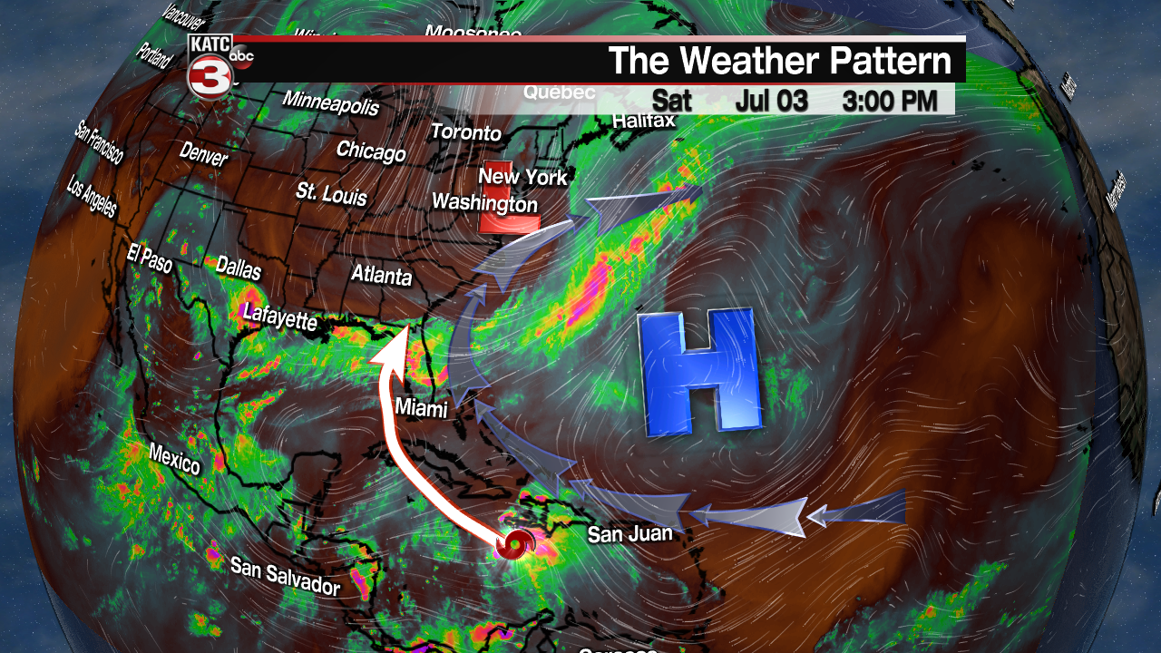
It is expected to move through Cuba by the end of the weekend before emerging into the eastern Gulf of Mexico for the start of the week.
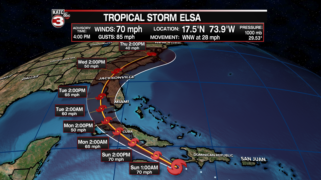
It will then begin making a turn to the northeast impacting the West peninsula of Florida as a tropical storm.
It continues to pose no threat to the Western Gulf of Mexico, nor us here in Acadiana.
The rest of the tropics are quiet at this time.
