Well, it was kind of a dreary start to the weekend with clouds mostly locked in and light showers/sprinkles this morning.
Mostly cloudy skies will persist through the night, but some clearing at times will be possible.
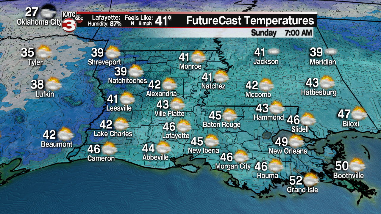
Chilly conditions as temperatures drop into the lower to mid-40s.

The upper-level energy finally be making its way out of here on Sunday.
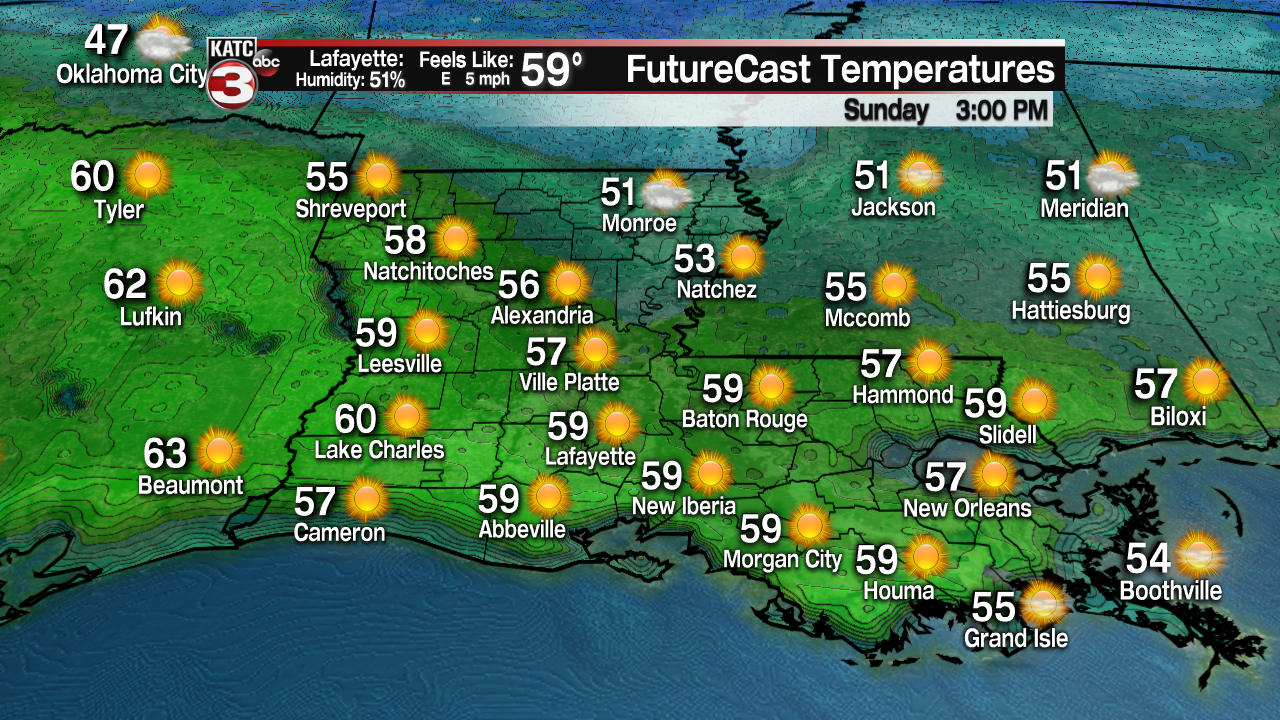
Expect clouds to remain in place for the first part of your Sunday, but that will be giving way to gradual clearing skies by the afternoon.

It will be a cool day as afternoon highs top out in the upper 50s to lower 60s.
Clouds and southerly winds will quickly be back on Monday as temperatures climb into the middle 60s after a chilly start in the lower 40s.
We stay mild through mid-week as temperatures push the lower 70s for both Tuesday and Wednesday.

Scattered rain chances are back on Wednesday and will peak on Thursday (perhaps extending into Thursday night) ahead of a frontal boundary.
This is where the forecast becomes complicated as models begin to diverge considerably.
The big question is going to be just how much of the cold, arctic plunges southward.
The GFS has a morning start for us in the upper teens for NEXT Sunday morning (a week out!) whereas the coldest the Euro gets us is in the lower 30s on Sunday morning.
The GFS also keeps us near or below freezing throughout the majority of next weekend.
Bottom line: Until we will get a better, solid agreement with the models, the forecast remains a bit tricky for days 7-10.
We will continue to watch the trends in the days ahead.
The models have backed off on any winter precipitation for the time being as well...
------------------------------------------------------------
Stay in touch with us anytime, anywhere.
To reach the newsroom or report a typo/correction, click HERE.
Sign up for newsletters emailed to your inbox. Select from these options: Breaking News, Evening News Headlines, Latest COVID-19 Headlines, Morning News Headlines, Special Offers


