


Mild and muggy tonight with overnight lows only in the mid-upper 60s.
Some fog/low clouds will be likely late tonight into Saturday morning.
Cold front arrives Saturday afternoon...
Highs will still be able to reach the upper 70s early in the afternoon before the front arrives.

Showers and storms a good bet for Acadiana Saturday afternoon/evening, although a few spotty showers will be possible through the morning hours.
There is a marginal risk (level 1 out of 5) for some severe weather.
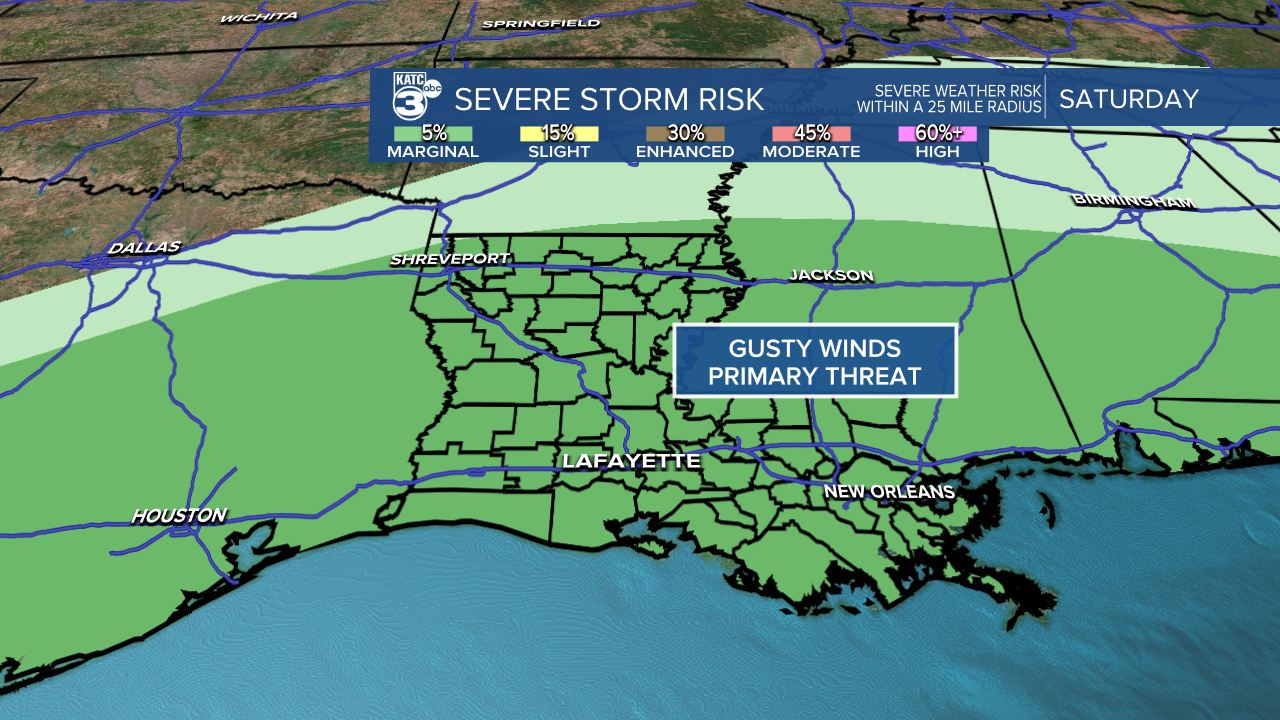
Primary threat would be gusty winds along the squall line.
An isolated tornado threat exists, but does not appear likely due to lack of dynamics.

Heavy rains will be possible at times.

0.5"-1" of rainfall for most of us.
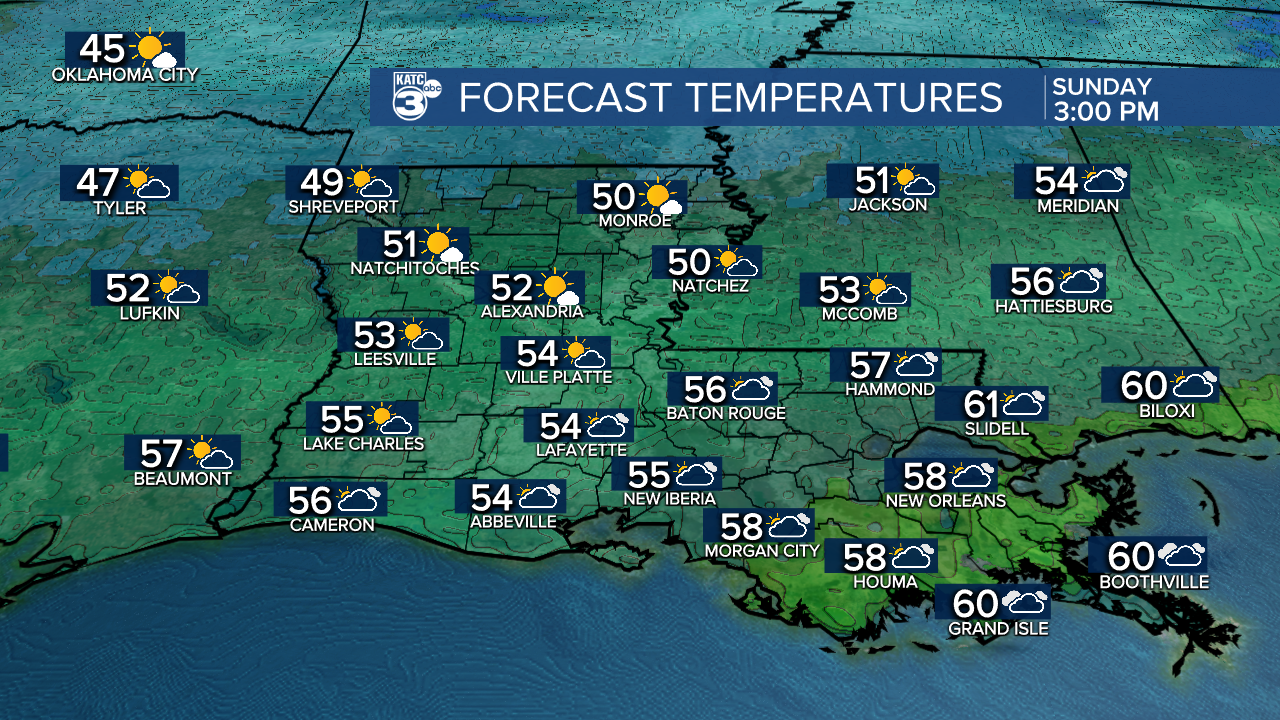
Winter chill returns for Sunday...
After a morning start in the mid-upper 40s, temperatures will struggle to reach the middle 50s by the afternoon under mostly cloudy skies.
Cloudy, chilly and occasional rain showers on Monday as highs remain in the 50s.
Full sunshine returns Tuesday and Wednesday as temperatures get back to more seasonal values.
However, we'll quickly warm back up for the end of the week and heading into Christmas.
Highs will be back in the mid-upper 70s.
So, chances of a white Christmas are quickly dwindling.
The good news is that after Monday, we will stay dry through the Christmas weekend.
Warmer than normal conditions could stick around into the following week as well.
Have a great weekend everyone!
~Bradley
