


HAPPY MOTHER'S DAY!
It was a warm and muggy one out there today as temperatures climbed into the 80s.
We did see a few, very isolated showers across the region.
Nothing that really amounted to much, but it covered the 10% we had in place for today.
A frontal boundary is positioned off to our north and helping to generate healthy showers and storms across the ArkLaTex this evening.
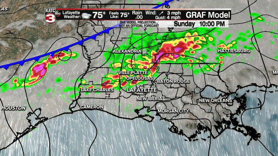
That boundary will drop southward through the night, and with time, will help to spark off scattered showers and storms across Acadiana.
Timing looks to be late this evening and through the early morning hours of our Monday.
One or two of the storms could be on the stronger side and capable of producing gusty winds.
Some locally heavy downpours will be possible as well.
Rain chances will gradually taper off through the morning and into the afternoon.
In other words, it will not be raining all day long.
Temperatures will top out in the lower to middle 80s after a morning start in the lower 70s.
Now that boundary is going to remain stalled out for a couple of days as impulses of upper-level energy work along it.
I've dropped rain chances to 50% on Tuesday.
The upper-level energy on Tuesday may actually track off more into central Louisiana which is where the heaviest of the rain may indeed set up.
Regardless, a few scattered showers and storms will be lurking around the area with that boundary not too far away.
Slightly better rain chances going into Tuesday evening as the boundary begins to drop farther to the south.
One last little disturbance will move in on Wednesday which will finally help to push everything out of here and shake up the pattern.
Scattered showers and a few storms are likely on Wednesday before drier weather returns to Acadiana as we round out the week.
Models continue to show most areas picking up ~1-2" of rainfall through the Wednesday evening time frame.
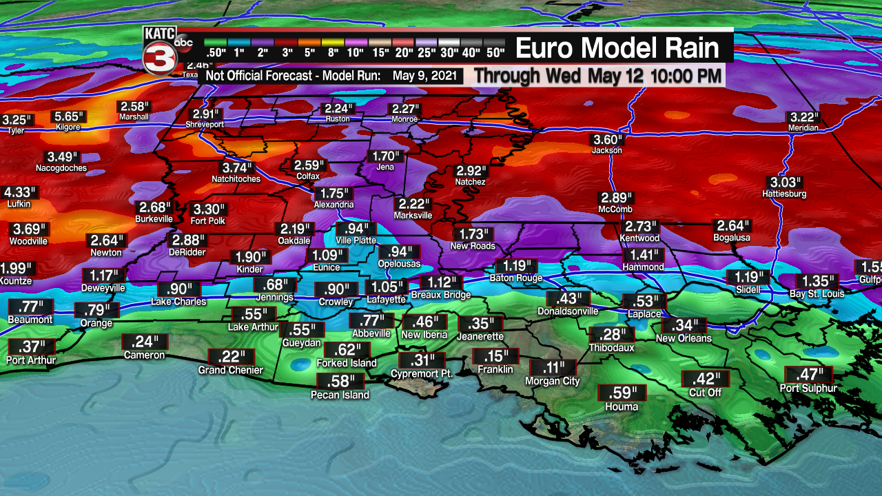
Some locally higher amounts could be possible, especially north of the interstate.
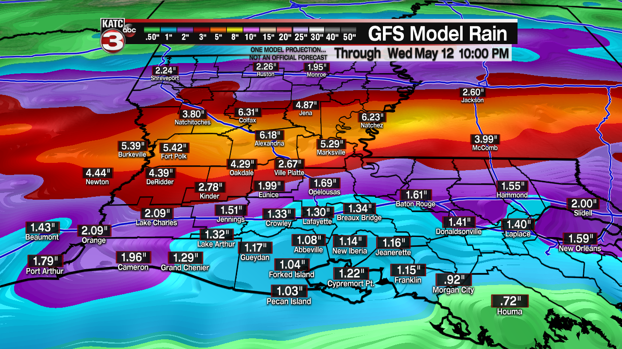
Even higher totals once you get into CenLa and Mississippi.
We'll continue to watch the trends.
Have a great week!
------------------------------------------------------------
Stay in touch with us anytime, anywhere.
To reach the newsroom or report a typo/correction, click HERE.
Sign up for newsletters emailed to your inbox. Select from these options: Breaking News, Evening News Headlines, Latest COVID-19 Headlines, Morning News Headlines, Special Offers
