


A weak westward drifting disturbance off the coast of Louisiana combined with deeper tropical moisture will keep plenty of clouds and decent rain chances in the forecast for Acadiana much of this week.
In the near term, scattered showers and a few embedded storms are expected to roll in from the east Monday evening with activity dissipating and reforming down toward the coast after midnight.

As the Gulf disturbance drifts westward toward the Texas Coast through mid-week and then possibly drifting north thereafter, the system will keep clouds and scattered primarily afternoon storms in the region through at least Friday.
Rain chances will be in the 50-60% range much of this week with most activity concentrating offshore and toward Texas.
Rain accumulations over the next week will will be a couple of inches or less for most, with higher totals likely toward Texas.

And with clouds and showers in the forecast, Acadiana's heat wave (Sunday afternoon's high was 100°) has finally been broken with daytime highs closer to the mid-upper 80s to near 90° on any given day this week.
See the KATC 10 Day Forecast for the latest.
Meanwhile in the tropics, Potential Tropical Cyclone #2 formed in the Atlantic Monday afternoon.
This system should remain a Caribbean threat only, and might become the first hurricane of the year...next name on the list is Bonnie.
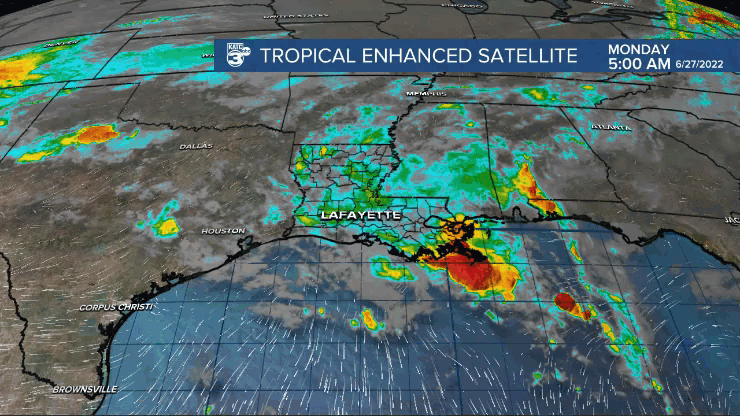
The disturbance sitting off the coast of Louisiana should be a rain-maker with highest rain totals into mid-Texas Coast next few days.
Elevated rain chances due to this disturbance will remain for Acadiana over the next few days but there are no significant flooding concerns locally at this time.
And on this date 65 years ago on June 27, 1957, the earliest most intensel hurricane to strike the U.S. Coast made landfall as a major storm in Southwest Louisiana.
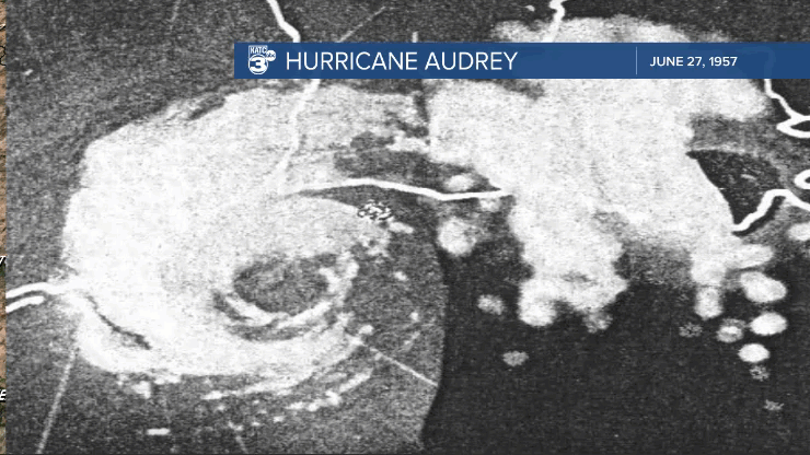
Hurricane Audrey intensified and accelerated to near 35 mph at landfall catching many off guard as the storm was expected to arrive a day later resulting in over 500 fatalities, most in Cameron Parish from the storm surge.
It remains the modern storm of record for devastating winds (likely higher than the official 125mph) at landfall impacting all of Acadiana/Southwest Louisiana with only Hurricane Rita in 2005 superseding Audrey's storm surge.
------------------------------------------------------------
Stay in touch with us anytime, anywhere.
To reach the newsroom or report a typo/correction, click HERE.
Sign up for newsletters emailed to your inbox. Select from these options: Breaking News, Evening News Headlines, Latest COVID-19 Headlines, Morning News Headlines, Special Offers
