Barry has weakened to a tropical depression as it pushes out of Louisiana and into Arkansas but the threat of heavy rains continues for much of the Acadiana and the southeast.
Today Acadiana has seen a wide range of rainfall totals from 3-10+ inches, with the highest totals in Iberia, St. Martin, St. Mary, lower Lafayette and western Vermilion parishes, where many streets and a few homes have flooded.
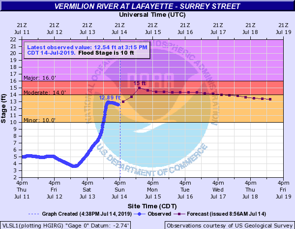
For those along the Vermilion River today's heavy showers raised the levels to 12.9 feet.
The river has come down some but it is holding at about 12.5 feet and with the possibility for more rains tonight it is still project to maybe reach 15 feet Monday afternoon.
Through the rest of tonight into Monday more showers and storms will slide across Acadiana with the possibility of heavy storms during the overnight hours into Monday morning.
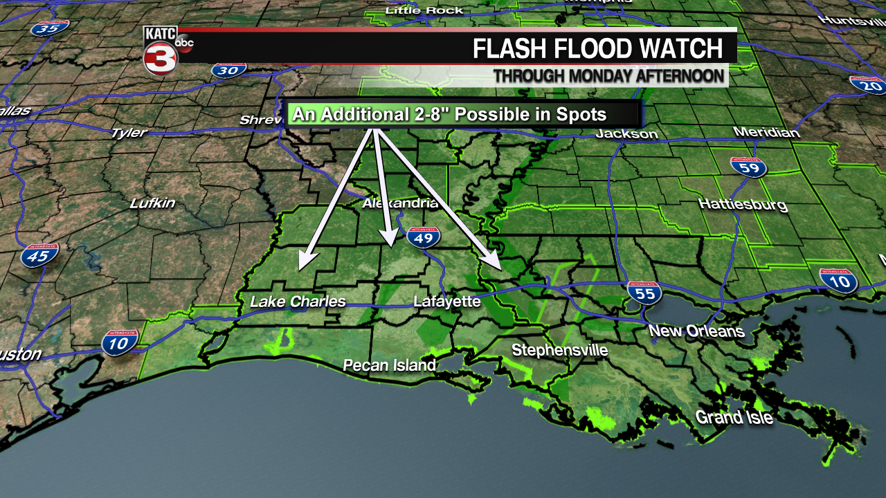
Models are hinting at the possibility of an additional 1-4+ inches of rain, which will cause more flooding throughout Acadiana.

For this reason Flash Flood Watches remain in affect for all of Acadiana until Monday afternoon.
Also, a Coastal Flood Warning continues for Iberia, St. Mary and Vermilion parishes as waters will remain high (2-5 feet above normal tides) as persistent southerly winds at 15-25 mph linger over the Bay.
Waters along the coast will not come down until Monday evening when the winds die down but it might take until Tuesday before they return to normal levels.

Tuesday partly sunny skies return across Acadiana but with all the water on the ground we could have a 40% for scattered showers and storms to fire up during the heating of the day.

Wednesday through Friday it is back to typical summer time pattern with highs in the low 90s, feel like temperatures near the triple digits and the slight chance(20-30%) for a pop-up shower/storm during the afternoon.
Beyond Friday there is still a little uncertainty in the forecast as high pressure will be in the east Gulf at the surface but there could be a couple shortwaves in the upper levels working across the region.
As these shortwaves push into the area that could increase rain chances so I am going with a few isolated showers on Saturday but more scattered (40%) activity on Sunday and into the following week.
