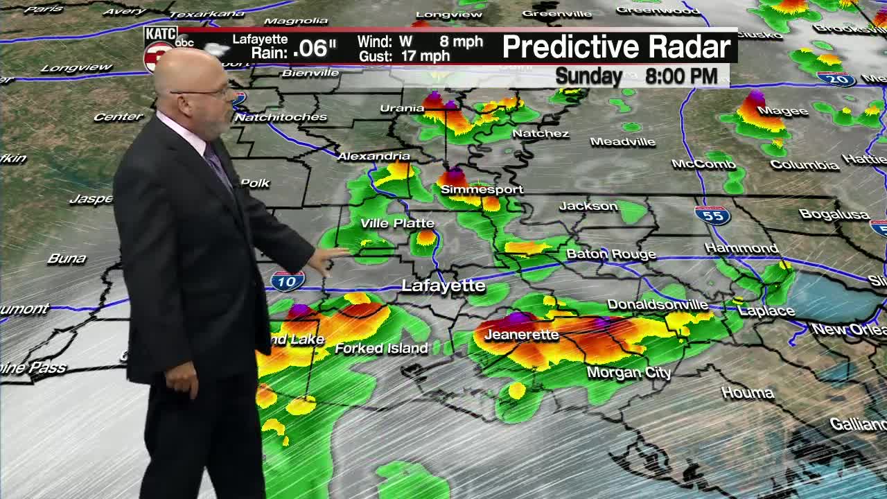


Showers and a few thunderstorms are expected to roll through Acadiana Sunday evening associated with an upper-level low just off to our north. Not expecting any severe weather with this system, but some storms may contain pockets of localized heavy rainfall.
As the low pushes eastward out of the area early Monday morning, drier, slightly less humid air will return to the region as northwesterly flow sets up behind it. This will lead to a rather nice Monday with highs in the low to mid 80s and and a nice breeze by the afternoon. Plenty of sunshine expected for Monday so make sure to get out and enjoy it if you can!
Continuing along in the 10-day, we will see temperatures beginning to increase to the upper 80s and we may even get close to 90 in some locations during the week. Rain chances remain low throughout the work week with only marginal rain chances by mid-week before a slight increase in those chances by the week's end and into next weekend, Have a great week, y'all!
In the tropics: Tropical Storm Arthur continues to spin off of the eastern seaboard with maximum sustained winds of 45 mph and is moving off to the northeast.
High surf, gusty winds and a couple of inches of rainfall are expected along the North Carolina coast over the next couple days before the storm then treks off into the open Atlantic. The storm poses no threat to the Gulf Coast nor Acadiana. Continue to follow the KATC storm team for the very latest.
