


Hurricane Sally continues to be the main story for residents all across the Gulf Coast this evening.
The storm quickly intensified on Monday afternoon reaching category one, hurricane strength.
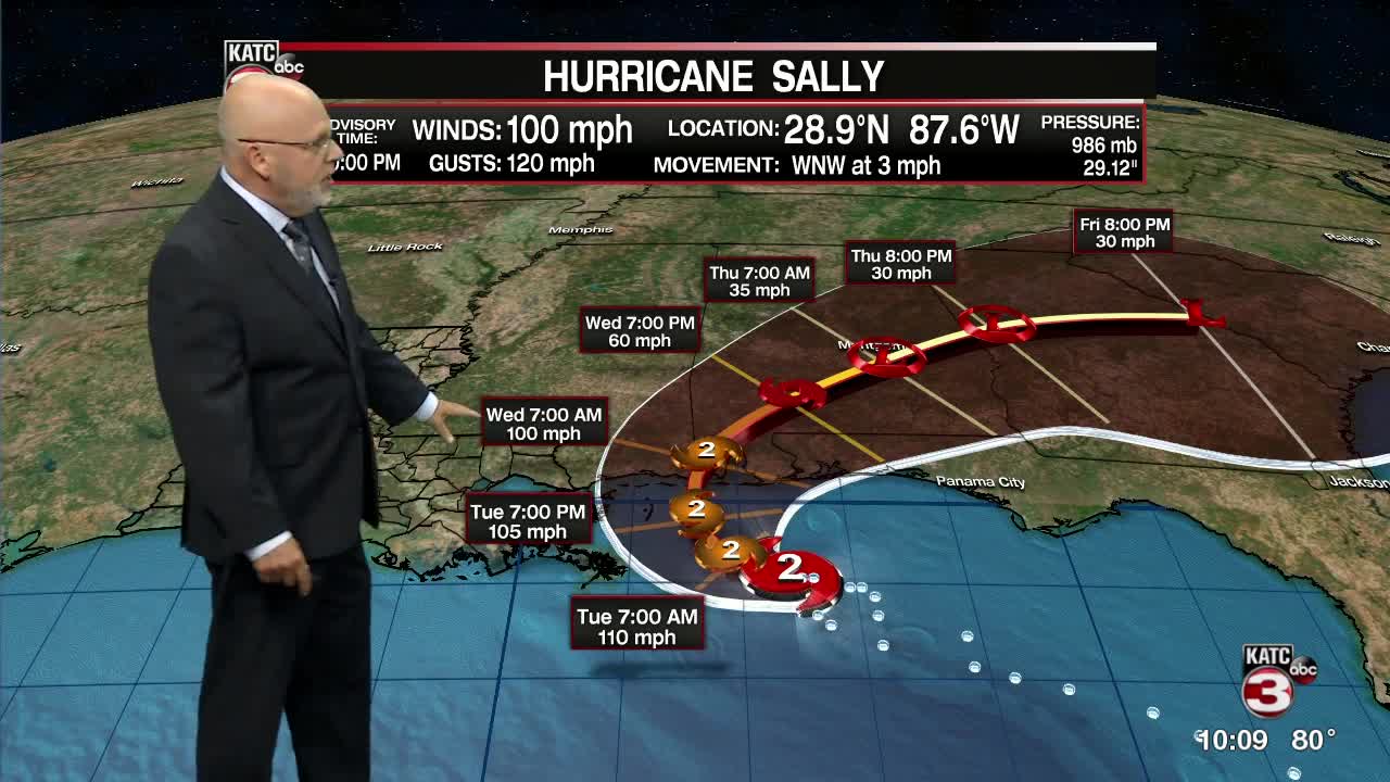
Sally is expected to strengthen further in the next day or so as it slowly crawls toward the Mississippi/Alabama coastlines.
The slow moment of the storm continues to be the main concern as extreme rainfall totals are looking to set up for areas along the Mississippi, Alabama, and Florida coasts.
Over a foot of rainfall is expected in some areas through the end of the week. This is on top of the life threatening surge that is anticipated from this storm as well.
For us here in Acadiana, impacts will remain slim to none although breezier afternoons may be in the forecast for areas farther east.
With us being on the western side of this system, expect northerly flow and drier air to filter in across the region which means sunnier days will be in our forecast for the week.
A few tropical showers will be possible on any given day this week, but most of us look to remain dry.
High temperatures will settle in the lower 90s.
We may see some cooler overnight lows heading into the weekend, but we will have to see how that plays out.
Otherwise, no real issues for our weather in Acadiana in the foreseeable future.
Elsewhere in the tropics: For the first time since 1971, there are five active Tropical Cyclones in the Atlantic Basin at one time.
Teddy and Vicky are the two newest storms, but both really won't be much of an issue in the days ahead.
Another area has just come off of the African and has a 50% chance to develop in the next 5 days. The next (and last name in the alphabet) name is Wilfred and then the rest of the season's storms will be named using the Greek alphabet.
None of these areas present a threat to Acadiana at this time.
