


A more changeable and unsettled weather pattern arrives to Acadiana this week.
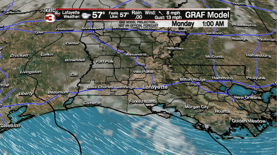
We will kick off the new week on the quiet side Monday.
Expect a morning start in the upper 40s to lower 50s.
We will see partly to mostly cloudy skies throughout the day as breezy southeasterly winds drive temperatures into the middle 70s.
An isolated light shower or two will be possible, but I expect most of us to remain dry.
Rain chances quickly ramp up on us heading into Monday night/Tuesday morning as a frontal boundary tries to move southward.
Scattered showers and storms are anticipated well out ahead of this boundary.
Ingredients look to be lacking to see any sort of severe weather on Tuesday, but some locally heavy downpours will be possible.
That boundary will stall out to our north which will keep us in an unsettle pattern through Wednesday and Thursday.
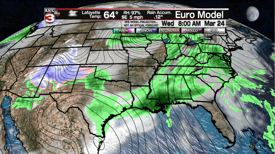
In fact, another round of showers and storms are expected on Wednesday as temperatures continue to top out in the 70s.
Heading into Thursday, our next upper-level disturbance and associated surface feature will work along that stalled frontal boundary keeping our rain chances elevated.
The environment on Thursday looks to be a little more conducive to support strong to perhaps severe storms across the south, but we will have to see how that plays out.
Still a little too early to say for sure whether or not a severe weather risk will take shape.
Regardless, with a few rounds of showers and storms expected, rain totals will begin to pile up.
The models have been VERY consistent with highlighting areas in SE LA/South MS as spots that will see the highest rainfall totals through Thursday evening.
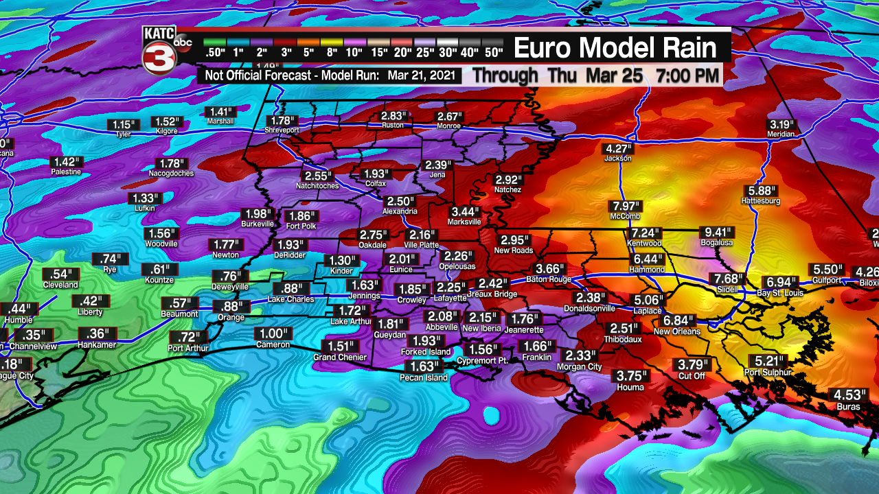
However, at least an inch or two of rain will be possible here across Acadiana with locally higher amounts possible in spots, especially where those heavier thunderstorms (and thus higher rain rates) set up.
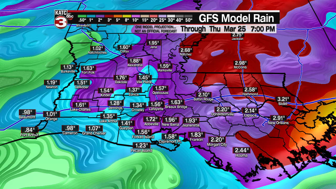
Of course, exact numbers for specific locations on the map will change, but the models continue to show the potential for heavy rain, especially off to our east.
We will continue to monitor this in the coming days.
We will clear out nicely for Friday as sunny skies return, but temperatures will still be pushing the middle to perhaps upper 70s.
We will see a little backdoor front action heading into next weekend which may help to generate some scattered showers (specifically on Saturday), but the weekend does not look like a washout.
Cooler and drier weather will follow heading into the first parts of next week.
Y'all have a great week!
~Bradley
------------------------------------------------------------
Stay in touch with us anytime, anywhere.
To reach the newsroom or report a typo/correction, click HERE.
Sign up for newsletters emailed to your inbox. Select from these options: Breaking News, Evening News Headlines, Latest COVID-19 Headlines, Morning News Headlines, Special Offers
