


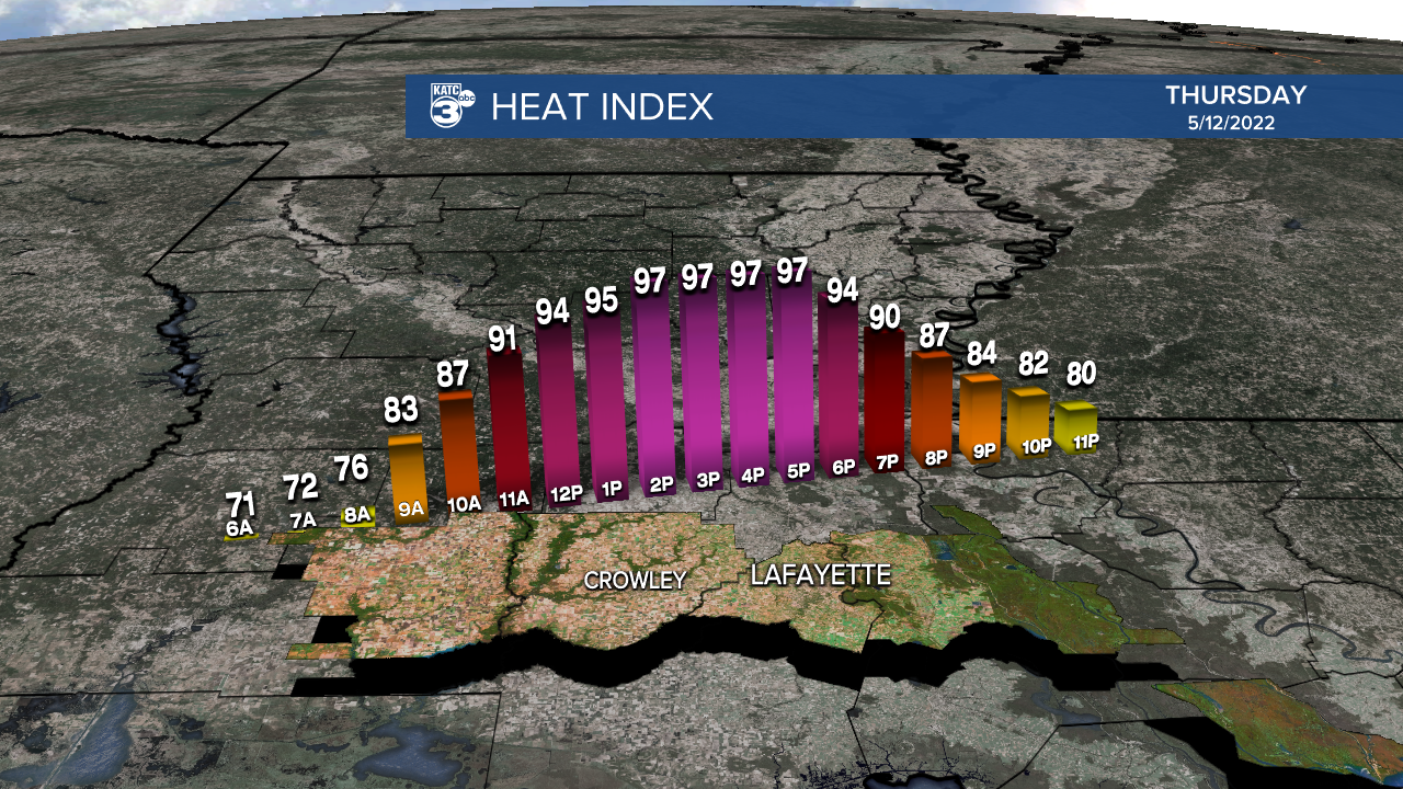
Record heat is expected for Acadiana Thursday with highs topping out in the mid 90s...and feeding off of that heat, we could see some healthy showers and storms roll in from the east by late in the day into the evening hours.
A strong upper level and surface ridge will allow for Acadiana's winds to turn more northwesterly Thursday, and not allowing for any cooling effects from the Gulf of Mexico.
In addition, an upper low over the Southeastern U.S. will be edging westward may allow for more atmospheric compressional heating which could force some readings to push even the upper 90s in portions of Acadiana Thursday afternoon.
The same upper low may have a "spoke" of energy travel westward from Southeast Louisiana where storms are expected tomorrow afternoon. Those storms may impact central and eastern portions of Acadiana by the late afternoon, and more than likely, into the evening hours.

A few storms may contain strong and gusty winds as they will be feeding off of the high heat that should be in place.
As far as records go, the high temperature record of 93° for Lafayette on May 12th was set back in 1922, so we should have not only the hottest day of the year to date, but also a new record.

Heat indices Thursday will be in the upper 90s to near 100°.
Moving into Friday and Saturday, it appears that a weakness in the upper ridge of high pressure will develop with disturbances rolling from the northwest to the southeast.
This in turn should translate to a pretty good chance of scattered showers and thunderstorms into the weekend (near 50-60%) with rain chances Friday mostly likely in the latter part of the afternoon into the early evening hours, while much the same should occur Saturday, with the onset of storms possibly earlier in the day.
By Sunday, drier more stable air should works its way back into the region setting up another abnormally hot week next week.
And to add insult to injury, by the end of next week, tropical moisture will surge northward from the Southern Gulf and the Caribbean translating to dew points rising into the mid-70s which will bring full summer humidity to the Acadiana area.
See the KATC 10 Day Forecast for the latest.
And in the tropics...while there are no areas of concern at this time, the longer range models, particularly the GFS, are hinting that deeper tropical moisture will be surging northward toward the Gulf during the 8-14 day period.
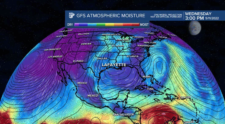
There could be some organization of this moisture possibly developing in the Northwest Caribbean with a possible drift toward the Gulf of Mexico in two week's time...yes, it's getting to be that time of year.
------------------------------------------------------------
Stay in touch with us anytime, anywhere.
To reach the newsroom or report a typo/correction, click HERE.
Sign up for newsletters emailed to your inbox. Select from these options: Breaking News, Evening News Headlines, Latest COVID-19 Headlines, Morning News Headlines, Special Offers
