


It'll be another warm and muggy night as low temperatures only fall back into the lower 70s.
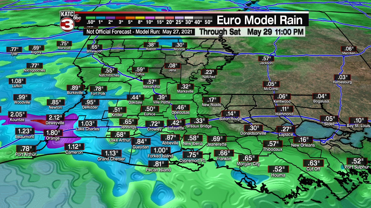
A few spotty showers will be possible early Friday morning as a storm complex drops in from the north.
However, that complex will be weakening as it makes its way into the region and the farther south it progresses.

Otherwise, expect partly to mostly cloudy skies out there on Friday with about a 40% chance to see scattered showers and a few isolated thunderstorms by the late afternoon and evening hours as a frontal trough moves in.
Temperatures will once again settle into the middle and upper 80s.
Another scattering of showers and storms will be possible heading into Saturday as an upper-level feature pushes through with an associated cold front.
That will set the stage for a very pleasant end to the holiday weekend on Sunday and Memorial Day with lower humidity and ever so slightly cooler temperatures.
Pretty typical early June weather as we head into next week with slightly higher rain chances returning for the middle part of the week.
Temperatures will find their way into the 80s.
------------------------------------------------------------
Stay in touch with us anytime, anywhere.
To reach the newsroom or report a typo/correction, click HERE.
Sign up for newsletters emailed to your inbox. Select from these options: Breaking News, Evening News Headlines, Latest COVID-19 Headlines, Morning News Headlines, Special Offers
