


After another round of showers and storms across the area today, expect activity to settle down later this evening.
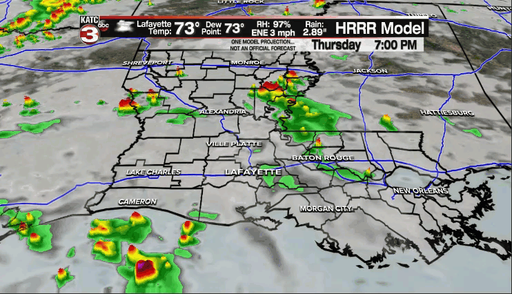
Check out some of these pretty impressive doppler rain estimates in northern Evangeline parish from the slow-moving storms Thursday morning.

The rest of the area has seen a decent soaking as well.
Mostly cloudy skies will be in place through the overnight period as temperatures drop into the lower 70s.
Some patchy fog could be possible as well.
The pattern will remain rather similar heading into Friday.
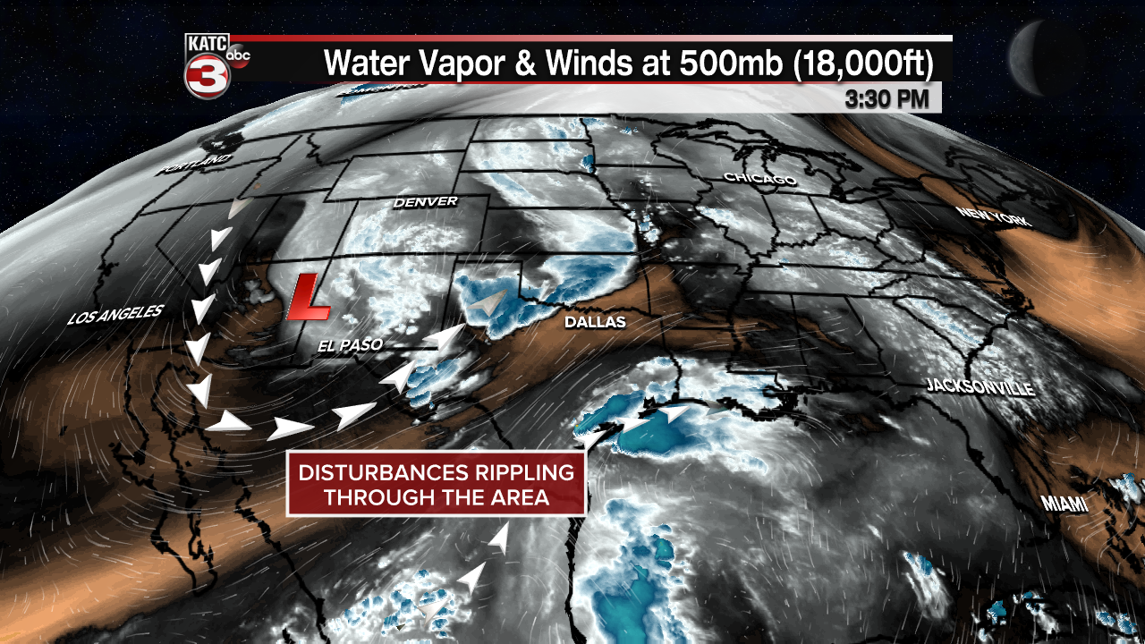
An upper-level disturbance off to our west will continue to supply atmospheric lift across the region, and as that interacts with tropical moisture at the surface, it gives us the chance to see scattered showers and storms.
We'll hold rain chances in the 50-60% range.
60-70% on those rain chances through the weekend as the pattern remains relatively active.
Keep in mind that any additional rainfall in areas that have already picked up several inches could lead to some localized flash flooding issues.
However, a cool front will push through the area on Monday and that will shake up the pattern by ushering in some drier, more comfortable weather for the rest of next week and into the following weekend.
We'll be talking lows in the 60s with afternoon highs in the lower 80s under mostly sunny skies.
Have a good one!
TROPICS
And then we were down to two in the tropics: Major hurricane Sam and tropical storm Victor.
But with that, there remains just ONE name left on the list.
Thereafter, a new supplemental list be brought in to replace the Greek alphabet for additional naming.
Both of the current storms will remain out in the open Atlantic and not be threat to land.

We continue to not see any pending threats to the Gulf over the next several days.
Of course, we'll continue to keep you updated on any new developments.
