


After early morning showers and storms across the area, we actually caught a nice lull in the action throughout the day on Wednesday.
Thankfully, abundant Gulf moisture robbed a lot of the energy and instability this afternoon which has prevented storms from building into the region.
The overall upper-level pattern remains pretty stagnant with troughing to our west and ridging to our east.
We have kind of been stuck in the middle with impulses of upper-level energy being sent our way.
That energy has been able to tap into that Gulf moisture and lead to daily rain chances.
The models are showing another round of showers and storms arriving to the area later on this evening and into the overnight period.

There is a low-end risk of severe storms as well with the possibility that some storms could be capable of producing gusty, damaging winds.
Locally heavy downpours will be possible as well.
Although nailing down the intensity of these storms has been a challenge.
Showers and storms will be more scattered in nature throughout the day on Thursday.
More can be said going into Friday as well.
That ridge of high pressure will begin to edge into the region by the weekend which will finally help to dry things out.
In the short-term, additional rainfall will remain the biggest issue.
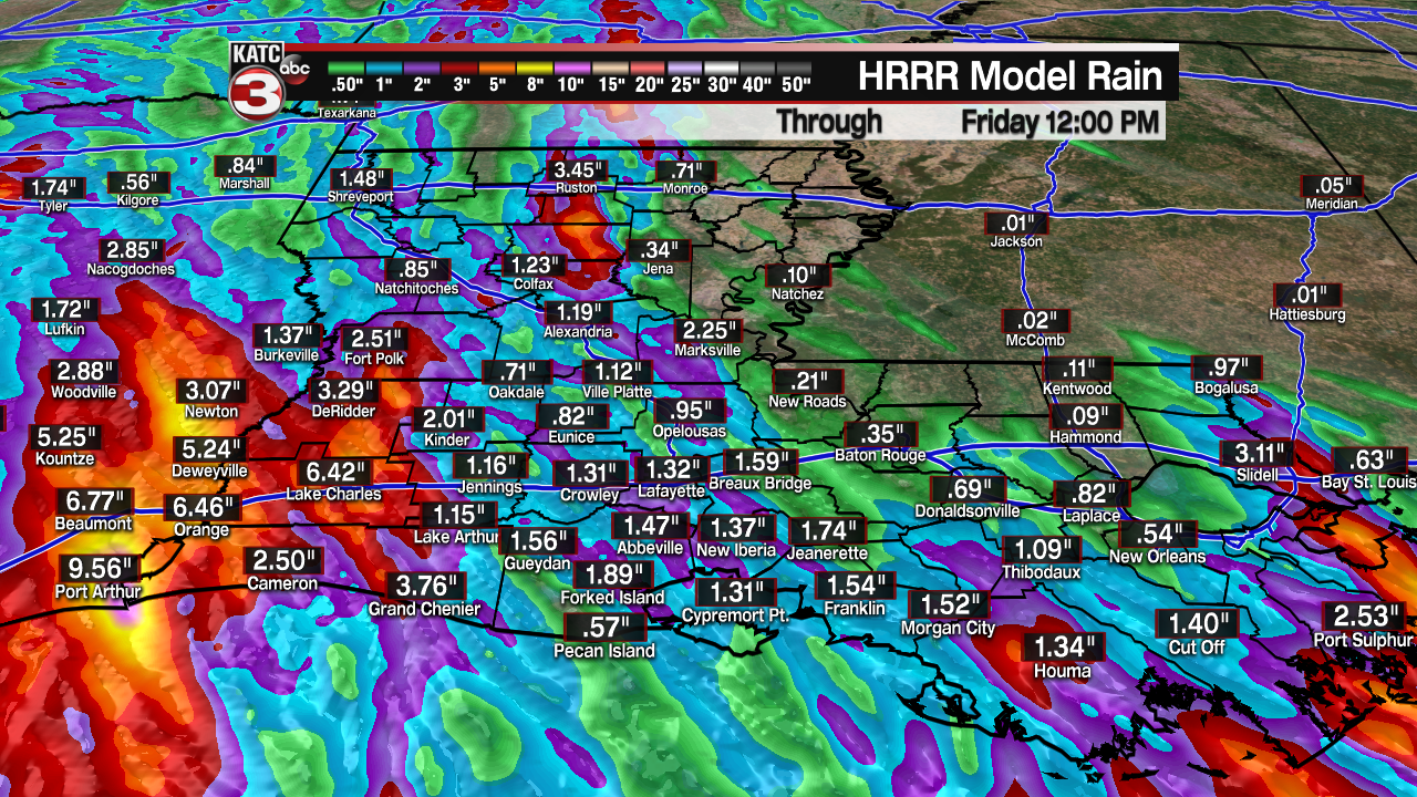
Models are showing an additional 1-3+" of rain through Friday with the greatest flash flooding threat perhaps setting up more so into SW LA.
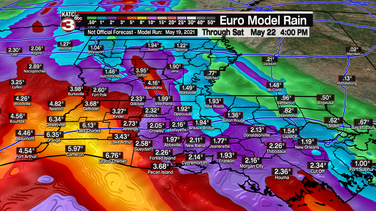
Regardless, a flash flood WATCH remains in effect for all of Acadiana until Thursday evening.
You'll still want to remain cautious of flooded roadways and areas that are prone to flooding over the next couple of days.
Medium range forecast looks drier but warmer into next week.
Be sure to stay with the KATC storm team for the very latest.
In the Tropics:
The National Hurricane Center (NHC) is highlighting one area of interest near Bermuda that could acquire subtropical characteristics in the days ahead.

It has a medium, 40% chance to develop in the next 5 days.
Regardless of development, it will stay out to sea and be no threat to land.
Rest of the tropics are quiet at this time.
------------------------------------------------------------
Stay in touch with us anytime, anywhere.
To reach the newsroom or report a typo/correction, click HERE.
Sign up for newsletters emailed to your inbox. Select from these options: Breaking News, Evening News Headlines, Latest COVID-19 Headlines, Morning News Headlines, Special Offers
