


A few scattered storms will remain possible through this evening as energy tries to roll in from the north and east.
Any one storm will be capable of producing very heavy rainfall and perhaps some gusty winds.
Back to fair skies after midnight as low temperatures drop into the middle 70s.
An upper-level feature will traverse the area on Thursday and will help to generate tropical, splash and dash showers.
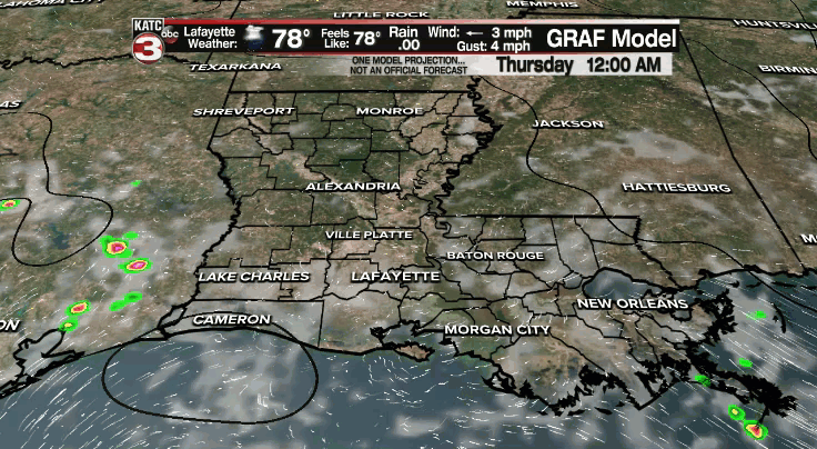
Rain chances will sit at 60%, but the day will not be a washout.
Temperatures will top out in the upper 80s to lower 90s.
Scattered afternoon shower and storm activity will remain possible on Friday and through the course of the weekend as our attention turns to the tropics.
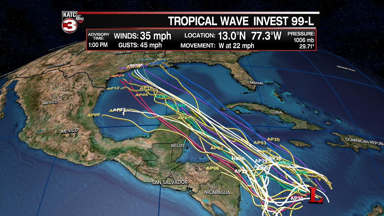
A tropical wave (Invest 99L) is currently located over the Caribbean where a broad area of low pressure is expected to form over the next day or so.
It is important to note that there is nothing currently developed.
Keeping that in mind and until we get a clear, definite center of circulation, models are going to have a difficult time getting a grasp on the situation.
What does that mean? Well, forecast confidence is not overly high at this time.
It is always informative to dust off the graphic below this time of year to help better understand the forecasting process.
We are currently in the 5–7-day range where we begin to see if there is agreement or consensus in the models.

Furthermore, we start to question how much more or less likely an event is going to happen.
When it comes to 99L, is looking more likely that we see a developed system in the Gulf by the weekend.
By the end of this week, we'll have a better idea on the path and potential impacts from the storm (Days 3-4 on the graphic).
So here's the set-up we are looking at:
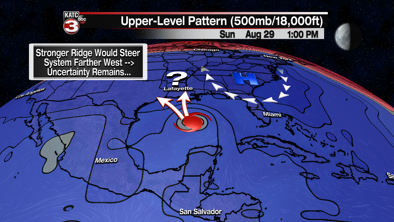
The Bermuda high will continue to steer the feature in a WNW direction in the short-term.
All signs point to the system emerging into the Gulf by Saturday where at least slow intensification is likely.
Thereafter, the question is going to be just how strong the ridge over the eastern US will be:
A stronger ridge would likely nudge the system farther to the west.
Furthermore, water temperatures just off the coastline are near 90° .
That factor coupled with potentially lowering wind shear into early next week, could result in the storm going through a rapid intensification process prior to landfall.
However, that is yet to be seen since it is so far out.
Bottom line: There are PLENTY of unknowns at this time, but we still have to take note of the current model trends.
Residents from the upper Texas coast all the way over to the entire northern Gulf coast need to monitor the evolution of the storm closely in the days ahead.
That includes us here in Acadiana.
IF we were to see any impacts from the storm, it would likely be Monday into Tuesday.
Here are the latest rain estimates from the global models.

Again, these are highly likely to change with time.
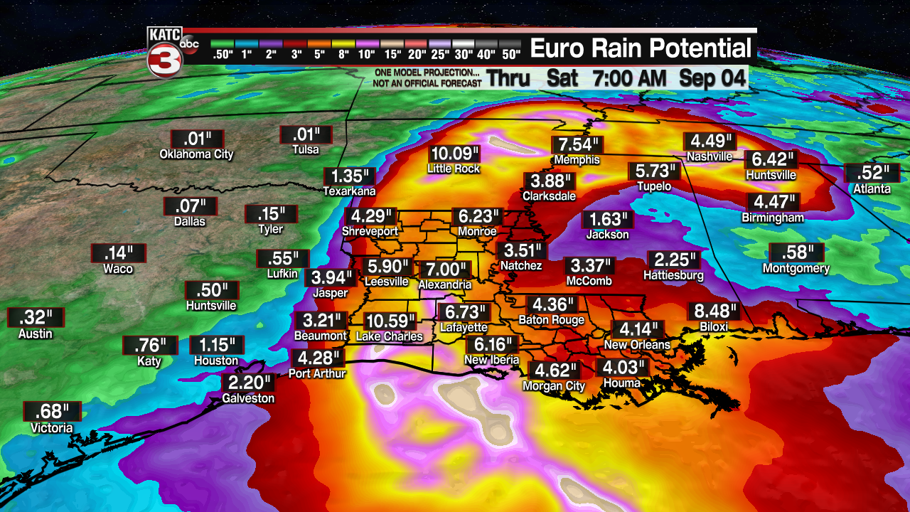
The GFS is showing higher totals simply due to the fact that it has the storm moving along at a slower pace.
Continue to stay with the KATC storm team for the very latest information.
