


Scattered tropical showers continue to work their way across portions of Acadiana late this afternoon.
A tropical easterly wave is spinning off the coastline which is helping to send rounds of moisture our way.
Deep convection remains offshore and has kind of stole some of the instability from working inland, but regardless, it has been another day of dodging those showers and storms.
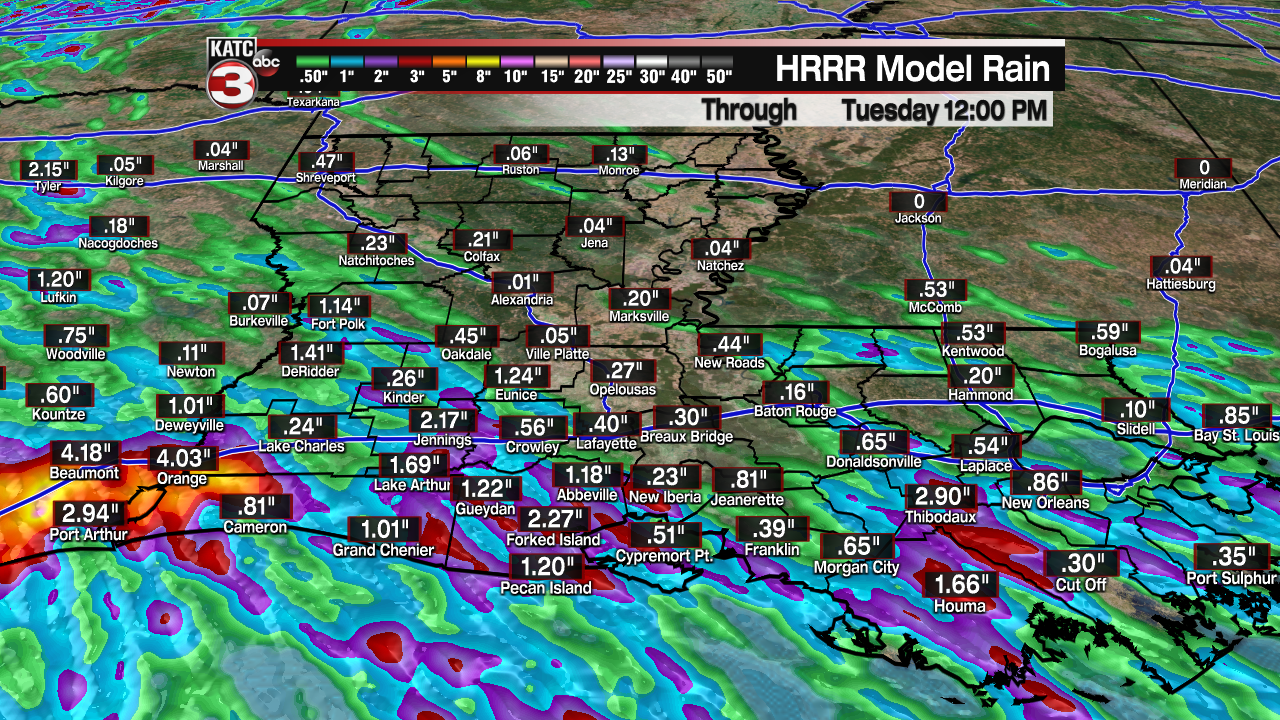
Scattered activity will remain possible through the overnight period, so I have rain chances at 30%.
Overnight lows will be falling back into the lower to middle 70s.
We get ready to do it all over again on Monday with a healthy scattering of showers and storms.
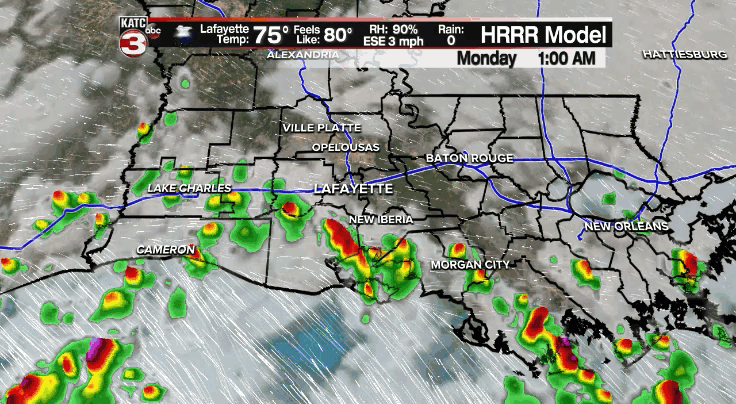
And with a good amount of low-level moisture continuing to be in place, some locally heavy downpours could be possible where some areas pick up a quick 1-2" of rain.
High temperatures will top out in the middle 80s.
We'll be fighting scattered activity on Tuesday as well with rain chances sitting in the 50-60% range.
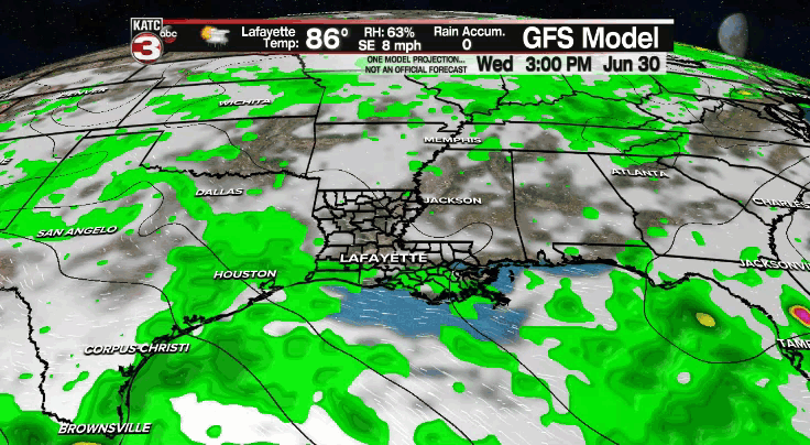
Those typical afternoon showers and thunderstorms will remain possible on Wednesday and Thursday.
The pattern could turn stormier by the end of the week and into the 4th of July weekend as a trough takes shape to our north.
The energy associated with that feature coupled with increasing low-level moisture will help to enhance our rain chances.
Now just how long that trough sticks around is still up in the air at this point and will have an impact on whether rain chances go up or down for the end of the holiday weekend and into the first parts of next week.
We'll continue to watch the trends in the days ahead as the forecast comes into better focus, so stay tuned!
In the Tropics:
We continue to monitor two areas in the Atlantic.
The first is south and west of Bermuda and now has a 50% chance of development in the next 5 days as it tracks closer to the east coast.
It is no threat to Acadiana.
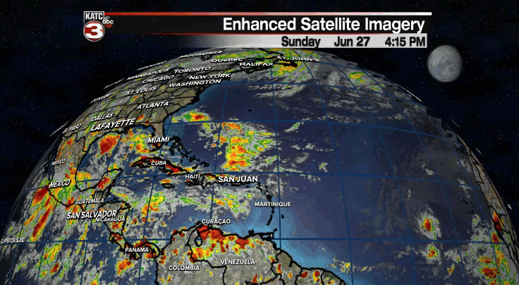
The second area is still way out in the Atlantic and has a low, 30% chance to develop in the coming days.
However, it is still very far out and nothing that we need to be worried about at this time.
Nonetheless, we'll keep an eye on it for you as it progresses westward with time
------------------------------------------------------------
Stay in touch with us anytime, anywhere.
To reach the newsroom or report a typo/correction, click HERE.
Sign up for newsletters emailed to your inbox. Select from these options: Breaking News, Evening News Headlines, Latest COVID-19 Headlines, Morning News Headlines, Special Offers
