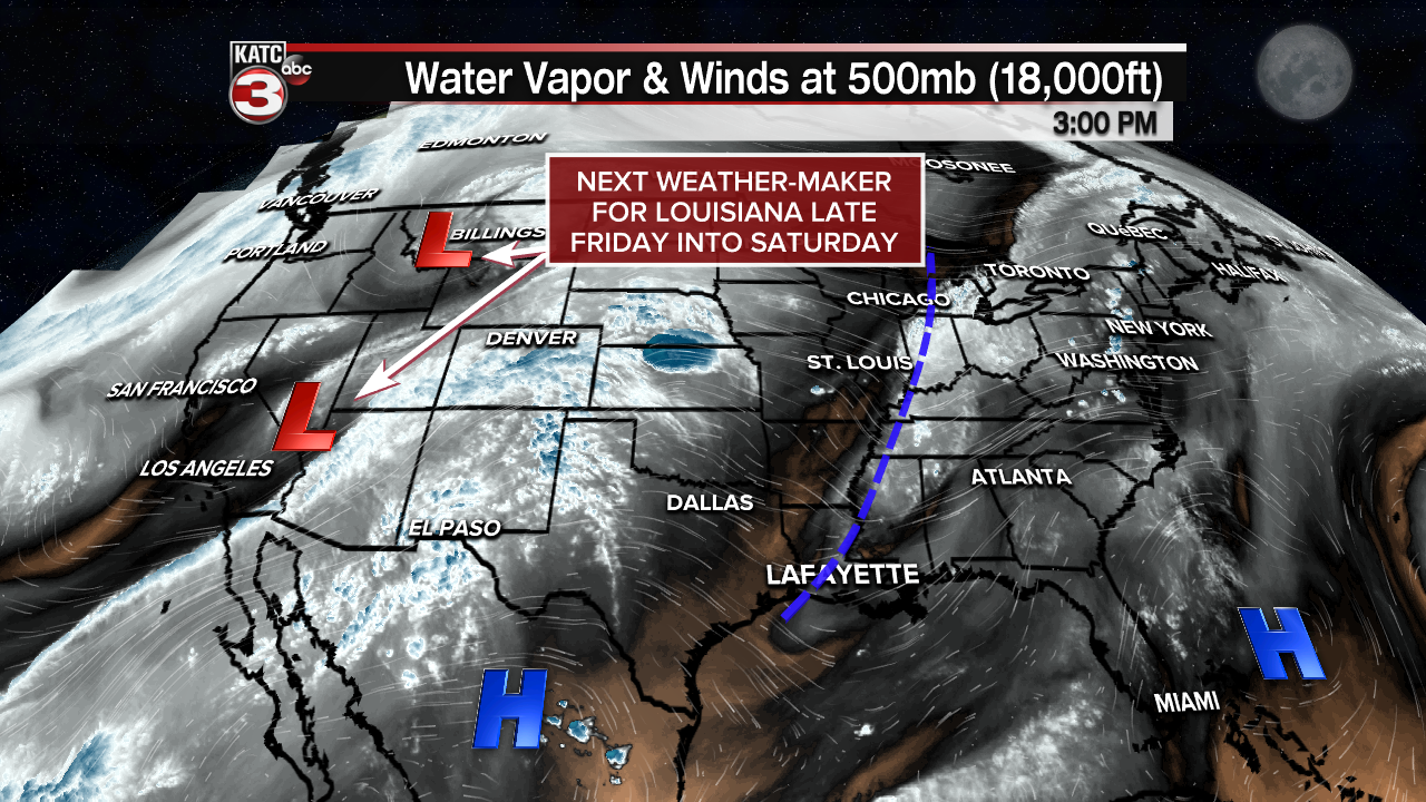
Weak high pressure moving in from the west is expected to knock down Acadiana's rain chances Thursday, but the next disturbance will likely enhance our chance of storms late Friday into Saturday.
But the good news is drier and more pleasant conditions are on tap for the rest of the holiday weekend.
In the near term, after a few scattered early evening showers, look for fair skies and a 99% full Super Flower Moon overnight.

Temperatures Thursday morning will drop into the lower 70s.
Mostly sunny skies and seasonably warm temperatures in the mid-80s are anticipated for Thursday as rain chances drop to 10% or less.

Friday will bring much of the same into the early afternoon, but an upper level trough and weak surface front will approach the region by Friday night which could open the door for the possibility of late afternoon or evening thunderstorms.

Best chance of storms will arrive Saturday, with current chance in the 60% range.
Although there are no overt signals for any severe storms, experience dictates there could be some healthy storms producing strong and gusty winds for any activity we night see late Friday into Saturday.

Models agree that drier, more pleasant conditions along with lower humidity & lower temperatures at night are in the offing for Sunday and Monday, Memorial Day.
The Euro & GFS diverge later next week with the former keeping relatively quiet conditions going through much of the week while the GFS is indicating that our region may slip back into a wetter pattern.

It will likely be several more days before we get a bellwether on the weather pattern for later next week!
See the KATC 10 Day Forecast for the latest.
------------------------------------------------------------
Stay in touch with us anytime, anywhere.
To reach the newsroom or report a typo/correction, click HERE.
Sign up for newsletters emailed to your inbox. Select from these options: Breaking News, Evening News Headlines, Latest COVID-19 Headlines, Morning News Headlines, Special Offers


