


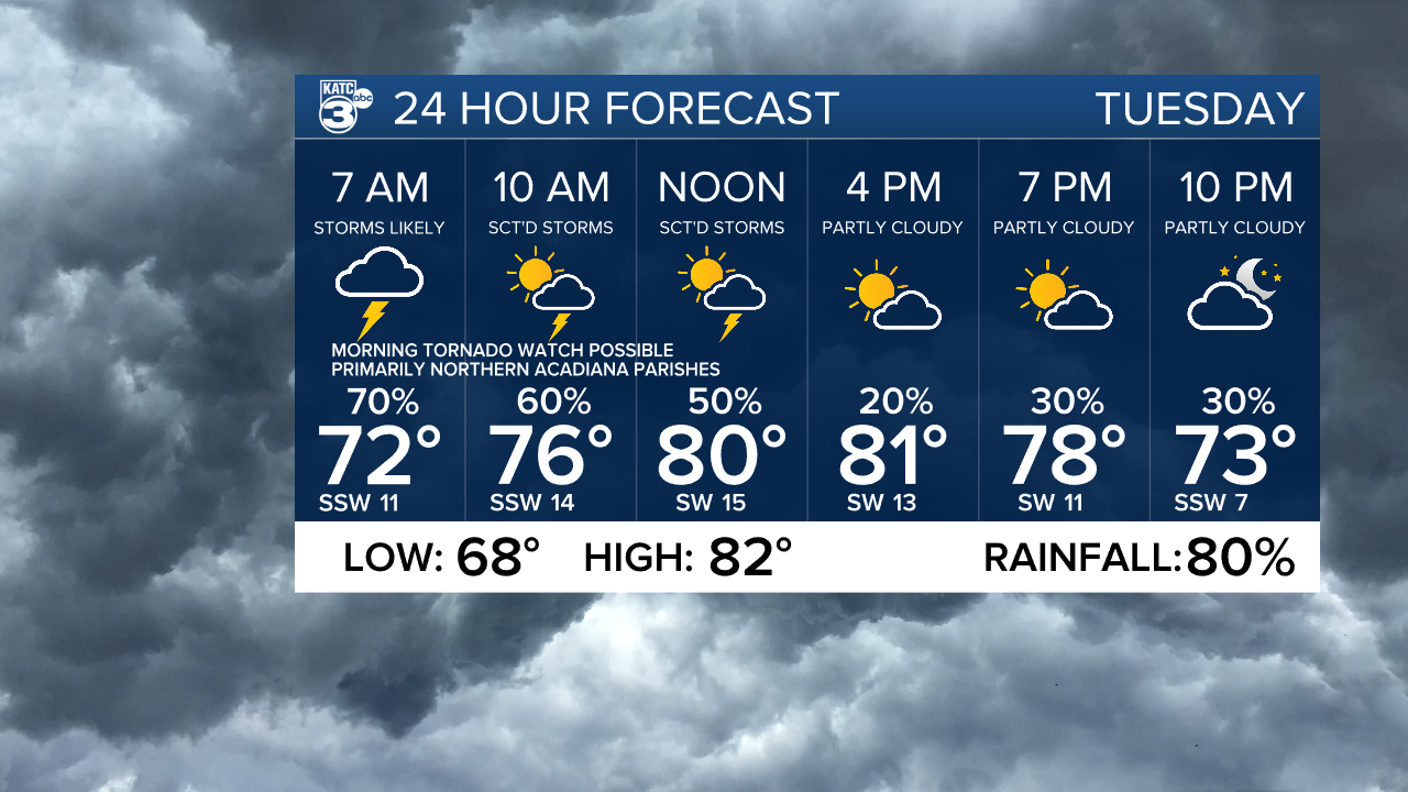
Tuesday looks to start out on the stormy side for portions Acadiana, especially the northern parishes, with a severe weather risk that may prompt a tornado watch for portions of the area.
A fairly active frontal system looks threaten much of the South with the possibility of severe storms, from Texas overnight to Georgia and South Carolina by the end of Tuesday.
The risk will be significantly higher north of our area.

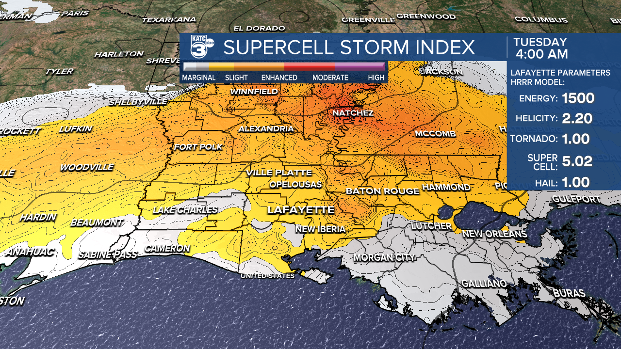
The greatest severe storm risk for Acadiana, looks to be in the northern Acadiana parishes (per usual) and especially into Central/Northern Louisiana starting several hours before sunrise Tuesday with activity sliding southward, and potentially weakening for the rest of Acadiana after daybreak through mid-morning.

Thereafter it should be quieter into Tuesday afternoon.
The Storm Prediction Center has much of Northern into Central Louisiana hatched in for an enhanced risk (level 3 out of 5) of severe storms late Monday night into early Tuesday, with most of the Acadiana area in a slight risk...a level 2 out of 5.

The chance of severe storms should be lower toward the coast and to the west.
The prime-time severe weather threats, if they materialize in Acadiana, should be within a few hours of daybreak (before and after) Tuesday.
The primary severe storms threats will be for super cell storms that could produce damaging winds and perhaps an isolated tornado.

Activity looks to tone down into Tuesday afternoon with a cloud and sun mix returning along with highs reaching the lower 80s.

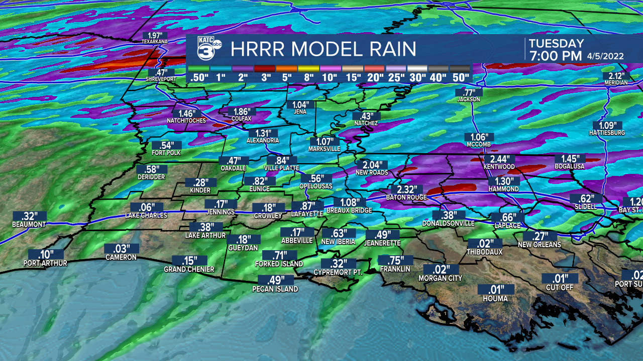
Rainfall does not appear to be an issue for our area with a few inches of rain possible mainly across the northern areas. Most other areas will likely see an inch or less.
Look for partly cloudy and warm conditions to return Wednesday with temperatures soaring into the mid-80s prior to a cool front pushing through the area.
That front may generate a few widely scattered showers or a thunderstorm, but no organized severe weather is anticipated.
Thereafter, the weather pattern looks perfect for Acadiana with lots of sunshine accompanied by seasonably cool temperatures, especially at night.
The weekend looks great too as temperatures slowly moderate.
The pattern looks to get a little more active again by mid-next week.
See the KATC 10 Day Forecast for the latest.
------------------------------------------------------------
Stay in touch with us anytime, anywhere.
To reach the newsroom or report a typo/correction, click HERE.
Sign up for newsletters emailed to your inbox. Select from these options: Breaking News, Evening News Headlines, Latest COVID-19 Headlines, Morning News Headlines, Special Offers
